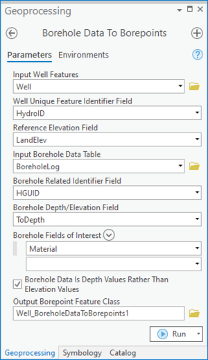
| Display title | File:ArcGIS Pro Borehole Data to Points.png |
| Default sort key | ArcGIS Pro Borehole Data to Points.png |
| Page length (in bytes) | 163 |
| Namespace | File |
| Page ID | 30511 |
| Page content language | en - English |
| Page content model | wikitext |
| Indexing by robots | Allowed |
| Number of redirects to this page | 0 |
| Hash value | 414bdf801060b814dcf20b815ad94bbb248c9b2b |
| Page image |  |
| Edit | Allow all users (infinite) |
| Move | Allow all users (infinite) |
| Upload | Allow all users (infinite) |
| Page creator | Rcorrigan (talk | contribs) |
| Date of page creation | 16:46, 15 August 2022 |
| Latest editor | Rcorrigan (talk | contribs) |
| Date of latest edit | 16:48, 15 August 2022 |
| Total number of edits | 2 |
| Total number of distinct authors | 1 |
| Recent number of edits (within past 90 days) | 0 |
| Recent number of distinct authors | 0 |
