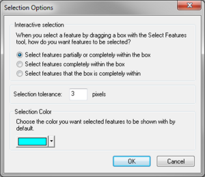
| Display title | File:GIS Selection Options.png |
| Default sort key | GIS Selection Options.png |
| Page length (in bytes) | 76 |
| Namespace | File |
| Page ID | 8379 |
| Page content language | en - English |
| Page content model | wikitext |
| Indexing by robots | Allowed |
| Number of redirects to this page | 0 |
| Hash value | 9e5f1f5c989b4fb200728c796e3006a4f0bfea89 |
| Page image |  |
| Edit | Allow all users (infinite) |
| Move | Allow all users (infinite) |
| Upload | Allow all users (infinite) |
| Page creator | Eshaw (talk | contribs) |
| Date of page creation | 16:02, 31 May 2008 |
| Latest editor | Jcreer (talk | contribs) |
| Date of latest edit | 16:28, 11 December 2015 |
| Total number of edits | 8 |
| Total number of distinct authors | 2 |
| Recent number of edits (within past 90 days) | 0 |
| Recent number of distinct authors | 0 |
