File:OceanMesh2D domain to-be-meshed.png: Difference between revisions
From XMS Wiki
Jump to navigationJump to search
No edit summary |
No edit summary |
||
| Line 1: | Line 1: | ||
Figure 2: The area to-be-meshed is represented as a blue hatched region and is the intersection area between the red and green polygons that represent the shoreline. The black-dashed polygon represents the model domain. The “inner” category represents polygons fully enclosed in the meshing domain while the “mainland” polygons are partially enclosed in the meshing domain. | |||
[[Category: Toolbox UGrid]] | |||
Latest revision as of 19:39, 27 June 2024
Figure 2: The area to-be-meshed is represented as a blue hatched region and is the intersection area between the red and green polygons that represent the shoreline. The black-dashed polygon represents the model domain. The “inner” category represents polygons fully enclosed in the meshing domain while the “mainland” polygons are partially enclosed in the meshing domain.
File history
Click on a date/time to view the file as it appeared at that time.
| Date/Time | Thumbnail | Dimensions | User | Comment | |
|---|---|---|---|---|---|
| current | ★ Approved revision 19:35, 27 June 2024 | 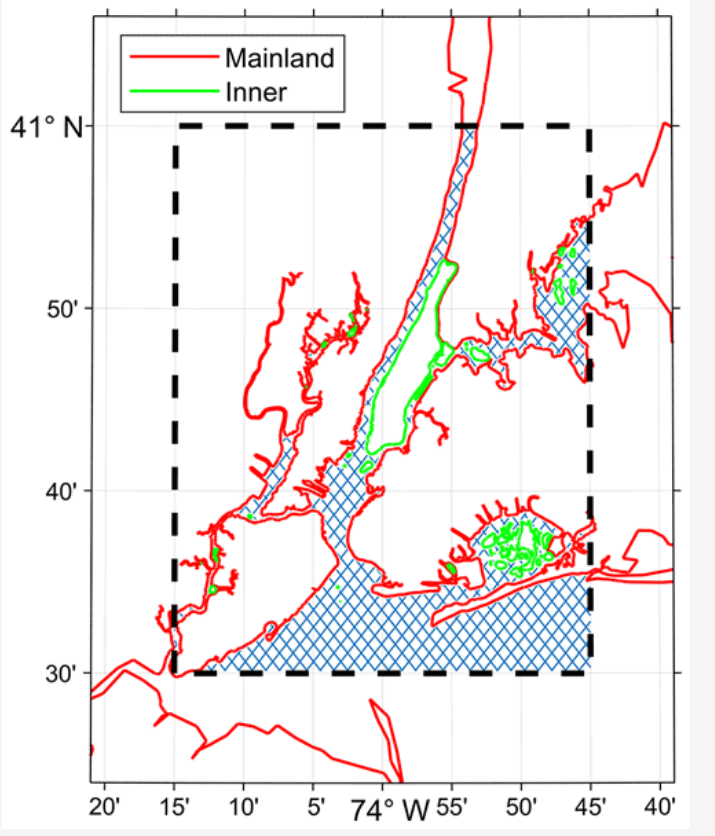 | 715 × 836 (288 KB) | Jcreer (talk | contribs) |
You cannot overwrite this file.
File usage
The following 2 pages use this file: