HY8:Locate Project: Difference between revisions
From XMS Wiki
Jump to navigationJump to search
No edit summary |
No edit summary |
||
| Line 1: | Line 1: | ||
==Locate Crossing== | ==Locate Crossing== | ||
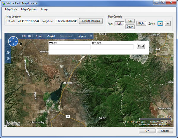
The first step in building a project is to identify the location of the crossing. The project contains all of the crossings while the crossings are the locations at which the culverts are placed. If desired (not required), the map viewer tool may be used to locate the crossing by entering (latitude,longitude) coordinates or the address of the crossing as shown in the figure below. | The first step in building a project is to identify the location of the crossing. The project contains all of the crossings while the crossings are the locations at which the culverts are placed. If desired (not required), the map viewer [[File:WMSIcon GIS Module.png]] tool may be used to locate the crossing by entering (latitude,longitude) coordinates or the address of the crossing as shown in the figure below. | ||
[[Image:HY8image LocateProject.jpg|thumb|none|600 px|''Virtual Earth Map Locator'']] | [[Image:HY8image LocateProject.jpg|thumb|none|600 px|''Virtual Earth Map Locator'']] | ||
Revision as of 15:52, 15 September 2016
Locate Crossing
The first step in building a project is to identify the location of the crossing. The project contains all of the crossings while the crossings are the locations at which the culverts are placed. If desired (not required), the map viewer ![]() tool may be used to locate the crossing by entering (latitude,longitude) coordinates or the address of the crossing as shown in the figure below.
tool may be used to locate the crossing by entering (latitude,longitude) coordinates or the address of the crossing as shown in the figure below.
