Template:SMS at a glance raster module: Difference between revisions
From XMS Wiki
Jump to navigationJump to search
m (Protected "Template:SMS at a glance raster module" ([Edit=Allow only administrators] (indefinite) [Move=Allow only administrators] (indefinite))) |
No edit summary |
||
| Line 1: | Line 1: | ||
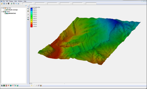
[[File:Raster4.png|thumb|500px|right|Raster | [[File:Raster4.png|thumb|500px|right|Raster module example]] | ||
{{{Heading}}} | {{{Heading}}} | ||
'''NOTE''': the functionality of this module was incorporated into the GIS module starting with SMS version 12.0 | '''NOTE''': the functionality of this module was incorporated into the GIS module starting with SMS version 12.0 | ||
Revision as of 14:46, 29 March 2017
{{{Heading}}} NOTE: the functionality of this module was incorporated into the GIS module starting with SMS version 12.0
- Open and visualize raster data
- Supports many gridded elevation file formats. A complete list can be found at: www.globalmapper.com/product/formats.htm
- One or more rasters are placed under a raster set in the project explorer.
- Convert raster to TIN (scatter set)
- Interpolate data from raster to TINs /2D Mesh/2D Grid
- Use rasters with observation profile plots
