Template:Bounds to Polygon: Difference between revisions
From XMS Wiki
Jump to navigationJump to search
(Created page with "__NOINDEX__ __NOTOC__ <noinclude>Category:Tools</noinclude>") |
No edit summary |
||
| (11 intermediate revisions by 2 users not shown) | |||
| Line 1: | Line 1: | ||
__NOINDEX__ | __NOINDEX__ | ||
__NOTOC__ | __NOTOC__ | ||
===Bounds to Polygon=== | |||
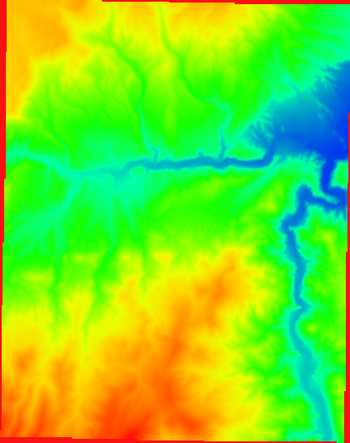
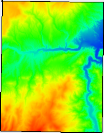
The ''Bounds to Polygon'' tool creates a new coverage with polygons bounding all of the active regions of the raster. Any inactive regions that fall within an interior polygon will be deleted automatically. | |||
Inactive regions of a raster are determined by the NODATA value of the raster. | |||
<noinclude>[[Category: | :[[File:BoundstoPolygon1.png|thumb|none|350 px|Raster containing NODATA cells (shown in red) on the border.]] | ||
:[[File:BoundstoPolygon2.png|thumb|none|350 px|Boundary polygon surrounding the active region of the polygon.]] | |||
====Input Parameters==== | |||
*''Input raster'' – The raster for which the active boundary polygon will be created. | |||
====Output Parameters==== | |||
*''Output coverage'' – The new coverage to be created, containing the boundary polygon for the active region of the input raster. | |||
====Current Location in Toolbox==== | |||
Rasters/Bounds to Polygon | |||
<noinclude>[[Category:Toolbox Rasters]]</noinclude> | |||
Latest revision as of 18:30, 26 October 2023
Bounds to Polygon
The Bounds to Polygon tool creates a new coverage with polygons bounding all of the active regions of the raster. Any inactive regions that fall within an interior polygon will be deleted automatically.
Inactive regions of a raster are determined by the NODATA value of the raster.
Input Parameters
- Input raster – The raster for which the active boundary polygon will be created.
Output Parameters
- Output coverage – The new coverage to be created, containing the boundary polygon for the active region of the input raster.
Current Location in Toolbox
Rasters/Bounds to Polygon

