Category:Terrain Data
From XMS Wiki
Jump to navigationJump to search
Articles related to the Terrain Data Module.
Subcategories
This category has only the following subcategory.
W
- WMS Terrain Module Tool Icons (21 F)
Pages in category "Terrain Data"
The following 4 pages are in this category, out of 4 total.
Media in category "Terrain Data"
The following 20 files are in this category, out of 20 total.
- Create Points Tool.svg 45 × 41; 2 KB
- Create Vertices tool.png 16 × 16; 330 bytes
- Edit dem.jpg 443 × 323; 47 KB
- Select Point tool.png 16 × 16; 418 bytes
- Select Point Tool.svg 53 × 51; 2 KB
- Terraindatamoduleexample.png 691 × 512; 240 KB
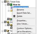
- TerrainProjectExplorer1.png 227 × 128; 4 KB
- TerrainProjectExplorer2.png 307 × 131; 7 KB
- TerrainProjectExplorer3.png 376 × 511; 25 KB
- TerrainProjectExplorer4.png 228 × 210; 9 KB
- TerrainProjectExplorer5.png 310 × 407; 17 KB
- WMS DynamicToolsQuick.png 218 × 26; 3 KB
- WMS SelectDEMpointsTool.svg 41 × 55; 8 KB
- WMS SelectTrianglesTool.svg 60 × 63; 3 KB
- WMS SwapTriangleEdgesTool.svg 60 × 60; 6 KB
- WMS TerrainIcon.svg 60 × 60; 6 KB
- WMSIcon Select DEM Points.png 15 × 16; 434 bytes
- WMSIcon Select Triangles.png 16 × 16; 501 bytes
- WMSIcon Swap Triangle Edges.png 16 × 16; 400 bytes
- WMSIcon Terrain Data Module.png 16 × 16; 493 bytes


