File:OceanMesh2D domain to-be-meshed.png
From XMS Wiki
Jump to navigationJump to search

Size of this preview: 513 × 600 pixels. Other resolution: 715 × 836 pixels.
Original file (715 × 836 pixels, file size: 288 KB, MIME type: image/png)
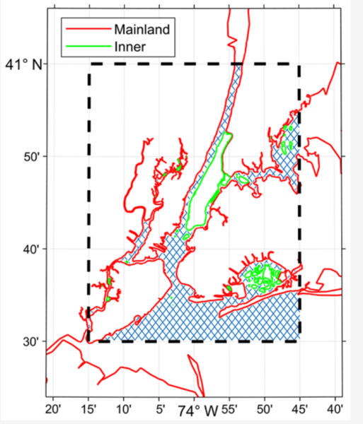
Figure 2: The area to-be-meshed is represented as a blue hatched region and is the intersection area between the red and green polygons that represent the shoreline. The black-dashed polygon represents the model domain. The “inner” category represents polygons fully enclosed in the meshing domain while the “mainland” polygons are partially enclosed in the meshing domain.
File history
Click on a date/time to view the file as it appeared at that time.
| Date/Time | Thumbnail | Dimensions | User | Comment | |
|---|---|---|---|---|---|
| current | ★ Approved revision 19:35, 27 June 2024 | | 715 × 836 (288 KB) | Jcreer (talk | contribs) |
You cannot overwrite this file.
File usage
The following 2 pages use this file: