Search results
From XMS Wiki
Jump to navigationJump to search
Page title matches
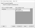
File:WMS GIS to Feature Objects Wizard1.png [[Category:WMS GIS]] [[Category:WMS Feature Objects]](479 × 390 (7 KB)) - 17:34, 22 June 2023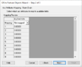
File:WMS GIS to Feature Objects Wizard2.png [[Category:WMS GIS]] [[Category:WMS Feature Objects]](479 × 390 (35 KB)) - 19:59, 5 January 2024File:WMS GIS to Feature Objects Wizard1.jpg #REDIRECT [[File:WMS GIS to Feature Objects Wizard1.png]](479 × 390 (7 KB)) - 17:34, 22 June 2023File:WMS GIS to Feature Objects Wizard2.jpg #REDIRECT [[File:WMS GIS to Feature Objects Wizard2.png]](479 × 390 (35 KB)) - 19:59, 5 January 2024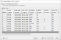
File:GIS to Feature Objects Wizard -- Step 1 of 2.jpg [[Category:SMS GIS]] [[Category:SMS GIS Dialogs]](740 × 485 (31 KB)) - 18:22, 7 April 2023


Page text matches
File:WMS GIS to Feature Objects Wizard1.png [[Category:WMS GIS]] [[Category:WMS Feature Objects]](479 × 390 (7 KB)) - 17:34, 22 June 2023File:WMS GIS to Feature Objects Wizard2.png [[Category:WMS GIS]] [[Category:WMS Feature Objects]](479 × 390 (35 KB)) - 19:59, 5 January 2024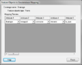
File:GIS FeatureToGeodatabase.png [[Category:WMS GIS]] [[Category:WMS Feature Objects]](493 × 396 (14 KB)) - 16:28, 11 December 2015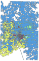
File:WMS GISdataExample.png [[Category:WMS GIS]] GIS data example.(256 × 400 (21 KB)) - 15:44, 9 January 2017File:GIS to Feature Objects Wizard -- Step 1 of 2.jpg [[Category:SMS GIS]] [[Category:SMS GIS Dialogs]](740 × 485 (31 KB)) - 18:22, 7 April 2023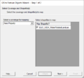
File:GIS to Feature Step1.png [[Category:SMS GIS]] [[Category:SMS GIS Dialogs]](479 × 445 (13 KB)) - 18:20, 7 April 2023File:WMS GIS to Feature Objects Wizard2.jpg #REDIRECT [[File:WMS GIS to Feature Objects Wizard2.png]](479 × 390 (35 KB)) - 19:59, 5 January 2024File:WMS GIS to Feature Objects Wizard1.jpg #REDIRECT [[File:WMS GIS to Feature Objects Wizard1.png]](479 × 390 (7 KB)) - 17:34, 22 June 2023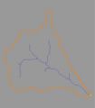
File:Fobj.jpg [[Category:WMS Feature Objects]] ...est solution to creating a watershed model is to use the GIS data directly to delineate boundaries.(350 × 400 (8 KB)) - 16:22, 9 January 2017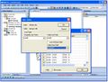
File:WMS JoinTableShapefile.jpg [[Category:WMS GIS]] ...MS and converting it to feature objects, users can use WMS to join a table to a shapefile's attribute table.(738 × 558 (88 KB)) - 16:04, 9 January 2017
File:GISshapefileExample.jpg [[Category:WMS GIS]] ...entire shapefile, or a subset of shapes, can then be converted to feature objects.(1,181 × 719 (187 KB)) - 16:56, 5 January 2017


