AHGW:Troubleshooting 3D Bore Lines: Difference between revisions
From XMS Wiki
Jump to navigationJump to search
m (Move page script moved page AHGW:Troubleshooting 3D Bore Lines to Test:Troubleshooting 3D Bore Lines without leaving a redirect) |
No edit summary |
||
| Line 1: | Line 1: | ||
In | In many cases, this problem is related to the dimensions of the feature classes. In many cases, feature datasets and feature classes are created with a limited Z domain with a value of set 0 as the minimum Z value, so features with elevations below 0 can not be written to the feature classes in this feature dataset. | ||
Here are the steps for redefining the Z domain: | Here are the steps for redefining the Z domain: | ||
Revision as of 17:47, 14 November 2019
In many cases, this problem is related to the dimensions of the feature classes. In many cases, feature datasets and feature classes are created with a limited Z domain with a value of set 0 as the minimum Z value, so features with elevations below 0 can not be written to the feature classes in this feature dataset.
Here are the steps for redefining the Z domain:
- Create a new geodatabase
- Create a new feature dataset
- make sure your feature dataset has the appropriate units (feet, meter) so that x, y, and z units are the same and match the vertical data in the BoreholeLog table.
- When you create the new feature dataset and get to the step defining the vertical coordinate system you will need to select one appropriate for your area.
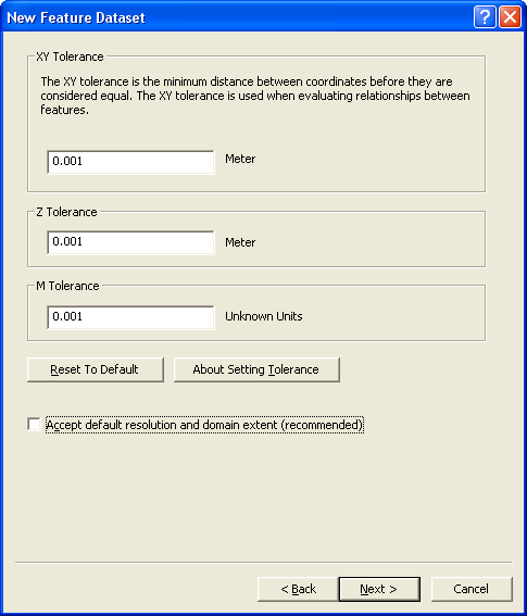
- In the next step – uncheck the accept default resolution and domain extent toggle.
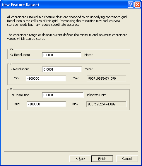
- In the next step set a minimum value for the Z domain that will include your data range.
- Select Finish to create the feature dataset.
- Load the data (wells, boreline) you have into the new feature dataset.
- Run the Create BoreLines tool with the data in the new feature dataset.


