File:Demtofobj.jpg: Difference between revisions
From XMS Wiki
Jump to navigationJump to search
No edit summary |
No edit summary |
||
| (2 intermediate revisions by the same user not shown) | |||
| Line 1: | Line 1: | ||
[[Category:WMS Quick Tour]] | |||
[[Category:DEM]] | |||
After delineating a watershed and sub-basin boundaries using a DEM, the results are always converted to points (outlets), lines (streams), and polygons (boundaries) for more convenient data storage and manipulation. | |||
Latest revision as of 15:39, 9 January 2017
After delineating a watershed and sub-basin boundaries using a DEM, the results are always converted to points (outlets), lines (streams), and polygons (boundaries) for more convenient data storage and manipulation.
File history
Click on a date/time to view the file as it appeared at that time.
| Date/Time | Thumbnail | Dimensions | User | Comment | |
|---|---|---|---|---|---|
| current | ★ Approved revision 19:45, 7 June 2007 | 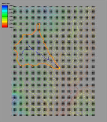 | 350 × 400 (56 KB) | Cballard (talk | contribs) |
You cannot overwrite this file.
File usage
The following page uses this file: