File:DepthVaryingOverlandRoughness.png: Difference between revisions
From XMS Wiki
Jump to navigationJump to search
No edit summary |
No edit summary |
||
| Line 3: | Line 3: | ||
Depth Varying Overland Roughness in the GSSHA Map Table dialog | Depth Varying Overland Roughness in the GSSHA Map Table dialog | ||
GSSHA Roughness Exponent Mapping Table Editor | |||
Revision as of 15:28, 2 July 2018
Depth Varying Overland Roughness in the GSSHA Map Table dialog
GSSHA Roughness Exponent Mapping Table Editor
File history
Click on a date/time to view the file as it appeared at that time.
| Date/Time | Thumbnail | Dimensions | User | Comment | |
|---|---|---|---|---|---|
| current | ★ Approved revision 16:48, 16 May 2023 | 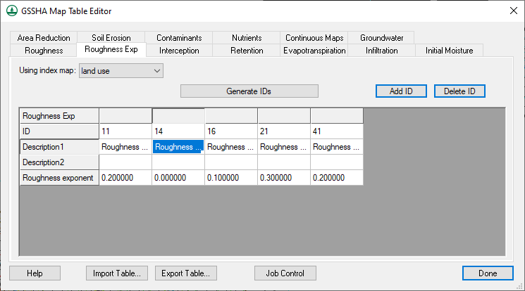 | 745 × 414 (14 KB) | Klemon (talk | contribs) | |
| 15:53, 12 June 2014 | 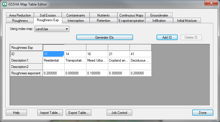 | 759 × 420 (47 KB) | Cmsmemoe (talk | contribs) |
You cannot overwrite this file.
File usage
The following page uses this file: