File:GSDACoordConvFig1.png: Difference between revisions
From XMS Wiki
Jump to navigationJump to search
No edit summary |
No edit summary |
||
| Line 1: | Line 1: | ||
[[Category:GSDA]] | [[Category:GSDA]] | ||
Figure 1: The DEM contour depicting the edge of Anchor Bay is in red. | |||
Latest revision as of 18:25, 3 November 2014
Figure 1: The DEM contour depicting the edge of Anchor Bay is in red.
File history
Click on a date/time to view the file as it appeared at that time.
| Date/Time | Thumbnail | Dimensions | User | Comment | |
|---|---|---|---|---|---|
| current | ★ Approved revision 19:28, 8 May 2008 | 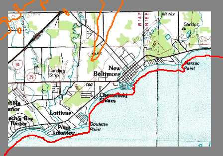 | 448 × 314 (247 KB) | Eshaw (talk | contribs) |
You cannot overwrite this file.
File usage
The following page uses this file: