File:NSS MaxFloodRegion.jpg: Difference between revisions
From XMS Wiki
Jump to navigationJump to search
No edit summary |
m (Jcreer moved page File:Image89.gif to File:NSS MaxFloodRegion.gif) |
(No difference)
| |
Revision as of 17:25, 10 June 2015
Map showing maximum flood regions in the United States
File history
Click on a date/time to view the file as it appeared at that time.
| Date/Time | Thumbnail | Dimensions | User | Comment | |
|---|---|---|---|---|---|
| current | ★ Approved revision 17:27, 10 June 2015 | 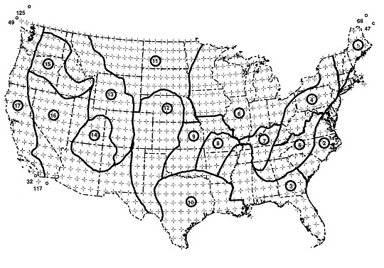 | 540 × 378 (75 KB) | Jcreer (talk | contribs) | |
| 21:50, 2 August 2007 |  | 540 × 378 (50 KB) | Cballard (talk | contribs) |
You cannot overwrite this file.
File usage
The following page uses this file: