File:Test2.jpg: Difference between revisions
From XMS Wiki
Jump to navigationJump to search
No edit summary |
No edit summary |
||
| (3 intermediate revisions by the same user not shown) | |||
| Line 1: | Line 1: | ||
[[Category:WMS Quick Tour]] | [[Category:WMS Quick Tour]] | ||
[[Category:HEC-RAS]] | |||
[[Category:WMS Plot]] | |||
The 1D Hydraulic tools in WMS can be used to set up a HEC-RAS GIS Import file. Using feature arcs and polygons, users create a River schematic that consists of a river centerline, which includes data for cross-sections, river reaches, and Manning's roughness coefficients. | |||
Then, using the water surface elevations computed by HEC-RAS, WMS can delineate a floodplain based on ground elevations contained in a TIN. | |||
[[Category:Needs Update]] | |||
Latest revision as of 18:43, 22 February 2017
The 1D Hydraulic tools in WMS can be used to set up a HEC-RAS GIS Import file. Using feature arcs and polygons, users create a River schematic that consists of a river centerline, which includes data for cross-sections, river reaches, and Manning's roughness coefficients.
Then, using the water surface elevations computed by HEC-RAS, WMS can delineate a floodplain based on ground elevations contained in a TIN.
File history
Click on a date/time to view the file as it appeared at that time.
| Date/Time | Thumbnail | Dimensions | User | Comment | |
|---|---|---|---|---|---|
| current | ★ Approved revision 19:25, 20 August 2007 | 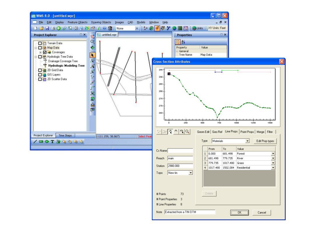 | 1,146 × 800 (111 KB) | Trabadi (talk | contribs) |
You cannot overwrite this file.
File usage
The following page uses this file: