File:WMS GISdataExample.png: Difference between revisions
From XMS Wiki
Jump to navigationJump to search
m (Jcreer moved page File:Image299.gif to File:WMS GISdataExample.gif) |
No edit summary |
||
| Line 1: | Line 1: | ||
[[Category:WMS Quick Tour]] | [[Category:WMS Quick Tour]] | ||
GIS data example. | |||
The GIS module in WMS is designed for reading GIS data into WMS. The GIS data can then be converted to Feature Objects, or simply act as a background image. | The GIS module in WMS is designed for reading GIS data into WMS. The GIS data can then be converted to Feature Objects, or simply act as a background image. | ||
Revision as of 16:40, 2 June 2015
GIS data example.
The GIS module in WMS is designed for reading GIS data into WMS. The GIS data can then be converted to Feature Objects, or simply act as a background image.
File history
Click on a date/time to view the file as it appeared at that time.
| Date/Time | Thumbnail | Dimensions | User | Comment | |
|---|---|---|---|---|---|
| current | ★ Approved revision 15:44, 9 January 2017 | 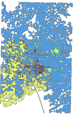 | 256 × 400 (21 KB) | Jcreer (talk | contribs) | |
| 19:54, 7 June 2007 |  | 256 × 400 (15 KB) | Cballard (talk | contribs) |
You cannot overwrite this file.
File usage
The following page uses this file: