Uploads by Cmsmemoe
From XMS Wiki
Jump to navigationJump to search
This special page shows all uploaded files.
| Date | Name | Thumbnail | Size | Description | Versions |
|---|---|---|---|---|---|
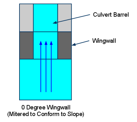
| 22:50, 16 June 2011 | 0DegreeWingwallConspanCulvertDiagram.png (file) |  |
9 KB | O Degree Wingwall Conspan Culvert Diagram | 1 |
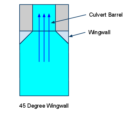
| 22:49, 16 June 2011 | 45DegreeWingwallConspanCulvertDiagram.png (file) |  |
8 KB | 45 Degree Wingwall Conspan Culvert Diagram | 1 |
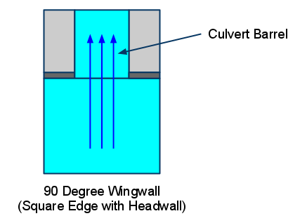
| 22:51, 16 June 2011 | 90DegreeWingwallConspanCulvertDiagram.png (file) |  |
8 KB | 90 Degree Wingwall Conspan Culvert Diagram | 1 |
| 21:38, 18 October 2012 | AddDataCommand.png (file) | 4 KB | Get Data Toolbar with the Add Data button. | 1 | |
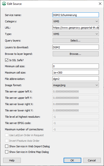
| 20:42, 22 March 2023 | AddNewSource.png (file) |  |
20 KB | 2 | |
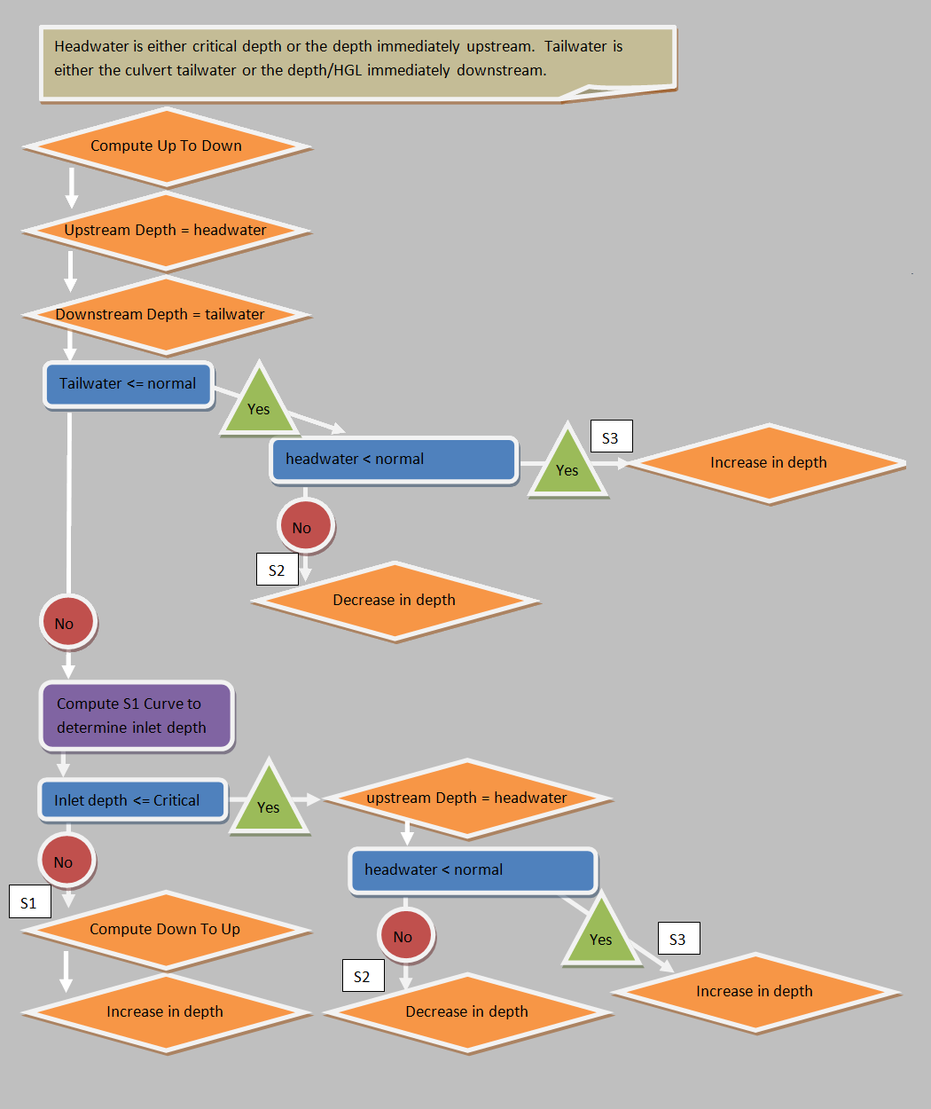
| 21:51, 6 October 2011 | BrokenBackMildBoundaryConditions.png (file) |  |
82 KB | Diagram describing the steps for computing the boundary conditions for a mild broken back culvert section | 1 |
| 21:50, 6 October 2011 | BrokenBackSteepBoundaryConditions.png (file) |  |
108 KB | Diagram describing the steps for computing the boundary conditions for a steep broken back culvert section | 1 |
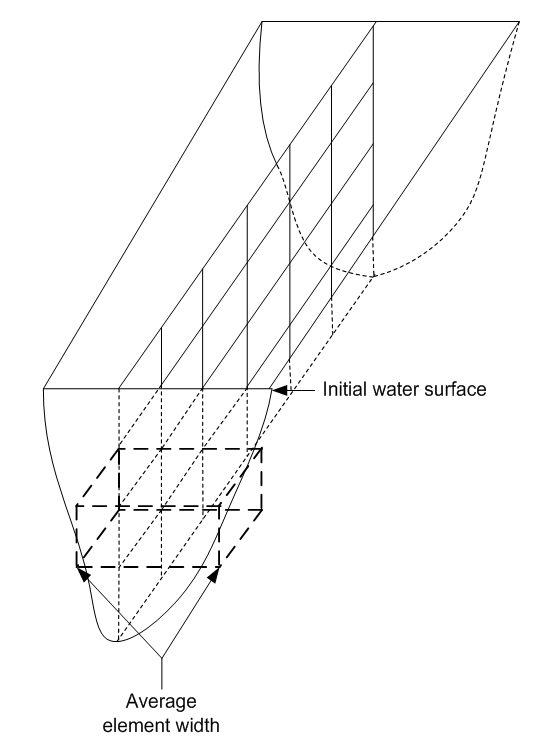
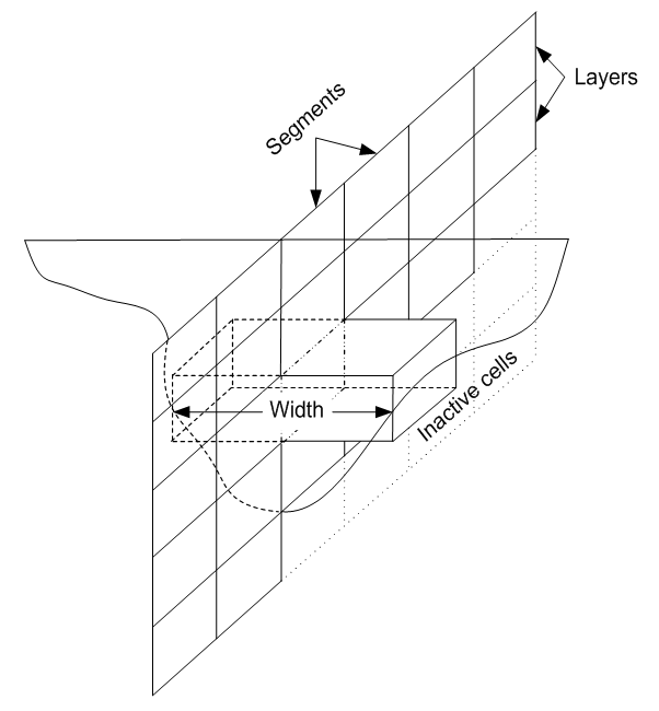
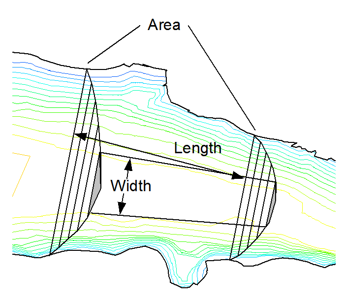
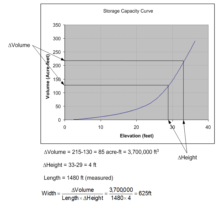
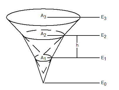
| 00:38, 20 March 2013 | CEQUALW2BathymetryFig1.png (file) |  |
25 KB | 1 | |
| 00:56, 20 March 2013 | CEQUALW2BathymetryFig10.png (file) |  |
19 KB | 1 | |
| 00:56, 20 March 2013 | CEQUALW2BathymetryFig11.png (file) |  |
22 KB | 1 | |
| 00:38, 20 March 2013 | CEQUALW2BathymetryFig2.png (file) |  |
42 KB | 1 | |
| 00:38, 20 March 2013 | CEQUALW2BathymetryFig3.png (file) |  |
36 KB | 1 | |
| 00:38, 20 March 2013 | CEQUALW2BathymetryFig4.png (file) |  |
36 KB | 1 | |
| 00:39, 20 March 2013 | CEQUALW2BathymetryFig5.png (file) |  |
48 KB | 1 | |
| 00:39, 20 March 2013 | CEQUALW2BathymetryFig6.png (file) |  |
7 KB | 1 | |
| 00:55, 20 March 2013 | CEQUALW2BathymetryFig7.png (file) |  |
19 KB | 1 | |
| 00:55, 20 March 2013 | CEQUALW2BathymetryFig8.png (file) |  |
65 KB | 1 | |
| 00:56, 20 March 2013 | CEQUALW2BathymetryFig9.png (file) |  |
22 KB | 1 | |
| 20:29, 26 February 2009 | Calibration.png (file) |  |
80 KB | 1 | |
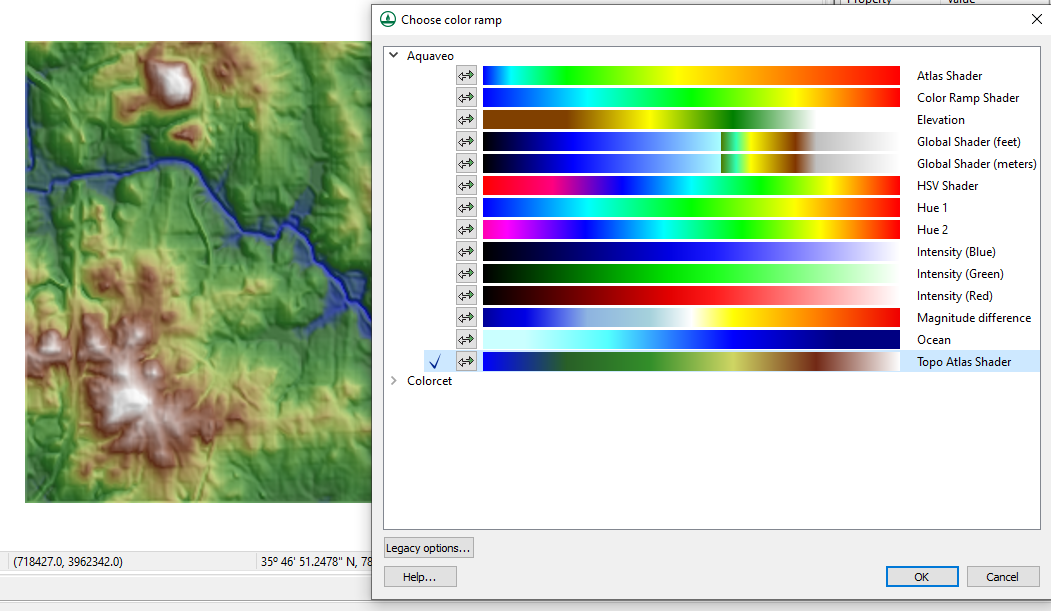
| 06:21, 8 March 2023 | ColorPalettes.png (file) |  |
451 KB | Choose color ramp dialog in WMS. | 1 |
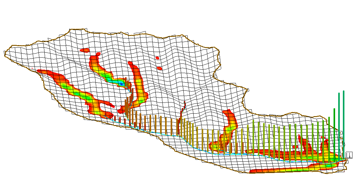
| 16:36, 22 September 2009 | ConstituentMassPlot.png (file) |  |
144 KB | 1 | |
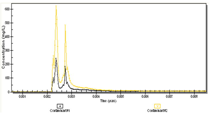
| 16:36, 22 September 2009 | ContaminantConcentration.png (file) |  |
46 KB | 1 | |
| 18:35, 24 October 2017 | CorineLandUseTable.txt (file) | 2 KB | CORINE (European Land Cover Database) land use table for computing composite curve numbers. | 1 | |
| 18:46, 17 May 2018 | CrossSectionDatabase.png (file) |  |
29 KB | 1 | |
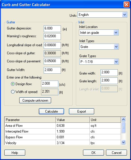
| 20:36, 18 March 2008 | CurbGutterCalculator.jpg (file) |  |
62 KB | 1 | |
| 19:18, 18 December 2008 | DatasetZonalClassification2.jpg (file) |  |
78 KB | 1 | |
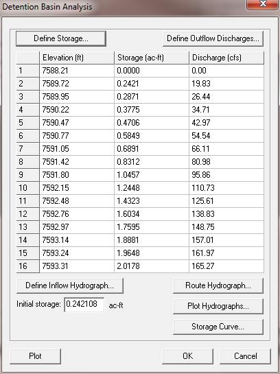
| 23:13, 9 February 2011 | DetentionBasinAnalysis.png (file) |  |
21 KB | 1 | |
| 23:51, 19 March 2013 | DisplayOrderOffObliqueView.png (file) |  |
512 KB | 1 | |
| 23:51, 19 March 2013 | DisplayOrderOnObliqueView.png (file) |  |
521 KB | 1 | |
| 23:50, 19 March 2013 | DisplayOrderOnPlanView.png (file) |  |
67 KB | 1 | |
| 21:49, 6 October 2011 | DoubleBrokenBackCulvert.png (file) |  |
22 KB | Double Broken Back Culvert Diagram | 1 |
| 20:31, 26 February 2009 | Embankments.png (file) |  |
331 KB | 1 | |
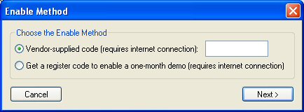
| 21:50, 4 September 2008 | EnableWizard.jpg (file) |  |
20 KB | 1 | |
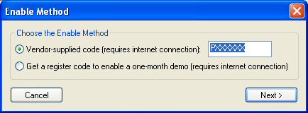
| 22:28, 4 September 2008 | EnableWizard1.jpg (file) |  |
20 KB | 1 | |
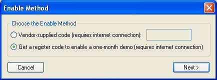
| 22:30, 4 September 2008 | EnableWizard2.jpg (file) |  |
21 KB | 1 | |
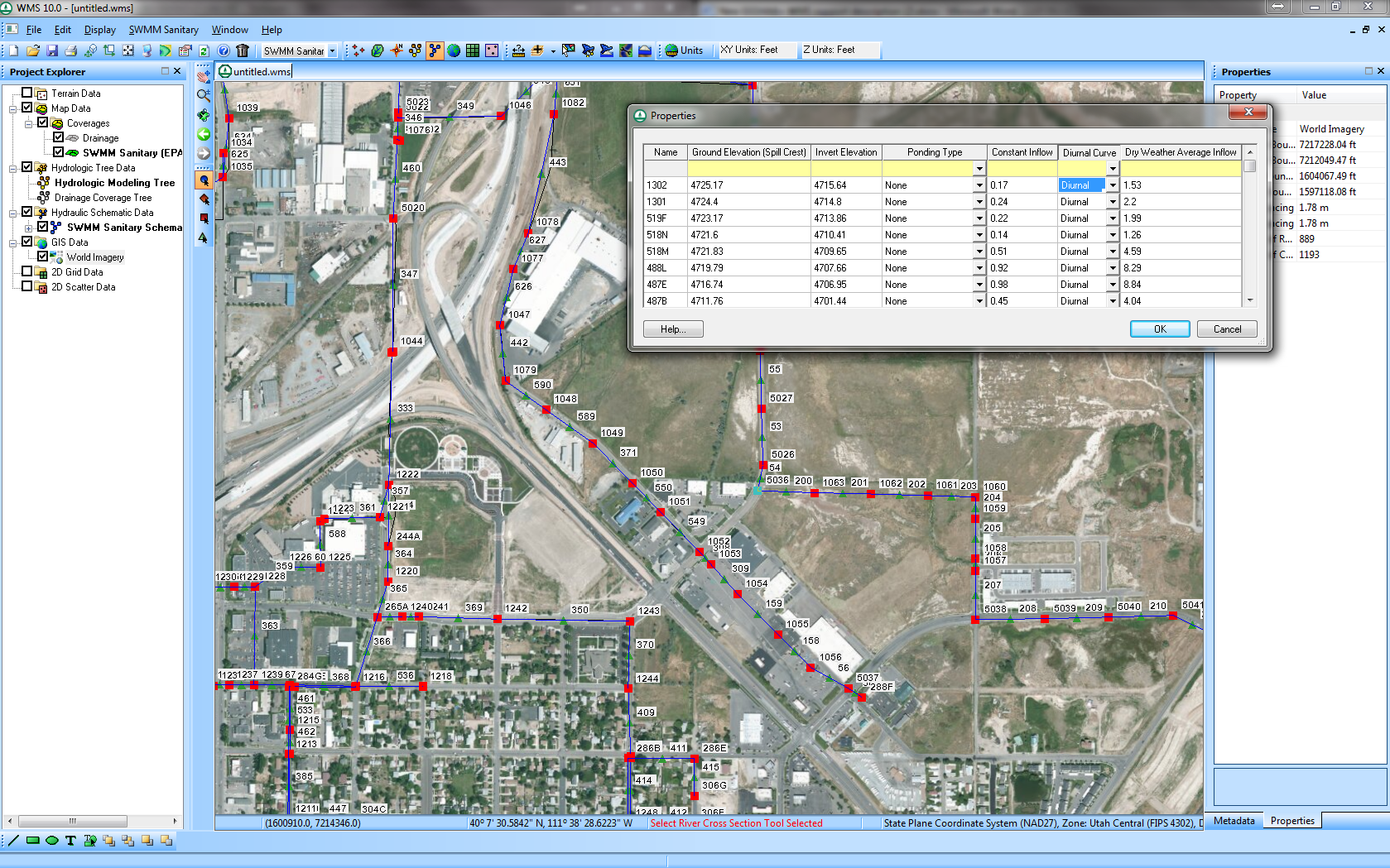
| 17:37, 12 June 2014 | EpaSwmmSanitarySewerModeling.png (file) |  |
1.58 MB | 1 | |
| 22:21, 7 December 2015 | Epanet.png (file) |  |
169 KB | EPANET Interface | 1 |
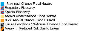
| 20:29, 20 January 2015 | FEMAFloodMapLegend.png (file) |  |
3 KB | 1 | |
| 17:47, 12 June 2014 | FemaFloodBoundaryLines.png (file) |  |
1.15 MB | 1 | |
| 17:47, 12 June 2014 | FemaFloodMapImages.png (file) |  |
1.18 MB | 1 | |
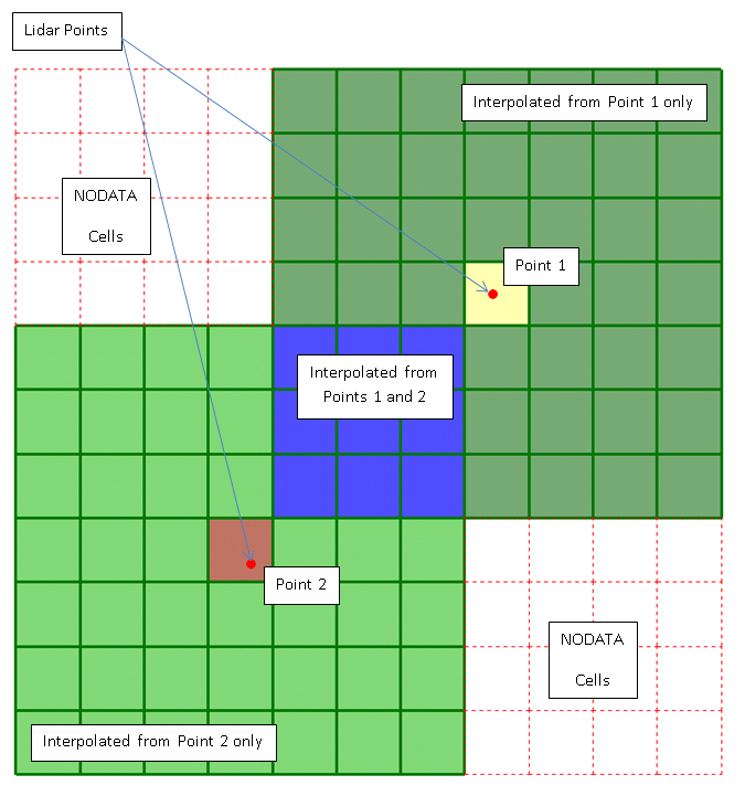
| 21:12, 26 May 2021 | FillWithFilter.png (file) |  |
83 KB | 1 | |
| 17:29, 15 December 2011 | GSDA CGIAR.png (file) | 15 KB | 2 | ||
| 17:26, 15 December 2011 | GSDA GeoBase.png (file) |  |
20 KB | 1 | |
| 17:17, 15 December 2011 | GSDA GeoCommunity.png (file) |  |
10 KB | 1 | |
| 17:17, 15 December 2011 | GSDA LandInfo.png (file) |  |
13 KB | 1 | |
| 17:16, 15 December 2011 | GSDA MapMart.png (file) |  |
17 KB | 1 | |
| 17:16, 15 December 2011 | GSDA USGS.png (file) |  |
12 KB | 1 | |
| 17:16, 15 December 2011 | GSDA webGIS.png (file) |  |
4 KB | 1 | |
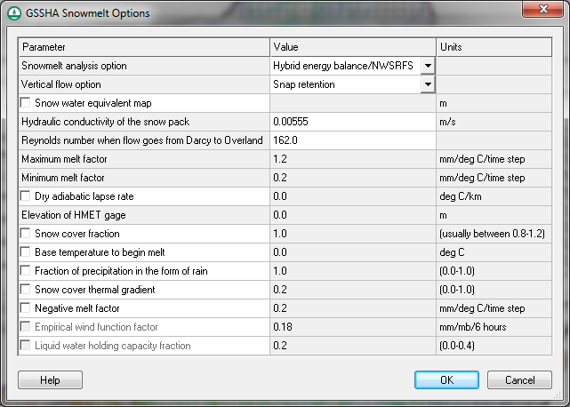
| 00:15, 19 October 2012 | GSSHASnowmelt.png (file) |  |
46 KB | GSSHA Snowmelt Dialog | 1 |
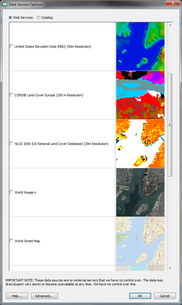
| 23:23, 18 October 2012 | GetDataDialog.png (file) |  |
217 KB | The Data Service Options (Get Data) dialog | 1 |