Help
Uploads by Jmonson
From XMS Wiki
Jump to navigation
Jump to search
This special page shows all uploaded files.
File list
Items per page:
20
50
100
250
500
Username:
Include old versions of files
Go
First page
Previous page
Next page
Last page
Date
Name
Thumbnail
Size
Description
Versions
00:51, 15 October 2015
2D Grid Module icon.png
(
file
)
357 bytes
1
19:41, 21 August 2019
AHGW-image-library.png
(
file
)
272 KB
Arc Hydro Groundwater
gallery image for splash page.
Category:AHGW General Information
1
23:49, 11 November 2019
AHGW - ArcGIS Field Calculator dialog.png
(
file
)
35 KB
The
''Field Calculator'' dialog
in ArcGIS.
Category:ArcGIS Images
1
18:48, 12 September 2019
AHGW - Arc Hydro Groundwater Toolbar.png
(
file
)
5 KB
The
''Arc Hydro Groundwater Toolbar''
in
Arc Hydro Groundwater
.
Category:AHGW Toolbars
1
18:45, 12 September 2019
AHGW - Arc Hydro Groundwater Toolbar floating.png
(
file
)
6 KB
The
''Arc Hydro Groundwater Toolbar'' (floating)
in
Arc Hydro Groundwater
.
Category:AHGW Toolbars
1
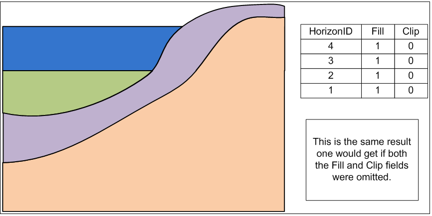
22:41, 23 October 2019
AHGW - GeoSections showing the default clip and fill options.png
(
file
)
29 KB
Example of GeoSections showing the default clip and fill options.
Category:AHGW Images
Category:AHGW Subsurface Analyst
1
19:05, 12 September 2019
AHGW - MODFLOW Analyst Toolbar.png
(
file
)
4 KB
The
''MODFLOW Analyst Toolbar''
in
Arc Hydro Groundwater
.
Category:AHGW Toolbars
Category:AHGW MODFLOW Analyst
Category:AHGW Images
1
19:06, 12 September 2019
AHGW - MODFLOW Analyst Toolbar floating.png
(
file
)
6 KB
The
''MODFLOW Analyst Toolbar'' (floating)
in
Arc Hydro Groundwater
.
Category:AHGW Toolbars
Category:AHGW MODFLOW Analyst
Category:AHGW Images
1
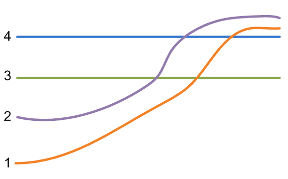
22:39, 23 October 2019
AHGW - Sample horizons ordered by HorizonID values.png
(
file
)
14 KB
Example of horizons ordered by HorizonID values.
Category:AHGW Images
Category:AHGW Subsurface Analyst
1
19:03, 22 August 2019
AHGW - The Assign Related Identifier tool assists in populating key fields.png
(
file
)
23 KB
The Assign Related Identifier tool assists in populating key fields in
Arc Hydro Groundwater
.
Category:AHGW Images
1
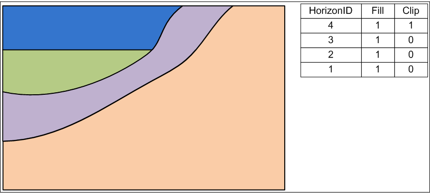
22:41, 23 October 2019
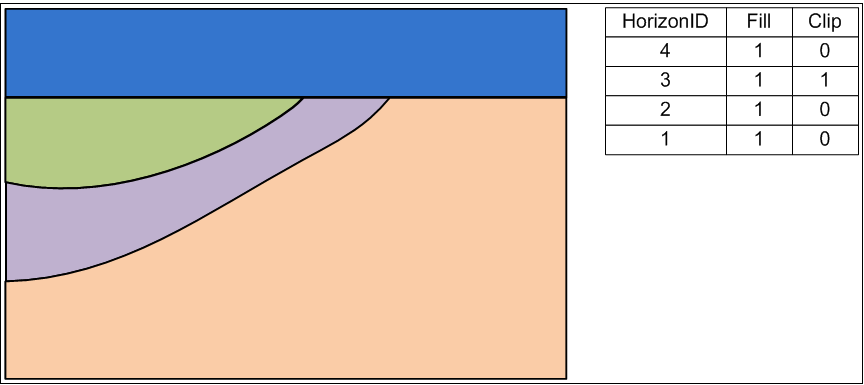
AHGW - Using the clip option for the top horizon.png
(
file
)
18 KB
Example of using the clip option for the top horizon.
Category:AHGW Images
Category:AHGW Subsurface Analyst
1
22:42, 23 October 2019
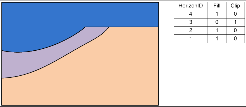
AHGW - Using the clip option on other horizons.png
(
file
)
14 KB
Example of using the clip option on other horizons.
Category:AHGW Images
Category:AHGW Subsurface Analyst
1
22:42, 23 October 2019
AHGW - Using the fill option on horizons.png
(
file
)
15 KB
Example of using the fill option on horizons.
Category:AHGW Images
Category:AHGW Subsurface Analyst
1
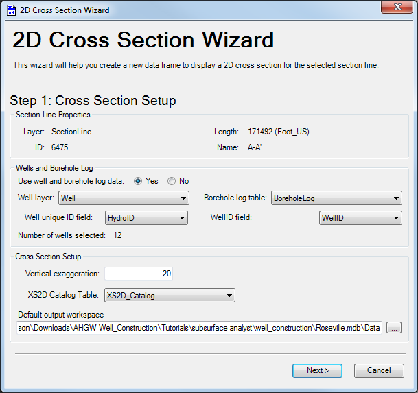
22:24, 28 October 2019
AHGW 2D Cross Section Wizard dialog Step 1.png
(
file
)
45 KB
Step 1 of the
''2D Cross Section Wizard'' dialog
accessed from the
Arc Hydro Groundwater Toolbar
in
ArcGIS
.
Category:AHGW Images
1
22:25, 28 October 2019
AHGW 2D Cross Section Wizard dialog Step 2.png
(
file
)
44 KB
Step 2 of the
''2D Cross Section Wizard'' dialog
accessed from the
Arc Hydro Groundwater Toolbar
in
ArcGIS
.
Category:AHGW Images
1
22:25, 28 October 2019
AHGW 2D Cross Section Wizard dialog Step 3.png
(
file
)
44 KB
Step 3 of the
''2D Cross Section Wizard'' dialog
accessed from the
Arc Hydro Groundwater Toolbar
in
ArcGIS
.
Category:AHGW Images
1
18:28, 22 August 2019
AHGW 3D GeoSection features example.jpg
(
file
)
23 KB
3D GeoSection features example from
Arc Hydro Groundwater
.
Category:AHGW Images
1
20:58, 21 August 2019
AHGW 3D borelines visualization.png
(
file
)
124 KB
Visualizing boreholes example from
Arc Hydro Groundwater
.
Category:AHGW General Information
1
20:58, 21 August 2019
AHGW 3D geovolumes Ssa3.png
(
file
)
80 KB
Generated 3D GeoVolumes example from
Arc Hydro Groundwater
.
Category:AHGW General Information
1
22:03, 21 August 2019
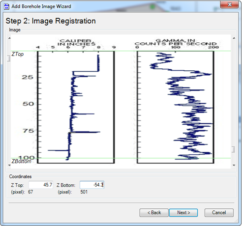
AHGW Add Borehole Image Wizard dialog step 2 v3 2 0.png
(
file
)
106 KB
Page 2 of the
''Add Borehole Image Wizard'' dialog
from
Arc Hydro Groundwater
.
Category:AHGW General Information
1
22:03, 21 August 2019
AHGW Add Borehole Image Wizard results example v3 2 0.png
(
file
)
111 KB
Example results from the
''Add Borehole Image Wizard'' dialog
from
Arc Hydro Groundwater
.
Category:AHGW General Information
1
20:43, 7 November 2019
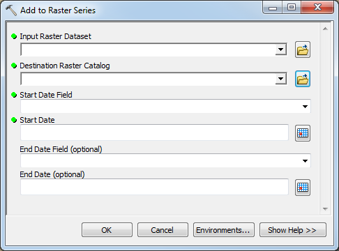
AHGW Add to Raster Series dialog.png
(
file
)
25 KB
The
''Add to Raster Series'' dialog
from
Arc Hydro Groundwater
.
Category:AHGW Images
Category:AHGW Groundwater Analyst
Category:AHGW Dialogs
1
19:35, 12 September 2019
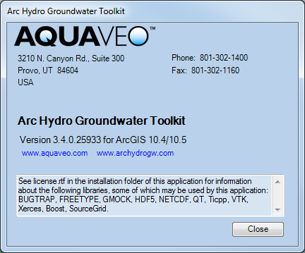
AHGW Arc Hydro Groundwater Toolkit dialog.png
(
file
)
32 KB
The
''Arc Hydro Groundwater Toolkit''
dialog in
ArcGIS
.
1
00:09, 8 November 2019
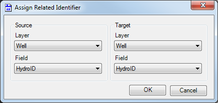
AHGW Assign Related Identifier dialog.png
(
file
)
17 KB
2
18:27, 22 August 2019
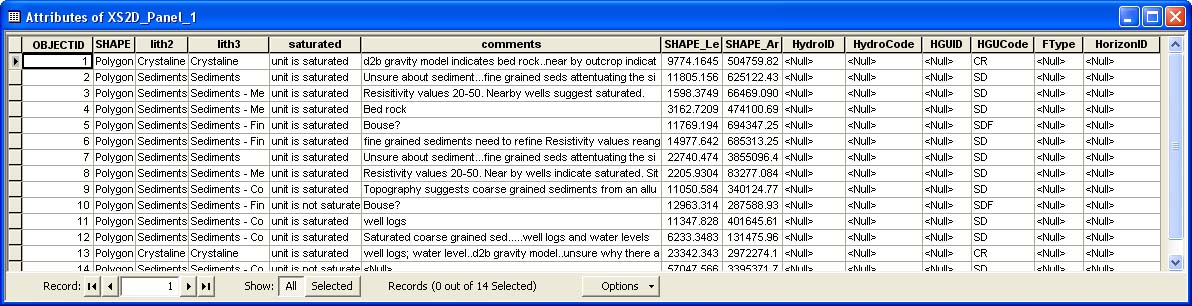
AHGW Attributes XS2D Panel example.jpg
(
file
)
158 KB
Attributes XS2D Panel example from
Arc Hydro Groundwater
.
Category:AHGW Images
1
22:33, 11 November 2019
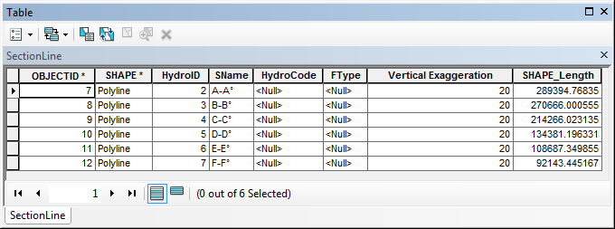
AHGW Attributes of SectionLine dialog example.jpg
(
file
)
22 KB
2
19:48, 22 August 2019
AHGW BAS6 component used by the Build MODFLOW Cell3D tool.jpg
(
file
)
28 KB
BAS6 component used by the MODFLOW
''Build Cell3D Features'' tool
in
Arc Hydro Groundwater
.
Category:AHGW Images
Category:MODFLOW
1
19:49, 22 August 2019
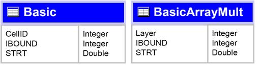
AHGW Basic tables for the BuildMODFLOW Cell3D tool.jpg
(
file
)
15 KB
Basic tables for the BuildMODFLOW Cell3D tool in
Arc Hydro Groundwater
.
Category:AHGW Images
Category:MODFLOW
1
20:12, 22 August 2019
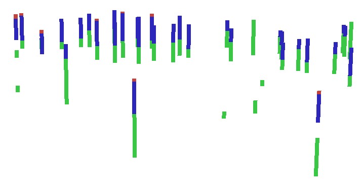
AHGW BoreLines example.jpg
(
file
)
24 KB
Example results from using the
''Create Borelines'' tool
in
Arc Hydro Groundwater
.
Category:AHGW Images
1
22:39, 25 October 2019
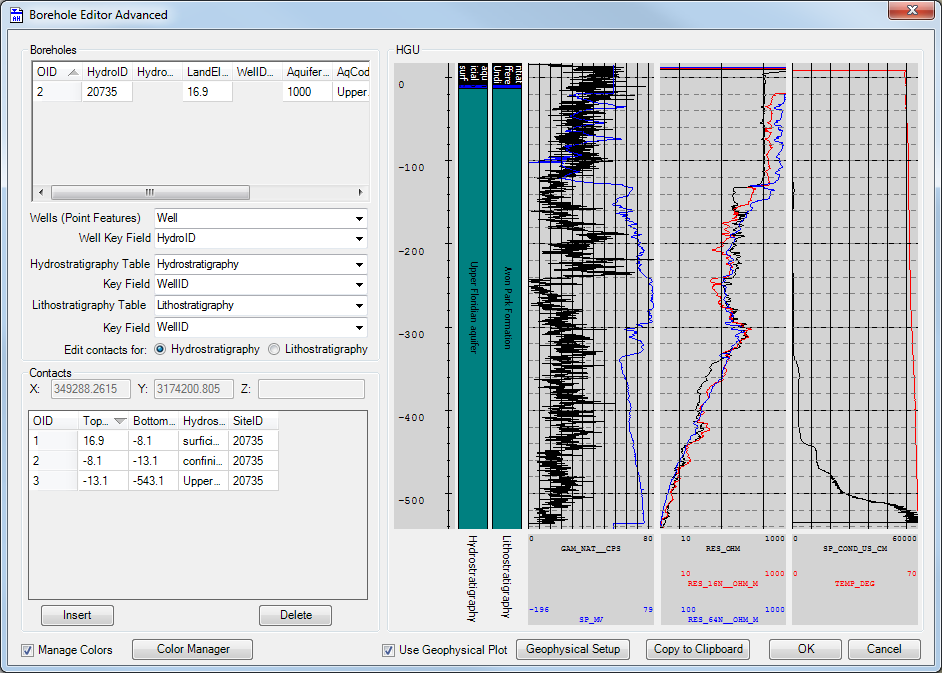
AHGW Borehole Editor Advanced dialog.png
(
file
)
80 KB
The
''Borehole Editor Advanced'' dialog
accessed from the
Arc Hydro Groundwater Toolbar
in
ArcGIS
.
Category:AHGW Images
1
19:29, 22 August 2019
AHGW Borehole Editor dialog.jpg
(
file
)
72 KB
The
''Borehole Editor'' dialog
from
Arc Hydro Groundwater
.
Category:AHGW Images
1
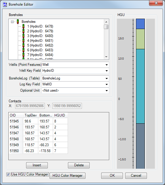
19:57, 25 October 2019
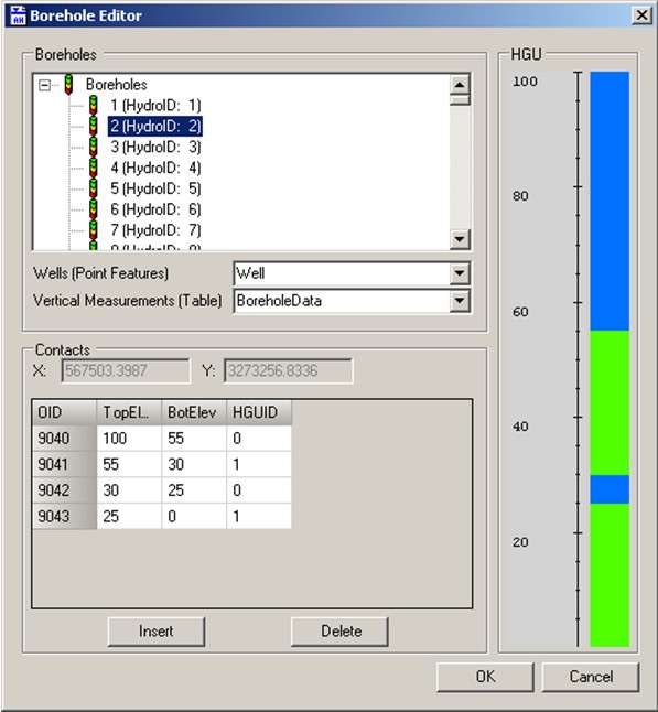
AHGW Borehole Editor dialog.png
(
file
)
51 KB
The
''Borehole Editor'' dialog
accessed from the
Arc Hydro Groundwater Toolbar
in
ArcGIS
.
Category:AHGW Images
1
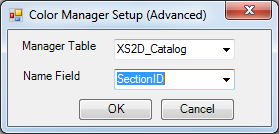
23:21, 25 October 2019
AHGW Color Manager Setup (Advanced) dialog.png
(
file
)
14 KB
The
''Color Manager Setup (Advanced)'' dialog
in
ArcGIS
.
Category:AHGW Images
1
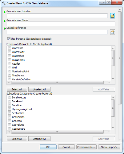
21:37, 21 August 2019
AHGW Create Blank AHGW Geodatabase dialog v3 1 0.png
(
file
)
64 KB
The
''Create Blank AHGW Database'' dialog
from
Arc Hydro Groundwater
.
Category:AHGW General Information
1
22:05, 4 November 2019
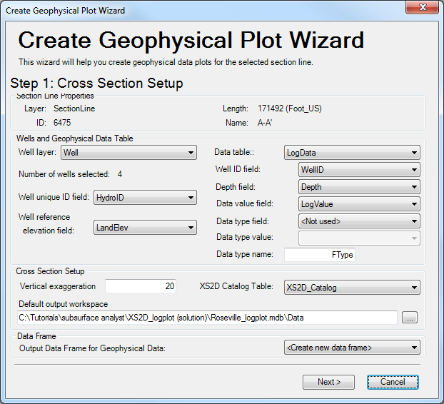
AHGW Create Geophysical Plot Wizard (wells) dialog Step 1.png
(
file
)
57 KB
The
''Create Geophysical Plot Wizard'' dialog for wells
, accessed from the
Arc Hydro Groundwater Toolbar
in
ArcGIS
.
Category:AHGW Images
1
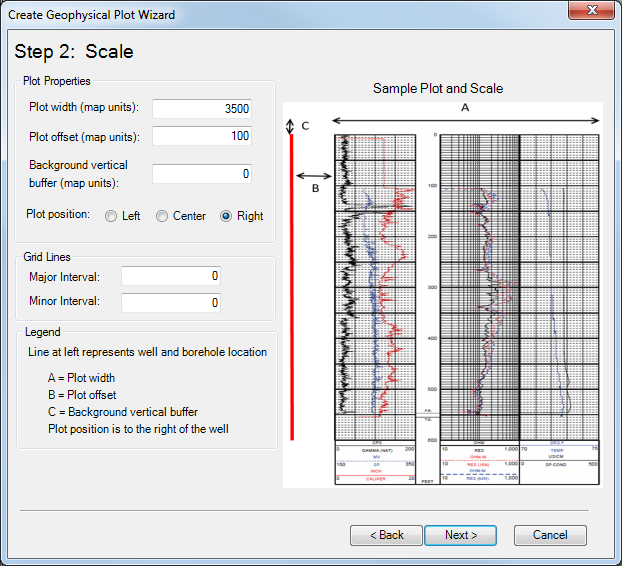
22:24, 4 November 2019
AHGW Create Geophysical Plot Wizard (wells) dialog Step 2.png
(
file
)
221 KB
The second page of the
''Create Geophysical Plot Wizard'' dialog for wells
, accessed from the
Arc Hydro Groundwater Toolbar
in
ArcGIS
.
Category:AHGW Images
1
22:43, 4 November 2019
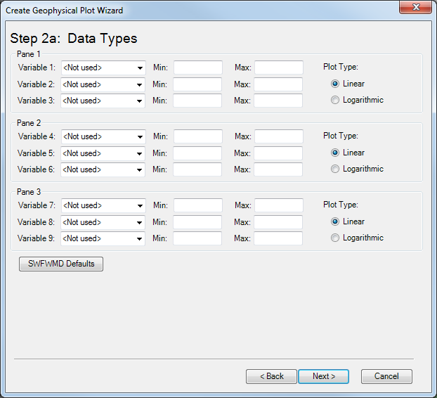
AHGW Create Geophysical Plot Wizard (wells) dialog Step 2a.png
(
file
)
43 KB
Page 2a of the
''Create Geophysical Plot Wizard'' dialog for wells
, accessed from the
Arc Hydro Groundwater Toolbar
in
ArcGIS
.
Category:AHGW Images
1
22:47, 4 November 2019
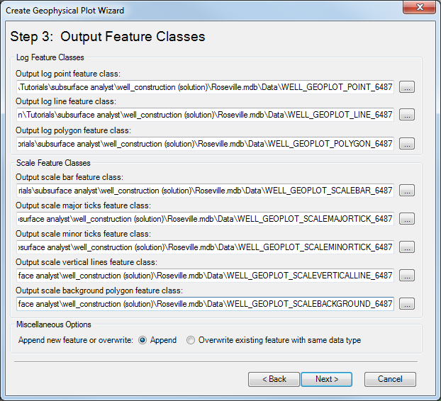
AHGW Create Geophysical Plot Wizard (wells) dialog Step 3.png
(
file
)
60 KB
Page 3 of the
''Create Geophysical Plot Wizard'' dialog for wells
, accessed from the
Arc Hydro Groundwater Toolbar
in
ArcGIS
.
Category:AHGW Images
1
22:48, 4 November 2019
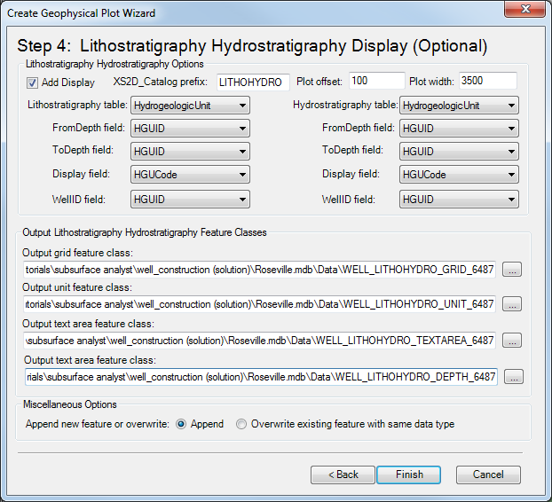
AHGW Create Geophysical Plot Wizard (wells) dialog Step 4.png
(
file
)
56 KB
Page 4 of the
''Create Geophysical Plot Wizard'' dialog for wells
, accessed from the
Arc Hydro Groundwater Toolbar
in
ArcGIS
.
Category:AHGW Images
1
21:45, 21 August 2019
AHGW Create Geophysical Plot Wizard dialog step 1.png
(
file
)
47 KB
Page 1 of the
''Create Geophysical Plot Wizard'' dialog
from
Arc Hydro Groundwater
.
Category:AHGW General Information
1
21:45, 21 August 2019
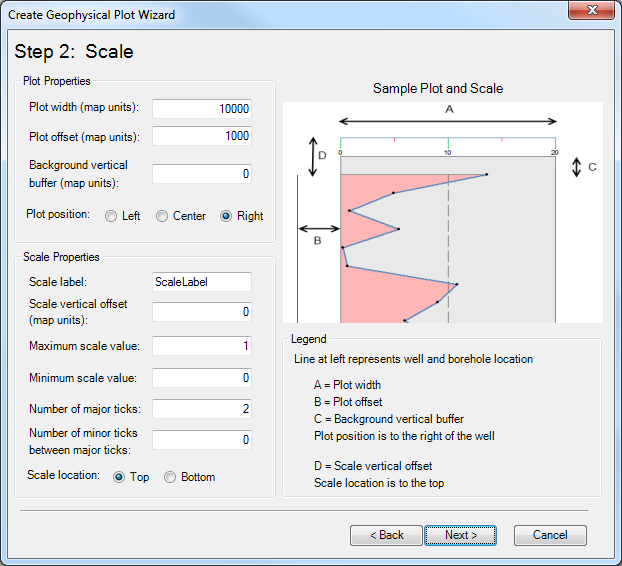
AHGW Create Geophysical Plot Wizard dialog step 2.png
(
file
)
45 KB
Page 2 of the
''Create Geophysical Plot Wizard'' dialog
from
Arc Hydro Groundwater
.
Category:AHGW General Information
1
21:45, 21 August 2019
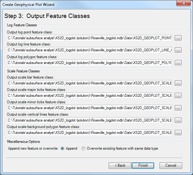
AHGW Create Geophysical Plot Wizard dialog step 3.png
(
file
)
50 KB
Page 3 of the
''Create Geophysical Plot Wizard'' dialog
from
Arc Hydro Groundwater
.
Category:AHGW General Information
1
18:41, 5 November 2019
AHGW Create Lithological Description Wizard dialog Step 1.png
(
file
)
59 KB
Page 1 of the
''Create Lithological Description Wizard'' dialog for wells
, accessed from the
Arc Hydro Groundwater Toolbar
in
ArcGIS
.
Category:AHGW Images
1
18:41, 5 November 2019
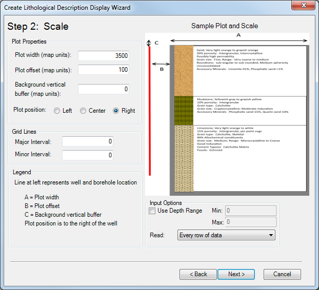
AHGW Create Lithological Description Wizard dialog Step 2.png
(
file
)
96 KB
Page 2 of the
''Create Lithological Description Wizard'' dialog for wells
, accessed from the
Arc Hydro Groundwater Toolbar
in
ArcGIS
.
Category:AHGW Images
1
18:42, 5 November 2019
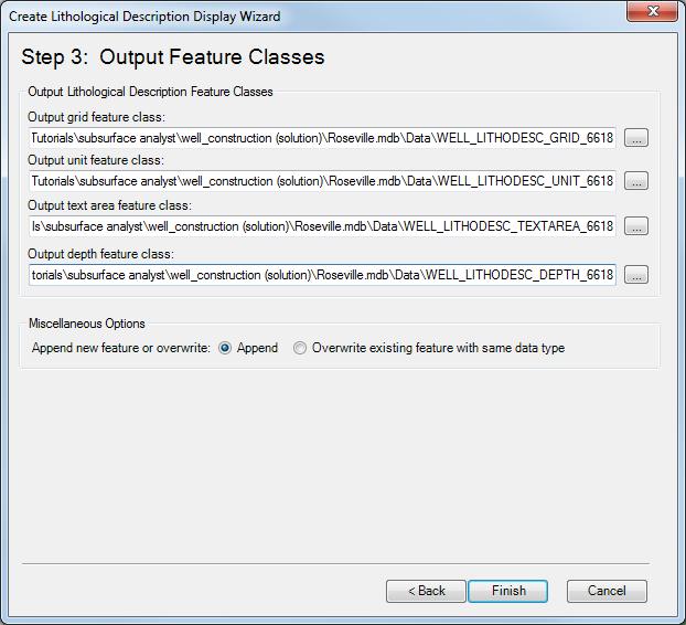
AHGW Create Lithological Description Wizard dialog Step 3.png
(
file
)
43 KB
Page 3 of the
''Create Lithological Description Wizard'' dialog for wells
, accessed from the
Arc Hydro Groundwater Toolbar
in
ArcGIS
.
Category:AHGW Images
1
21:06, 21 August 2019
AHGW Create Non-vertical Borelines.png
(
file
)
6 KB
Example of non-vertical borelines from
Arc Hydro Groundwater
.
Category:AHGW General Information
1
18:26, 22 August 2019
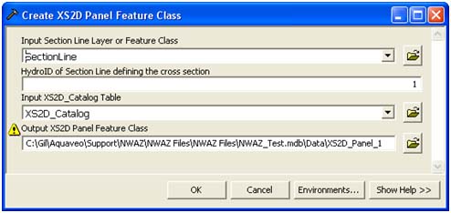
AHGW Create XS2D Panel Feature Class dialog.jpg
(
file
)
37 KB
The
''Create XS2D Panel Feature Class'' dialog
from
Arc Hydro Groundwater
.
Category:AHGW Images
1
22:04, 21 August 2019
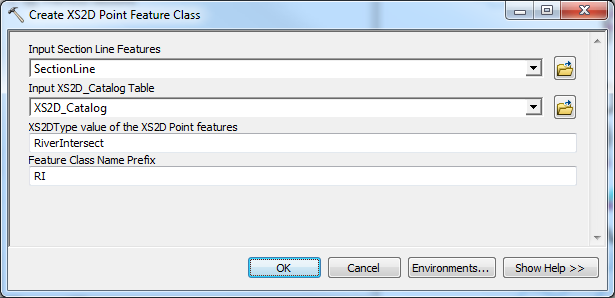
AHGW Create XS2D Point Feature Class dialog v3 2 0.png
(
file
)
28 KB
The
''Create XS2D Point Feature Class'' dialog
from
Arc Hydro Groundwater
.
Category:AHGW General Information
1
18:28, 22 August 2019
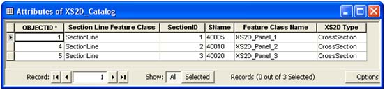
AHGW Example XS2D Catalog Table.jpg
(
file
)
33 KB
Example XS2D Catalog Table from
Arc Hydro Groundwater
.
Category:AHGW Images
1
18:39, 23 August 2019
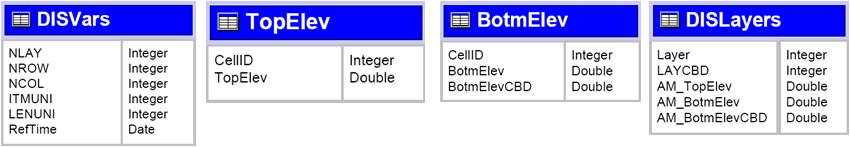
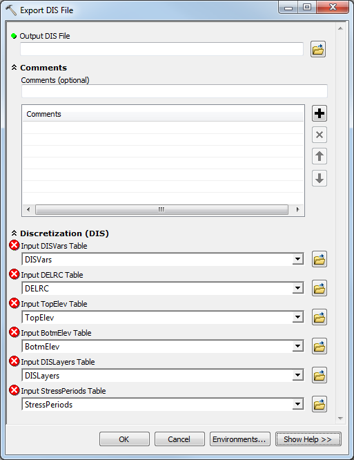
AHGW Export DIS File dialog.png
(
file
)
43 KB
2
First page
Previous page
Next page
Last page
Navigation menu
Page actions
Special page
Page actions
Special page
Tools
Personal tools
English
Create account
Log in
XMS Projects
XMS
GMS
SMS
WMS
AHGW
CityWater
Search
Links
Aquaveo
Downloads
Licensing
Training
Consulting
Help
Tools
User contributions
Logs
View user groups
Special pages
Printable version


_dialog.png)
_dialog_Step_1.png)
_dialog_Step_2.png)
_dialog_Step_2a.png)
_dialog_Step_3.png)
_dialog_Step_4.png)


