Gallery of new files
From XMS Wiki
Jump to navigationJump to search
This special page shows the last uploaded files.
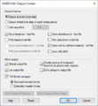
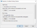
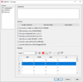
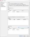
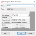
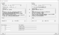
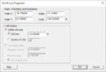
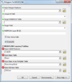
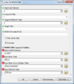
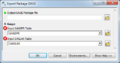
 GMS MODFLOW 6 - Constant-Head (CHD) Package dialog.png Jcreer
21:17, 7 February 2020
649 × 657; 27 KB
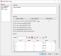
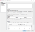
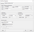
 GMS MODFLOW 6 - Structured Discretization (DIS) Package dialog.png Jcreer
21:01, 7 February 2020
688 × 766; 31 KB


 GMS MODFLOW 6 - Filter on Selected Cells button.png Jmonson
23:25, 4 February 2020
24 × 24; 785 bytes


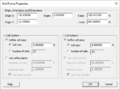
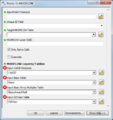
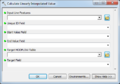
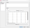 GMS MODFLOW 6 - Initial Conditions (IC) Package dialog.png Jmonson
20:48, 4 February 2020
704 × 647; 17 KB
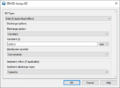
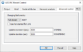
 GMS MODFLOW 6 - Node Property Flow (NPF) Package dialog.png Jmonson
00:11, 1 February 2020
704 × 647; 31 KB
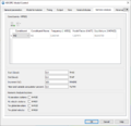
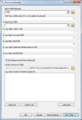
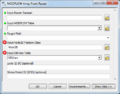
 GMS MODFLOW 6 - Iterative Model Solution (IMS) dialog.png Jmonson
23:08, 30 January 2020
704 × 647; 26 KB


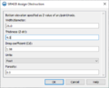
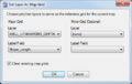
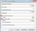
 GMS MODFLOW 6 - Temporal Discretization (TDIS) Package dialog.png Jmonson
21:53, 30 January 2020
766 × 647; 17 KB


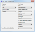

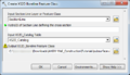
 AHGW using the Time Series Statistics tool with the Import Raster Series tool - model example.png Jcreer
23:31, 5 November 2019
1,618 × 730; 90 KB
 AHGW Create Lithological Description Wizard dialog Step 3.png Jmonson
18:42, 5 November 2019
622 × 566; 43 KB
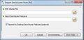
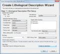
 AHGW Create Lithological Description Wizard dialog Step 2.png Jmonson
18:41, 5 November 2019
622 × 566; 96 KB
 AHGW Create Lithological Description Wizard dialog Step 1.png Jmonson
18:41, 5 November 2019
622 × 566; 59 KB
 AHGW Create Geophysical Plot Wizard (wells) dialog Step 4.png Jmonson
22:48, 4 November 2019
622 × 566; 56 KB
 AHGW Create Geophysical Plot Wizard (wells) dialog Step 3.png Jmonson
22:47, 4 November 2019
622 × 566; 60 KB
 AHGW Create Geophysical Plot Wizard (wells) dialog Step 2a.png Jmonson
22:43, 4 November 2019
622 × 566; 43 KB
 AHGW Create Geophysical Plot Wizard (wells) dialog Step 2.png Jmonson
22:24, 4 November 2019
622 × 566; 221 KB
 AHGW Create Geophysical Plot Wizard (wells) dialog Step 1.png Jmonson
22:05, 4 November 2019
622 × 566; 57 KB


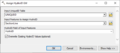
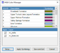
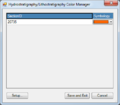 AHGW Hydrostratigraphy-Lithostratigraphy Color Manager dialog.png Jmonson
23:25, 25 October 2019
406 × 354; 18 KB

 ArcGIS Borehole-Well Editor and Advanced Editor icon 10 5.png Jmonson
19:20, 25 October 2019
16 × 16; 720 bytes

 AHGW - Using the clip option for the top horizon.png Jmonson
22:41, 23 October 2019
864 × 389; 18 KB
 AHGW - GeoSections showing the default clip and fill options.png Jmonson
22:41, 23 October 2019
866 × 434; 29 KB
 AHGW - Sample horizons ordered by HorizonID values.png Jmonson
22:39, 23 October 2019
574 × 357; 14 KB

 AHGW Subsurface Analyst XS2D Editor - Transform Faults to XS2D Lines.png Jcreer
17:49, 18 September 2019
377 × 434; 20 KB

 AHGW Subsurface Analyst XS2D Editor - Transform Raster to XS2D Line.png Jcreer
16:31, 13 September 2019
377 × 361; 18 KB
 AHGW Subsurface Analyst XS2D Editor - Transform GeoSection to XS2D Panel.png Jcreer
16:29, 13 September 2019
377 × 254; 13 KB


 AHGW Subsurface Analyst XS2D Editor - Transform Lines to XS2D Points.png Jcreer
14:16, 10 September 2019
377 × 365; 20 KB
 AHGW Subsurface Analyst XS2D Editor - Transform Points to XS2D Points.png Jcreer
14:14, 10 September 2019
377 × 365; 20 KB

 AHGW Subsurface Analyst XS2D Editor - Transform Polygons to XS2D Lines.png Jcreer
16:51, 5 September 2019
377 × 421; 20 KB
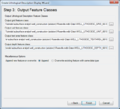
 AHGW Subsurface Analyst XS2D Editor - Create XS2D Line Feature Class.png Jcreer
16:50, 5 September 2019
375 × 260; 12 KB

 AHGW Subsurface Analyst XS2D Editor - Transform XS2D Well Detail Polygon.png Jmonson
22:43, 30 August 2019
486 × 637; 41 KB
 AHGW Subsurface Analyst XS2D Editor - Transform XS2D Well Detail Line.png Jmonson
22:17, 30 August 2019
486 × 614; 39 KB
 AHGW Subsurface Analyst XS2D Editor - Transform XS2D Panel to GeoSection.png Jmonson
22:04, 30 August 2019
486 × 257; 27 KB
 AHGW Subsurface Analyst XS2D Editor - Transform XS2D Lines to Points.png Jmonson
21:46, 30 August 2019
486 × 281; 26 KB
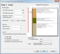
 AHGW Subsurface Analyst XS2D Editor - Scale XS2D Features.png Jmonson
19:15, 30 August 2019
486 × 241; 23 KB
 AHGW Subsurface Analyst XS2D Editor - Reverse Section Line Orientation.png Jmonson
19:10, 30 August 2019
486 × 227; 21 KB


 AHGW Subsurface Analyst XS2D Editor - NonVertical Boreline to XS2D.png Jmonson
17:24, 30 August 2019
486 × 333; 30 KB
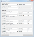
 AHGW Subsurface Analyst XS2D Editor - Create XS2D Catalog Table.png Jmonson
17:15, 30 August 2019
486 × 232; 20 KB
 AHGW Subsurface Analyst XS2D Editor - Create XS2D Polygon Feature Class.png Jmonson
17:12, 30 August 2019
486 × 263; 26 KB
 AHGW Subsurface Analyst XS2D Editor - Create XS2D Point Feature Class.png Jmonson
17:08, 30 August 2019
486 × 263; 26 KB
 AHGW Subsurface Analyst XS2D Editor - Create XS2D Panel Feature Class.png Jmonson
16:59, 30 August 2019
486 × 269; 29 KB
 AHGW Subsurface Analyst XS2D Editor - Create XS2D Panel Divider.png Jmonson
16:54, 30 August 2019
486 × 346; 32 KB
 AHGW Subsurface Analyst XS2D Editor - Create XS2D Grid.png Jmonson
16:22, 30 August 2019
486 × 605; 62 KB

 AHGW Subsurface Analyst Features - Desurvey Borelog.png Jmonson
21:50, 29 August 2019
486 × 712; 51 KB
 AHGW Subsurface Analyst XS2D Editor - Create XS2D Boreline Feature Class.png Jmonson
21:47, 29 August 2019
486 × 280; 44 KB
 AHGW Subsurface Analyst XS2D Editor - Create XS2D Geophysical Plot Features for Well.png Jmonson
20:01, 29 August 2019
486 × 1,674; 84 KB
 AHGW Subsurface Analyst XS2D Editor - Create XS2D Geophysical Plot Features.png Jmonson
19:52, 29 August 2019
486 × 1,018; 57 KB
 AHGW Subsurface Analyst XS2D Editor - Create XS2D Geophysical Plot Feature Classes.png Jmonson
19:26, 29 August 2019
486 × 246; 25 KB
 AHGW Subsurface Analyst XS2D Editor - Create XS2D Borelines.png Jmonson
18:47, 29 August 2019
486 × 449; 37 KB
 AHGW Subsurface Analyst XS2D Editor - Create Lithostratigraphy Hydrostratigraphy Feature Classes.png Jmonson
18:27, 29 August 2019
486 × 269; 27 KB
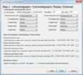
 AHGW Subsurface Analyst XS2D Editor - Create Lithostratigraphy Hydrostratigraphy Display.png Jmonson
18:18, 29 August 2019
486 × 1,080; 63 KB
 AHGW Subsurface Analyst Features - Rasters to GeoVolumes.png Jmonson
00:11, 29 August 2019
486 × 440; 32 KB
 AHGW Subsurface Analyst Features - Rasters to GeoSections.png Jmonson
00:02, 29 August 2019
486 × 438; 34 KB
 AHGW Subsurface Analyst Features - GeoSection to Points.png Jmonson
23:41, 28 August 2019
486 × 297; 27 KB


 AHGW Subsurface Analyst Features - Create SectionLine Feature Class.png Jmonson
20:45, 28 August 2019
486 × 227; 20 KB
 AHGW Subsurface Analyst Features - Create GeoVolume Feature Class.png Jmonson
20:34, 28 August 2019
486 × 228; 22 KB
 AHGW Subsurface Analyst Features - Create GeoSection Feature Class.png Jmonson
20:32, 28 August 2019
486 × 228; 22 KB
 AHGW Subsurface Analyst Features - Create BorePoints.png Jmonson
20:27, 28 August 2019
486 × 229; 21 KB
 AHGW Subsurface Analyst Features - Create BoreLines.png Jmonson
20:07, 28 August 2019
486 × 515; 32 KB
 AHGW Subsurface Analyst Features - BoreholeLog Table to Points.png Jmonson
20:03, 28 August 2019
486 × 701; 39 KB
 AHGW Subsurface Analyst Features - Borehole Data to Borepoints.png Jmonson
19:03, 28 August 2019
486 × 630; 35 KB
 AHGW Subsurface Analyst 3D Import- Create 3D Geophysical Plot Features.png Jmonson
17:34, 28 August 2019
486 × 418; 31 KB
 AHGW MODFLOW Analyst Well Permitting - Create Well Feature.png Jmonson
23:55, 27 August 2019
486 × 423; 26 KB
 AHGW MODFLOW Analyst Well Permitting - Create MODFLOW Well Records.png Jmonson
23:46, 27 August 2019
486 × 605; 42 KB
 AHGW MODFLOW Analyst Well Permitting - Copy Simulated to Observed.png Jmonson
23:35, 27 August 2019
486 × 227; 22 KB
 AHGW MODFLOW Analyst Well Permitting - Copy Output to Starting Heads.png Jmonson
23:31, 27 August 2019
486 × 247; 25 KB
 AHGW MODFLOW Analyst Views - Make MODFLOW Feature Layer.png Jmonson
23:26, 27 August 2019
486 × 746; 47 KB

 AHGW MODFLOW Analyst Views - Create MODFLOW Features.png Jmonson
22:19, 27 August 2019
486 × 750; 47 KB

 AHGW MODFLOW Analyst Tables - Polygons to MODFLOW.png Jmonson
20:55, 27 August 2019
486 × 553; 40 KB
 AHGW MODFLOW Analyst Tables - MODFLOW Array from Raster.png Jmonson
20:42, 27 August 2019
486 × 380; 30 KB
 AHGW MODFLOW Analyst Tables - MODFLOW Array from Polygons.png Jmonson
20:36, 27 August 2019
486 × 420; 31 KB
 AHGW MODFLOW Analyst Tables - MODFLOW Array Based Parameters to Table.png Jmonson
20:26, 27 August 2019
486 × 661; 53 KB
 AHGW MODFLOW Analyst Tables - Delete MODFLOW Tables.png Jmonson
20:11, 27 August 2019
486 × 225; 18 KB
 AHGW MODFLOW Analyst Tables - Create CellIndex Table.png Jmonson
20:07, 27 August 2019
486 × 223; 21 KB
 AHGW MODFLOW Analyst Tables - Calculate Linearly Interpolated Value.png Jmonson
19:26, 27 August 2019
486 × 340; 25 KB
 AHGW MODFLOW Analyst Stress Periods - Add SP Start and End.png Jmonson
19:09, 27 August 2019
486 × 221; 22 KB
 AHGW MODFLOW Analyst Stress Periods - Add Absolute Time.png Jmonson
19:08, 27 August 2019
477 × 214; 22 KB
 AHGW MODFLOW Analyst Import - Import Simulated Equivalents.png Jmonson
18:01, 27 August 2019
486 × 275; 27 KB
 AHGW MODFLOW Analyst Import - Import MODFLOW Tables.png Jmonson
17:32, 27 August 2019
486 × 451; 43 KB
 AHGW MODFLOW Analyst Import - Import MODFLOW Output.png Jmonson
16:51, 27 August 2019
486 × 647; 51 KB
 AHGW MODFLOW Analyst Import - Import MODFLOW Model.png Jmonson
21:17, 26 August 2019
486 × 513; 42 KB
 AHGW MODFLOW Analyst Import - Import Georeferenced MODFLOW Model.png Jmonson
21:04, 26 August 2019
486 × 341; 32 KB
 AHGW MODFLOW Analyst Import - Fill Output Arrays dialog.png Jmonson
20:52, 26 August 2019
486 × 384; 35 KB
 AHGW MODFLOW Analyst Import - Create MODFLOW World File dialog.png Jmonson
20:43, 26 August 2019
486 × 301; 26 KB
 AHGW MODFLOW Analyst Import - Add Output File dialog.png Jmonson
20:30, 26 August 2019
486 × 358; 28 KB
 AHGW MODFLOW Analyst Features - DIS to Boundary dialog.png Jmonson
20:06, 26 August 2019
486 × 348; 28 KB
 AHGW MODFLOW Analyst Features - Create MODFLOW Node3D dialog.png Jmonson
20:01, 26 August 2019
486 × 532; 45 KB
 AHGW MODFLOW Analyst Features - Create MODFLOW Node2D dialog.png Jmonson
19:55, 26 August 2019
486 × 230; 23 KB
 AHGW MODFLOW Analyst Features - Create MODFLOW Cell3D dialog.png Jmonson
19:51, 26 August 2019
486 × 528; 45 KB
 AHGW MODFLOW Analyst Features - Create MODFLOW Cell2D dialog.png Jmonson
19:44, 26 August 2019
486 × 278; 28 KB
 AHGW MODFLOW Analyst Features - Build Boundary Rectangle dialog.png Jmonson
19:38, 26 August 2019
486 × 332; 25 KB
 AHGW MODFLOW Analyst Features - Boundary to DIS Refine Points dialog.png Jmonson
19:29, 26 August 2019
486 × 490; 34 KB
 AHGW MODFLOW Analyst Features - Boundary to DIS dialog.png Jmonson
19:21, 26 August 2019
486 × 415; 31 KB


 ArcGIS - Arc Hydro Groundwater toolbar - Field drop-downs.png Jmonson
19:01, 23 August 2019
304 × 22; 2 KB


_Package_dialog.png)
_Package_dialog.png)


_Package_dialog.png)


_Package_dialog.png)


_Package_dialog.png)

_dialog.png)


_Package_dialog.png)


_dialog_Step_4.png)
_dialog_Step_3.png)
_dialog_Step_2a.png)


_dialog_Step_2.png)
_dialog_Step_1.png)


_dialog.png)


