Template:SMS at a glance image support: Difference between revisions
From XMS Wiki
Jump to navigationJump to search
No edit summary |
No edit summary |
||
| Line 1: | Line 1: | ||
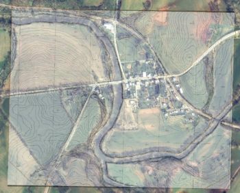
[[Image:SMS image transparency.jpg |thumb|350px|right|A color aerial photo under a semi-transparent topographic map]] | [[Image:SMS image transparency.jpg |thumb|350px|right|A color aerial photo under a semi-transparent topographic map]] | ||
{{{Heading}}} | {{{Heading}}} | ||
* Multiple images can be read/viewed at the same time | * Multiple images can be read/viewed at the same time (tiled or overlay) | ||
* Independent transparency specified for each image | |||
* Images can be loaded from web services as either static or dynamic images | |||
* Images can be draped over mesh or scatter data | |||
* Many image formats are supported including JPG, TIFF, PNG, MrSID, and ECW | * Many image formats are supported including JPG, TIFF, PNG, MrSID, and ECW | ||
* | * Local images can be geo-referenced to view images along with other data | ||
* Image pyramids can be created for very large images | |||
* Image pyramids can be created | |||
{{{Link|}}} | {{{Link|}}} | ||
<br style="clear:both;"/> | <br style="clear:both;"/> | ||
<noinclude>[[Category:SMS at a glance]]</noinclude> | <noinclude>[[Category:SMS at a glance]]</noinclude> | ||
Revision as of 19:54, 14 October 2014
{{{Heading}}}
- Multiple images can be read/viewed at the same time (tiled or overlay)
- Independent transparency specified for each image
- Images can be loaded from web services as either static or dynamic images
- Images can be draped over mesh or scatter data
- Many image formats are supported including JPG, TIFF, PNG, MrSID, and ECW
- Local images can be geo-referenced to view images along with other data
- Image pyramids can be created for very large images
