WMS:Quick Tour -Rational - IDF Curve Generation: Difference between revisions
From XMS Wiki
Jump to navigationJump to search
No edit summary |
No edit summary |
||
| Line 6: | Line 6: | ||
[[Category:WMS Quick Tour|R]] | [[Category:WMS Quick Tour|R]] | ||
[[Category:Rational Method]] | |||
Revision as of 16:29, 9 January 2017
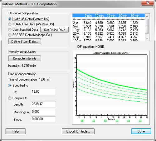
IDF curves, used to determine rainfall intensity in the rational equaiton, can be derived for any location in the united states. Hydro-35 (eastern) maps are included in the documentation, NOAA Atlas II maps (western) are available online. If there already is an IDF curve, the information may be entered into WMS for use with the Rational Method calculator.
