File:DEM Guidelines 4.jpg
From XMS Wiki
Jump to navigationJump to search
No higher resolution available.
DEM_Guidelines_4.jpg (394 × 373 pixels, file size: 36 KB, MIME type: image/jpeg)
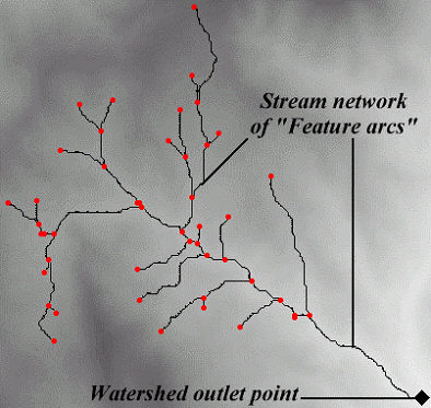
With the aid of the flow accumulations, the location of the watershed outlet needs to be determined and an outlet feature point created there. A minimum threshold is then defined and all of the DEM points “upstream” from the defined outlet(s) are connected together to form a stream network of feature arcs.
File history
Click on a date/time to view the file as it appeared at that time.
| Date/Time | Thumbnail | Dimensions | User | Comment | |
|---|---|---|---|---|---|
| current | ★ Approved revision 16:35, 2 February 2008 | | 394 × 373 (36 KB) | Eshaw (talk | contribs) |
You cannot overwrite this file.
File usage
The following page uses this file: