File:DEM Guidelines 5.jpg
From XMS Wiki
Jump to navigationJump to search
DEM_Guidelines_5.jpg (448 × 374 pixels, file size: 44 KB, MIME type: image/jpeg)
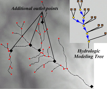
If wanting to further subdivide the watershed into sub-basins then nodes along the stream feature arcs should be converted to "outlet" nodes by using the feature point/node attributes dialog. As these nodes are converted the hydrologic modeling tree is automatically updated.
File history
Click on a date/time to view the file as it appeared at that time.
| Date/Time | Thumbnail | Dimensions | User | Comment | |
|---|---|---|---|---|---|
| current | ★ Approved revision 16:35, 2 February 2008 |  | 448 × 374 (44 KB) | Eshaw (talk | contribs) |
You cannot overwrite this file.
File usage
The following page uses this file:
