File:DEM Guidelines 7.jpg
From XMS Wiki
Jump to navigationJump to search
No higher resolution available.
DEM_Guidelines_7.jpg (377 × 378 pixels, file size: 53 KB, MIME type: image/jpeg)
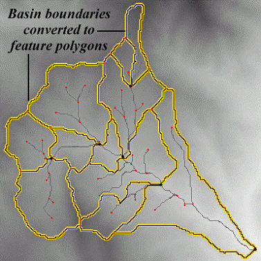
Similar to how flow accumulations were converted to stream arcs, the boundaries between DEM points with different basin IDs can be converted to feature polygons. Storing a basin as a single polygon rather than several hundreds (or thousands) of DEM cells is much more efficient.
File history
Click on a date/time to view the file as it appeared at that time.
| Date/Time | Thumbnail | Dimensions | User | Comment | |
|---|---|---|---|---|---|
| current | ★ Approved revision 16:36, 2 February 2008 | | 377 × 378 (53 KB) | Eshaw (talk | contribs) |
You cannot overwrite this file.
File usage
The following page uses this file: