File:GIS Attribute Table.png
From XMS Wiki
Jump to navigationJump to search
No higher resolution available.
GIS_Attribute_Table.png (562 × 396 pixels, file size: 22 KB, MIME type: image/png)
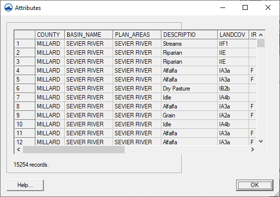
Example of a GIS Attributes table.
Example of the Attribute Table dialog using a shapefile
File history
Click on a date/time to view the file as it appeared at that time.
| Date/Time | Thumbnail | Dimensions | User | Comment | |
|---|---|---|---|---|---|
| current | ★ Approved revision 15:21, 30 September 2019 | | 562 × 396 (22 KB) | Jcreer (talk | contribs) | |
| 22:32, 8 July 2015 |  | 570 × 402 (104 KB) | Jcreer (talk | contribs) | ||
| 16:57, 24 April 2013 |  | 1,365 × 701 (274 KB) | Jcreer (talk | contribs) |
You cannot overwrite this file.
File usage
The following page uses this file: