File:JoinSsurgoData.png
From XMS Wiki
Jump to navigationJump to search

Size of this preview: 800 × 518 pixels. Other resolution: 849 × 550 pixels.
Original file (849 × 550 pixels, file size: 229 KB, MIME type: image/png)
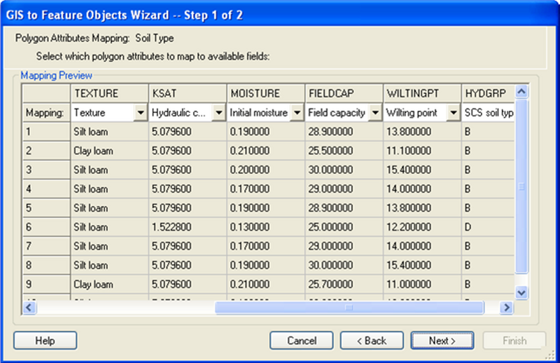
This figure shows the different values extracted from the SSURGO soil that are mapped in the WMS soil coverage.
File history
Click on a date/time to view the file as it appeared at that time.
| Date/Time | Thumbnail | Dimensions | User | Comment | |
|---|---|---|---|---|---|
| current | ★ Approved revision 16:37, 22 September 2009 | | 849 × 550 (229 KB) | Cmsmemoe (talk | contribs) |
You cannot overwrite this file.
File usage
The following page uses this file: