File:Swipackage.png
Original file (1,078 × 937 pixels, file size: 52 KB, MIME type: image/png)
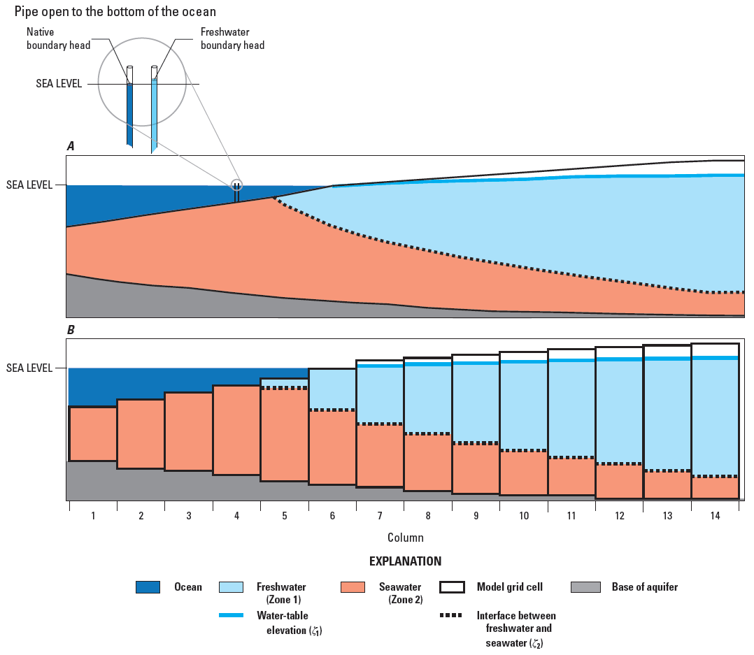
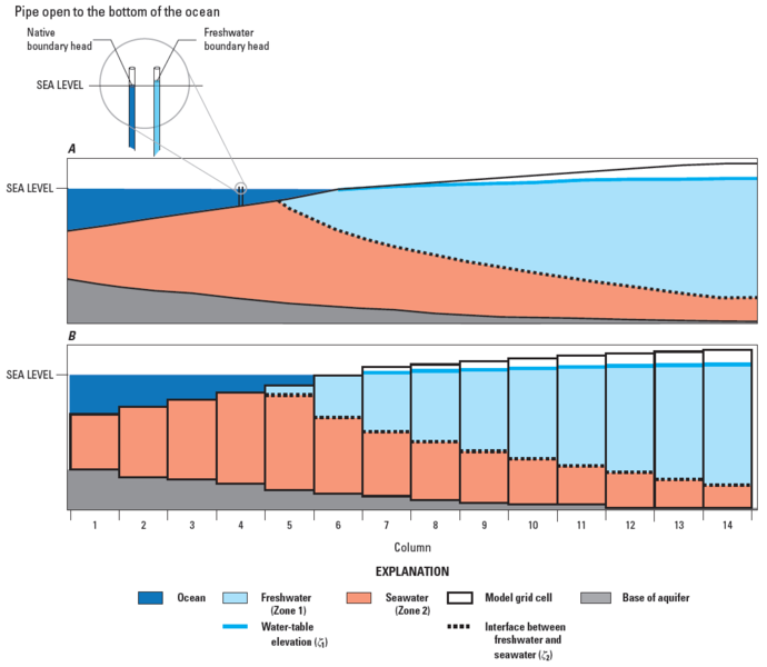
A, cross section through a coastal aquifer with freshwater flowing from right to left and discharging seaward of the coastline; B, cross section through a coastal aquifer discretized using a single model layer. The position of the freshwater-seawater interface is also shown on A and B.
Notes
Bakker, Mark, Schaars, Frans, Hughes, J.D., Langevin, C.D., and Dausman, A.M., (2013), Documentation of the Seawater Intrusion (SWI2) Package for MODFLOW: U.S. Geological Survey Techniques and Methods, book 6, chap. A46, 47 p.,, http://pubs.usgs.gov/tm/6a46/
File history
Click on a date/time to view the file as it appeared at that time.
| Date/Time | Thumbnail | Dimensions | User | Comment | |
|---|---|---|---|---|---|
| current | ★ Approved revision 18:31, 9 April 2015 | | 1,078 × 937 (52 KB) | Unjedai (talk | contribs) | |
| 18:28, 9 April 2015 | 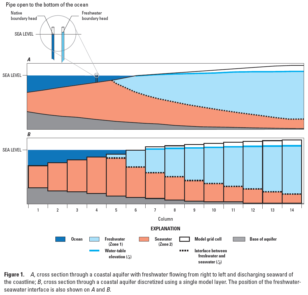 | 1,079 × 1,036 (63 KB) | Unjedai (talk | contribs) |
You cannot overwrite this file.
File usage
The following page uses this file: