File:Wetlands1.png
From XMS Wiki
Jump to navigationJump to search
No higher resolution available.
Wetlands1.png (650 × 292 pixels, file size: 108 KB, MIME type: image/png)
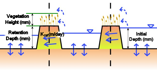
Lateral seepage flow conceptually is the flow through the subsurface peat layer. It is calculated as a darcian flow across the entire cell face. The flow through the vegetation is computed as a mixed mode flow, darcian and manning's. The flow is computed for both darcian and manning's flow and the actual flow rate varies between the two depending on the water height in relation to the plant height.
File history
Click on a date/time to view the file as it appeared at that time.
| Date/Time | Thumbnail | Dimensions | User | Comment | |
|---|---|---|---|---|---|
| current | ★ Approved revision 20:40, 1 October 2010 | | 650 × 292 (108 KB) | Cmsmemoe (talk | contribs) |
You cannot overwrite this file.
File usage
The following page uses this file: