WMS:Quick Tour - Conceptual Model: Difference between revisions
From XMS Wiki
Jump to navigationJump to search
No edit summary |
No edit summary |
||
| Line 9: | Line 9: | ||
[[Category:WMS Quick Tour|Conceptual]] | [[Category:WMS Quick Tour|Conceptual]] | ||
[[Category:WMS Map]] | |||
Revision as of 16:26, 9 January 2017
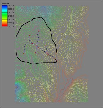
A conceptual model of the area the watershed exists in is created using a bounding polygon to define the limits of the area and stream arcs to identify the important channel data. The bounding polygon does not need to represent the actual watershed boundary; this will be determined later. The conceptual model will act like a "cookie cutter" in stamping out the region of the elevation data inside the polygon and then enforce the stream lines as triangle edges.

