User:Jcreer/Archived Images: Difference between revisions

From XMS Wiki
Jump to navigationJump to search
No edit summary
Line 78: Line 78:
|[[File:ArcGIS Database icon.png]]
|[[File:ArcGIS Database icon.png]]
|[[File:ArcGIS Catalog icon.png]]
|[[File:ArcGIS Catalog icon.png]]
|
|[[File:CityWaterSystemFlowBalanceIcon.png|16 px]]


|}
|}

Revision as of 22:42, 2 January 2020


This page shows images that are not being used, but may still have value. Images that are not being used and are not likely to be used in the future have been or will be deleted.

If an image on this page is being used in another wiki article, removed the image from this page.

Icons, Logos, and Headers

Files for icons and logos
Ambox deletion.png Ambox move.png Ambox speedy deletion.png X mark 18x18 04.gif Flecha tesela.png Ambox content.png Ambox notice.png Ambox protection.png Ambox style.png Book icoline.svg.png Edit-clear.png Gnome globe current event.png Padlock.png Sandbox.png Template-info.png
Wikibooks-logo.png Wikimedia-logo.png CGridDataTree.JPG Raster.png SMS Select 1D Grid Frame Tool Old.svg Windows - New Folder icon.png Cursor - Pointer Finger.png Get Data Tool icon inactive.png Vector Options macro inactive.png FrontView icon.png ObliqueView icon.png PreviousView icon.png SideView icon.png TethyWaterQualityOptionsIcon.png EPA SWMM Add button from Time Series Plot Selection dialog.png
Contour Options macro inactive.png NewIcon.jpg ZoomMapInIcon.jpg ZoomMapOutIcon.jpg PanIcon.jpg PerecentageIcon.jpg IncreaseBearingIcon.jpg DecreasebearingIcon.jpg IncreaseMapDipIcon.jpg DecreaseMapDipIcon.jpg Small drop-down arrow button from Parameters dialog.png Increment down arrow.png Increment up arrow.png Tree DataSetActive.png MapDataTree.jpg
Coverage icon - inactive.png Hydrologic Inactive Icon.svg SaveIcon.jpg HEC-HMS Project Explorer basin icon.png HEC-HMS Project Explorer control specifications icon.png HEC-HMS Project Explorer junction icon.png HEC-HMS Project Explorer meteorological model icon.png HEC-HMS Project Explorer sub-basin element icon.png HEC-HMS Project Explorer sub-basin icon.png SVG logo.svg EPA SWMM Create a Profile Plot icon.png EPA SWMM Time Series Plot button.png SMS 3D Cartesian Grid Module Icon.png ArcGIS Database icon.png ArcGIS Catalog icon.png CityWaterSystemFlowBalanceIcon.png

WSSMasthead4.png GSDAImage041.png GSDAImage042.png GmsBannerL.png GmsBannerR.png Aquaveo logo with water drop.png
Water waves with logo.png
Water waves with logo on top.png
Aquaveo logo background colors.png

Dialogs

Dialog images Group 1
HY8image41.jpg
ChannelCalculations.jpg
PressureFlowSimulation.jpg
Cartesian Grid Display Opttions.jpg
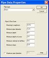
PipeDataProperties.jpg
SMS Vector Legen Options.jpg
NodeBC.JPG
WMS Display Opts Drawing Grid.jpg
Adcirc nodestrings.jpg
Probe manager.jpg
Rma4 material properties.jpg
SMS BOUSS 2D BC.jpg
CMS-Wave Model Control.jpg
STWAVE MC.jpg
STWAVE MC BC.jpg
SMS Film Loop Display.jpg
Generate Spectra.jpg
CityWaterWaterQualityOptions.png
WMS MWBM Embankmnet Locations.jpg
WMS MWBM Erosion Deposition.jpg
WMS MWBM GSSHA Parameters.jpg
WMS MWBM Index Maps.jpg
WMS MWBM Model Changes.jpg
WMS MWBM Outlet Locations.jpg
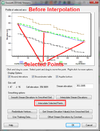
GsshaStormDrainElevationInterpFig2.png
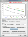
GsshaStormDrainElevationInterpFig3.png
GsshaStormDrainAdverseSlopeFig2.png
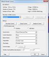
GsshaStormDrainPipeNodeParamsFig1.png
GsshaStormDrainIdentifyNodesFig1.png
GsshaStormDrainHydrographsFig1.png
Dialog images Group 2
CMS-Flow BC.jpg
ImportFromWeb-WebServiceOptions.png
Dataset Color Options SE.jpg
TUFLOW MC 1D general.jpg
TUFLOW Node Attributes.jpg
UGridInterpolation.png
WMS MWBM Define Watershed.jpg
PreferencesSEAWAT.jpg
MODFLOW-MNWIpackage.jpg
MODFLOW-SUB-Delay.jpg
TimeStepWindow.jpg
SMS - Create New Datum dialog.png
SelectProjection.jpg
NFF 1.jpg
TIN OptionsDialog.jpg
RegisterWMS.jpg
EnableWizard.jpg
EnableWizard1.jpg
EnableWizard2.jpg
WMS MWBM Elevation Data.jpg
WMS MWBM Output.jpg
WMS MWBM Rainfall.jpg
WMS MWBM Pumping Locations.jpg
WMS MWBM Output Locations.jpg
MWBM Wizard dialog - Read Existing Model.png
GsshaOverlandFlowBcRatingCurves.png
GsshaOverlandOutput.png
GsshaStormDrainHydrographsFig2.png
GsshaInsetModelModelLinkageOutput.png
GsshaInsetModelLinkToChildXY.png
NutrientsJobControl.jpg
GSSHAStreamIndexMap.jpg
SMS Info Raster.jpg
GridGenerator.png
Dialog images Group 3
Import Spectra.jpg
RunupPressureHeights.jpg
RasterTrimWarning.jpg
MergeRasterCellSize.jpg
ADH Model Control Transport.jpg
FESWMS Nodestring BC.jpg
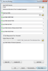
GIS SelectData.png
EditTR20ParametersQuick.jpg
HYDRO AS-2D GlobalParam.jpg
HYDRO AS-2D BCparameters.jpg
River Reach Att.jpg
SRHmonitorpointscoverage.jpg
TUFLOW AD IniConditions.png
TUFLOW AD MinDispersion.png
HMSjobcontrol.jpg
Featstamp.png
ZShape properties dialog.jpg
1D-HydraulicCross-Section.jpg
Refine Point.jpg
Databrowser.png
SMS Display Opts General.jpg
GsshaDepthVaryingRoughnessJobControl.png
GsshaDepthVaryingRoughnessIndexMap.png
GsshaLakeOptions.png
GSSHA Lakes and Wetlands.jpg
GsshaPipeArcProperties.png
GsshaPipePointProperties.png
GsshaStormDrainRedistributeFig2.png
AHGW Borehole Editor dialog.jpg
RasterDialog.png
AHGW Subsurface Analyst Features - Desurvey Borelog.png
AHGW Create XS2D Panel Feature Class dialog.jpg
AHGW Time Series Grapher Setup dialog.jpg

Graphs, Tables, and Equations

HY8Poly Table 2.JPG
HY8Poly Table 3.JPG
HY8Polynomial PipeArch.JPG
HY8Arch Table.JPG
HY8Arch High Profile.JPG
HY8Arch Low Profile Table.JPG
HY8User Defined Table.JPG
Brhole data.jpg
Brhole data cont.jpg
HY8Poly Table 1.JPG
Error.png
Weight.png
Profileplot.png
Alpha char.png
Mp3duTime.png
Cppcoordsys3.jpg

General Images

Images Group 1
Animation1.gif
Femwater.jpg
Brhole xsect.jpg
Solid cutaway.jpg
HY8Irregular Channel(SMALL).JPG
Solids.jpg
Xsect.jpg
3Dvisual.jpg
Manhole.jpg
3Dgeostat.jpg
TethysUsersPage.png
BOUSS-2D Boundary Image.png
SMS LayoutQuick2.jpg
ArcGIS - Arc Hydro Groundwater toolbar - Field drop-downs.png
GsshaInterface.png
Flux calib.jpg
UtexasDam.png
Saltlake b cropped.png
Hy8.png
X2coverage1.jpg
X2coverage2.jpg
GsshaStormDrainElevationInterpFig1.png
GsshaStormDrainAdverseSlopeFig1.png
GsshaStormDrainHydrographsFig3.png
AHGW Time Series example.png
AHGW MODFLOW Cell2D and Cell3D features example.jpg
AHGW BAS6 component used by the Build MODFLOW Cell3D tool.jpg
AHGW Basic tables for the BuildMODFLOW Cell3D tool.jpg
Images Group 2
Del criterion.png
LayoutSelectMenu.jpg
Conc isosurf w.png
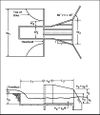
HY8fig9-11 hook trap (rev).jpg
HY8fig9-12hooktrap-hor (rev).jpg
HY8fig9-8hook (rev).jpg
HY8fig9-8b&w.jpg
HY8fig10-1riprap-plan-new text.jpg
HY8fig10-1riprap-profile-new text.jpg
HY8fig11-4 (box drop).jpg
Graphics window.jpg
Transparent logo block.png
Right Click GW.jpg
GsshaOverlandFlowBcExample.png
Terraserver.jpg
Generic Model Interface.jpg
WMS Screen.jpg
RationalStormDrainQuick.png
Water waves.png
GsshaStormDrainRedistributeFig3.png
GsshaStormDrainRedistributeFig1.png

Other