Category:Archived
From XMS Wiki
Jump to navigationJump to search
Articles and images that no longer used in release versions of XMS.
Subcategories
This category has the following 26 subcategories, out of 26 total.
1
- 1D River Dialogs (2 P, 10 F)
A
- Archived Icon Images (148 F)
- ART3D (1 P, 2 F)
B
- BASEMENT (2 P)
C
- Cascade Dialogs (1 P, 1 F)
- Archived CMS-Flow (13 P, 17 F)
- Coordinate Systems (19 P, 26 F)
- CSHORE (1 P)
- CSTORM-MS (1 P)
E
- EFDC Dialogs (1 P, 5 F)
- ELCIRC (2 P)
G
- GENESIS (4 P)
H
- HY-12 Dialogs (1 P, 9 F)
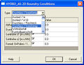
- HYDRO AS-2D Dialogs (1 P, 5 F)
M
- MWBM Dialogs (old) (13 F)
Q
- SMS Quick Tour (34 P, 36 F)
R
- RiverFlow2D (2 P)
S
- SMS 3D Cartesian Grid (2 P)
U
- UTCHEM (2 P, 1 F)
- UTEXAS Dialogs (2 P, 2 F)
W
Pages in category "Archived"
The following 146 pages are in this category, out of 146 total.
1
A
- SMS:ADCIRC Boundary Conditions 12.3 and earlier
- SMS:ADCIRC Coverage 12.3 and earlier
- SMS:ADCIRC Graphical Interface 12.3 and earlier
- SMS:ADCIRC Menu 12.3 and earlier
- SMS:ADCIRC Model Control 12.3 and earlier
- SMS:ADCIRC Spatial Attributes
- SMS:ADCIRC Weirs and Island Barriers
- GMS:ADH
- SMS:ADH Velocity Series Editor
- GMS:Arc Hydro Groundwater
- SMS:Archived Features
- GMS:Archived Features
- SMS:Archived Models
- GMS:ART3D
C
F
- GMS:FEMWATER Particle Sets
- SMS:FESWMS
- SMS:FESWMS Attributes Dialog
- SMS:FESWMS BC Nodestrings
- SMS:FESWMS executable known issues
- SMS:FESWMS Files
- SMS:FESWMS Graphical Interface
- SMS:FESWMS Hydraulic Structures
- SMS:FESWMS Material Properties
- SMS:FESWMS Menu
- SMS:FESWMS Model Control Dialog
- SMS:FESWMS Sediment Control
- SMS:FESWMS Spindown
- FHWA:2010 Webinars
- Flood Depth Raster Tool
- SMS:FTP Site Info
G
H
J
L
R
- Template:SMS at a glance raster module
- SMS:Raster Functionalities
- SMS:Raster Module
- SMS:Raster Module Interface
- User:Rcorrigan/Add WMS 11.2 Column
- User:Rcorrigan/GMS 10.6 Now Unsupported Table
- User:Rcorrigan/SMS 13.1 Now Unsupported Table
- SMS:Release Notes SMS 10.0
- SMS:Release Notes SMS 10.1
- SMS:Release Notes SMS 11.0
- SMS:Release Notes SMS 11.1
- SMS:Release Notes SMS 11.2
- SMS:Release Notes SMS 12.0
- GMS:Report A Bug
- SMS:Report Bug
- SMS:RiverFlow2D
- RMA4 errors
S
- SMS:Sample Problems
- SMS:SED-ZLJ
- SMS:Select/Delete Data...
- GMS:Set Operations
- Single Point Conversion
- SMS:Size Dataset Command
- Template:SMS at a glance coordinate systems
- Template:SMS at a glance create datasets
- Template:SMS at a glance drawing objects
- Template:SMS Deprecated Feature
- Template:SMS GIS Conversion
- Template:SMS GIS with ArcObjects Workflow
- Template:SMS Import Hydrologic Data Workflow
- SMS:Spectral Grid Properties
- Template:SRH Inflow BC Options Workflows
- Template:SRH Outflow BC Options Workflows
- SMS:SRH-2D Datasets to Rasters
- WMS:Storm Drain Job Control
- SMS:STWAVE Graphical Interface 12.3 and earlier
- SMS:STWAVE Menu 12.3 and earlier
- SMS:STWAVE Model Control 12.3 and earlier
T
Media in category "Archived"
The following 200 files are in this category, out of 242 total.
(previous page) (next page) 1D-HydraulicCross-Section.jpg 558 × 629; 102 KB
 1Dhydcrosssection.jpg 615 × 544; 114 KB
 2D Mesh Options.jpg 259 × 285; 27 KB
 3Dgeostat.jpg 512 × 281; 33 KB
 3Dvisual.jpg 512 × 274; 38 KB
 ADCIRC AddWeir.png 279 × 159; 12 KB
 ADCIRC Arc BC.jpg 456 × 405; 30 KB
 ADCIRC Binary Wind.jpg 304 × 222; 14 KB
 ADCIRC Fleet Wind File.jpg 444 × 365; 29 KB
 ADCIRC Island BC.jpg 636 × 360; 33 KB
 ADCIRC Mainland BC.jpg 636 × 360; 30 KB
 ADCIRC MC Files.jpg 732 × 611; 168 KB
 ADCIRC MC General.jpg 732 × 611; 110 KB
 ADCIRC MC Sediment.jpg 732 × 611; 61 KB
 ADCIRC MC Tidal.jpg 732 × 611; 128 KB
 ADCIRC MC Timing.jpg 732 × 611; 92 KB
 ADCIRC MC Wind.jpg 732 × 611; 64 KB
 ADCIRC NewConstituent.jpg 334 × 397; 45 KB
 Adcirc nodestrings.jpg 446 × 405; 49 KB
 ADCIRC Normal BC.jpg 321 × 186; 13 KB
 ADCIRC recording station.jpg 358 × 288; 21 KB
 ADCIRC RemoveWeir.png 356 × 195; 17 KB
 ADCIRC WettingDryingParameters.png 285 × 150; 12 KB
 ADCIRCweir1.jpg 1,043 × 833; 252 KB
 ADCIRCweir2.jpg 969 × 657; 261 KB
 ADCIRCweir4.jpg 687 × 555; 43 KB
 ADCIRCWeir5.jpg 626 × 350; 41 KB
 ADCIRCweirElevations.jpg 296 × 520; 33 KB
 ADH Constituents Table.png 405 × 275; 19 KB
 ADH Model Control Transport.jpg 696 × 500; 32 KB
 AHGW BAS6 component used by the Build MODFLOW Cell3D tool.jpg 850 × 147; 28 KB
 AHGW Basic tables for the BuildMODFLOW Cell3D tool.jpg 511 × 135; 15 KB
 AHGW Borehole Editor dialog.jpg 597 × 646; 72 KB
 AHGW Create XS2D Panel Feature Class dialog.jpg 494 × 234; 37 KB
 AHGW HGU Color Manager Dialog.png 392 × 348; 12 KB
 AHGW HGU Setup Dialog.png 246 × 174; 5 KB
 AHGW MODFLOW Cell2D and Cell3D features example.jpg 797 × 247; 26 KB
 AHGW Subsurface Analyst Features - Desurvey Borelog.png 486 × 712; 51 KB
 AHGW Time Series example.png 340 × 192; 50 KB
 AHGW Time Series Grapher Setup dialog.jpg 427 × 385; 27 KB
 Alpha char.png 14 × 11; 261 bytes
 Animation1.gif 200 × 155; 462 KB
 Aquaveo logo background colors.png 14 × 160; 706 bytes
 Aquaveo logo with water drop.png 160 × 160; 19 KB
 BOUSS-2D Boundary Image.png 401 × 341; 16 KB
 Brhole data cont.jpg 512 × 247; 18 KB
 Brhole data.jpg 512 × 369; 33 KB
 Brhole xsect.jpg 513 × 397; 40 KB
 Cartesian Grid Display Opttions.jpg 817 × 611; 27 KB
 ChannelCalculations.jpg 698 × 395; 130 KB
 CityWaterWaterQualityOptions.png 597 × 192; 17 KB
 CMS-Flow BC.jpg 399 × 448; 31 KB
 CMS-Wave Model Control.jpg 801 × 648; 74 KB
 CMS-Wave Structures dialog.bmp 276 × 328; 265 KB
 Compute NSTPS Dialog (From Channel).PNG 370 × 367; 10 KB
 Conc isosurf w.png 1,283 × 722; 169 KB
 CoordTrans.jpg 729 × 471; 61 KB
 Cppcoordsys3.jpg 350 × 52; 6 KB
 CreateDS.jpg 519 × 615; 52 KB
 Databrowser.png 407 × 504; 33 KB
 Dataset Color Options SE.jpg 597 × 496; 50 KB
 Define MA Data Dialog WMS.PNG 422 × 429; 9 KB
 Del criterion.png 462 × 256; 5 KB
 DisplayMaterials.png 733 × 573; 20 KB
 DisplayUTEXAS.jpg 729 × 579; 74 KB
 EditTR20ParametersQuick.jpg 484 × 263; 38 KB
 EnableWizard.jpg 434 × 160; 20 KB
 EnableWizard1.jpg 434 × 160; 20 KB
 EnableWizard2.jpg 434 × 160; 21 KB
 Error.png 225 × 81; 998 bytes
 Example.jpg 314 × 385; 29 KB
 Featstamp.png 550 × 600; 310 KB
 Femwater.jpg 512 × 344; 51 KB
 FESWMS Nodestring BC.jpg 451 × 470; 29 KB
 Filter Arc Segments Tool.jpg 285 × 222; 15 KB
 Filter Arcs Tool.jpg 285 × 222; 15 KB
 Flux calib.jpg 409 × 193; 31 KB
 Generate Spectra.jpg 666 × 582; 47 KB
 Generic Model Interface.jpg 1,510 × 1,059; 202 KB
 GIS items in WMS.png 739 × 486; 486 KB
 GIS SelectData.png 507 × 340; 24 KB
 Gms toolbar map.png 288 × 16; 5 KB
 GmsBannerR.png 308 × 68; 3 KB
 Graphics window.jpg 2,236 × 1,736; 158 KB
 GridGenerator.png 288 × 152; 11 KB
 GSDAImage041.png 255 × 64; 10 KB
 GSDAImage042.png 138 × 101; 4 KB
 GSSHA Lakes and Wetlands.jpg 486 × 439; 44 KB
 GsshaDepthVaryingRoughnessIndexMap.png 759 × 420; 23 KB
 GsshaDepthVaryingRoughnessJobControl.png 755 × 360; 32 KB
 GsshaInsetModelLinkToChildXY.png 682 × 439; 22 KB
 GsshaInsetModelModelLinkageOutput.png 585 × 309; 14 KB
 GsshaInterface.png 1,680 × 1,050; 679 KB
 GsshaLakeOptions.png 407 × 436; 20 KB
 GsshaOverlandFlowBcExample.png 922 × 608; 29 KB
 GsshaOverlandFlowBcRatingCurves.png 585 × 308; 18 KB
 GsshaOverlandOutput.png 585 × 309; 16 KB
 GsshaPipeArcProperties.png 881 × 309; 61 KB
 GsshaPipePointProperties.png 749 × 309; 51 KB
 GsshaStormDrainAdverseSlopeFig1.png 811 × 139; 7 KB
 GsshaStormDrainAdverseSlopeFig2.png 876 × 353; 17 KB
 GsshaStormDrainElevationInterpFig1.png 521 × 437; 24 KB
 GsshaStormDrainElevationInterpFig2.png 513 × 673; 30 KB
 GsshaStormDrainElevationInterpFig3.png 513 × 673; 27 KB
 GsshaStormDrainHydrographsFig1.png 960 × 309; 14 KB
 GsshaStormDrainHydrographsFig2.png 934 × 470; 36 KB
 GsshaStormDrainHydrographsFig3.png 1,680 × 1,050; 117 KB
 GsshaStormDrainIdentifyNodesFig1.png 790 × 585; 43 KB
 GsshaStormDrainPipeNodeParamsFig1.png 934 × 470; 36 KB
 GsshaStormDrainRedistributeFig1.png 433 × 495; 23 KB
 GsshaStormDrainRedistributeFig2.png 327 × 451; 13 KB
 GsshaStormDrainRedistributeFig3.png 577 × 561; 35 KB
 GSSHAStreamIndexMap.jpg 364 × 409; 33 KB
 HEC1OutputControlDialog.png 583 × 387; 36 KB
 HMSjobcontrol.png 592 × 436; 18 KB
 Hy8.png 1,034 × 697; 85 KB
 HY8Arch High Profile.JPG 559 × 105; 25 KB
 HY8Arch Low Profile Table.JPG 560 × 107; 26 KB
 HY8Arch Table.JPG 559 × 106; 27 KB
 HY8fig10-1riprap-plan-new text.jpg 456 × 248; 22 KB
 HY8fig10-1riprap-profile-new text.jpg 651 × 278; 31 KB
 HY8fig11-4 (box drop).jpg 420 × 482; 25 KB
 HY8fig9-11 hook trap (rev).jpg 550 × 364; 13 KB
 HY8fig9-12hooktrap-hor (rev).jpg 635 × 373; 21 KB
 HY8fig9-8b&w.jpg 686 × 576; 42 KB
 HY8fig9-8hook (rev).jpg 533 × 337; 11 KB
 HY8image41.jpg 470 × 420; 48 KB
 HY8Irregular Channel(SMALL).JPG 259 × 199; 4 KB
 HY8Poly Table 1.JPG 652 × 190; 58 KB
 HY8Poly Table 2.JPG 695 × 122; 39 KB
 HY8Poly Table 3.JPG 657 × 138; 42 KB
 HY8Polynomial PipeArch.JPG 649 × 274; 84 KB
 HY8User Defined Table.JPG 560 × 106; 27 KB
 HYDRO AS-2D BCparameters.jpg 365 × 284; 35 KB
 HYDRO AS-2D GlobalParam.jpg 440 × 350; 40 KB
 Import Spectra.jpg 312 × 303; 18 KB
 ImportFromWeb-WebServiceOptions.png 508 × 429; 27 KB
 LayoutSelectMenu.jpg 170 × 195; 6 KB
 Lidar load Options.png 712 × 569; 33 KB
 LTEA1.jpg 577 × 340; 38 KB
 LTEA2.jpg 577 × 340; 52 KB
 LTEA3.jpg 577 × 340; 36 KB
 LTEA4.jpg 577 × 340; 36 KB
 Manhole.jpg 337 × 248; 21 KB
 MergeRasterCellSize.jpg 288 × 157; 15 KB
 MODFLOW-MNWIpackage.jpg 448 × 176; 34 KB
 MODFLOW-SUB-Delay.jpg 711 × 487; 134 KB
 MODFLOW6-duplicate.png 634 × 582; 71 KB
 MODFLOW6-runall.png 574 × 360; 44 KB
 Mp3duTime.png 446 × 175; 17 KB
 MWBM Wizard dialog - Read Existing Model.png 679 × 514; 42 KB
 NFF 1.jpg 400 × 515; 40 KB
 NodeBC.JPG 720 × 450; 36 KB
 NutrientsJobControl.jpg 765 × 352; 79 KB
 PatternPicker.png 272 × 303; 9 KB
 PipeDataProperties.jpg 363 × 428; 32 KB
 PreferencesSEAWAT.jpg 619 × 511; 42 KB
 PressureFlowSimulation.jpg 395 × 312; 33 KB
 Probe manager.jpg 851 × 484; 131 KB
 Process 3D features from survey data.png 685 × 101; 9 KB
 ProfileLinesExampleA.png 1,584 × 734; 20 KB
 ProfileLinesExampleB.png 945 × 311; 13 KB
 Profileplot.png 782 × 308; 20 KB
 RasterDialog.png 567 × 431; 11 KB
 RasterTrimWarning.jpg 468 × 171; 21 KB
 RectangularPatchOptions.png 739 × 451; 27 KB
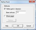 Refine Point.jpg 274 × 225; 13 KB
 RegisterWMS.jpg 488 × 317; 44 KB
 ReportBug.jpg 385 × 527; 54 KB
 Right Click GW.jpg 541 × 394; 30 KB
 Riv profile plot.png 760 × 295; 27 KB
 River Conceptual Model.jpg 400 × 326; 17 KB
 River Reach Att.jpg 336 × 425; 25 KB
 RivhydDisplayOpts.jpg 817 × 573; 74 KB
 Rma4 material properties.jpg 650 × 465; 46 KB
 RunupPressureHeights.jpg 211 × 339; 18 KB
 SAF.pdf 0 × 0; 368 KB
 Saltlake b cropped.png 1,138 × 751; 157 KB
 Scalar to vector toolbox.png 1,000 × 618; 177 KB
 Scatter Grid frame.jpg 306 × 381; 26 KB
 SchematicDisplayByValue.png 255 × 587; 13 KB
 SelectProjection.jpg 356 × 429; 58 KB
 SmoothStreams.png 503 × 593; 20 KB
 SMS - Create New Datum dialog.png 418 × 529; 20 KB
 SMS BOUSS 2D BC.jpg 456 × 322; 22 KB
 SMS Display Opts General.jpg 817 × 611; 28 KB
 SMS Film Loop Display.jpg 451 × 418; 25 KB
 SMS Hec Ras MP.png 200 × 250; 9 KB
 SMS LayoutQuick2.jpg 717 × 352; 87 KB
 SMS MaterialProperties.jpg 659 × 469; 54 KB
 SMS Pref Images.jpg 525 × 515; 27 KB
 SMS RiverReachAtt.png 322 × 419; 13 KB
 SMS UGrid Display.png 817 × 611; 28 KB
 SMS Vector Legen Options.jpg 407 × 294; 11 KB
 Solid cutaway.jpg 507 × 377; 55 KB
 Solids.jpg 512 × 305; 26 KB
 SRHmonitorpointscoverage.jpg 229 × 194; 12 KB
 StormDrainHydroQuick.png 738 × 526; 24 KB
 Stormpath1.jpg 637 × 435; 16 KB


.PNG)


.jpg)
.jpg)
.jpg)

.jpg)

.JPG)


