User:Jcreer/Archived Images: Difference between revisions
From XMS Wiki
Jump to navigationJump to search
| (36 intermediate revisions by the same user not shown) | |||
| Line 51: | Line 51: | ||
|[[File:Mf6sim mod.svg|16 px]] | |[[File:Mf6sim mod.svg|16 px]] | ||
|[[File:WMS GetDataToolIcon2.svg|16 px]] | |[[File:WMS GetDataToolIcon2.svg|16 px]] | ||
|[[File:ArcGIS Select Date button.png|16 px]] | |||
|[[File:Reverse Ramp Colors Button.png|16 px]] | |||
|[[File:Materials-edit.svg|16 px]] | |||
|- | |- | ||
|[[File:Contour Options macro inactive.png]] | |[[File:Contour Options macro inactive.png]] | ||
| Line 70: | Line 73: | ||
|[[File:Select Centerline Tool.svg|16 px]] | |[[File:Select Centerline Tool.svg|16 px]] | ||
|[[File:SMS Select Cross Section Tool.svg|16 px]] | |[[File:SMS Select Cross Section Tool.svg|16 px]] | ||
|[[File:Ugrid-3D-rectilinear-quadtree-icon.png|16 px]] | |||
|- | |- | ||
|[[File:Coverage icon - inactive.png]] | |[[File:Coverage icon - inactive.png]] | ||
| Line 183: | Line 186: | ||
| [[File:SMS Display Opts General 13.0.png|thumb|100 px]] | | [[File:SMS Display Opts General 13.0.png|thumb|100 px]] | ||
| [[File:Raster-to-flood-depths.png|thumb|100 px]] | | [[File:Raster-to-flood-depths.png|thumb|100 px]] | ||
| | | [[File:Mapviewerbutton.png|thumb|100 px]] | ||
| [[File:Create Spectral Energy.jpg| thumb | 100 px]] | |||
|} | |} | ||
{|class="mw-collapsible mw-collapsed" style="width:1050px; border:1px solid #D0E0FF; margin-bottom:0.4em;" | {|class="mw-collapsible mw-collapsed" style="width:1050px; border:1px solid #D0E0FF; margin-bottom:0.4em;" | ||
| Line 198: | Line 202: | ||
|- | |- | ||
|[[File:PreferencesSEAWAT.jpg|thumb|100px]] | |[[File:PreferencesSEAWAT.jpg|thumb|100px]] | ||
| | |[[File:Spectral Grid Attributes dialog.png|thumb | 100 px]] | ||
|[[File:MODFLOW-MNWIpackage.jpg|thumb|100px]] | |[[File:MODFLOW-MNWIpackage.jpg|thumb|100px]] | ||
|[[File:MODFLOW-SUB-Delay.jpg|thumb|100px]] | |[[File:MODFLOW-SUB-Delay.jpg|thumb|100px]] | ||
| Line 249: | Line 253: | ||
|[[File:TUFLOW AD MinDispersion.png|thumb|100px]] | |[[File:TUFLOW AD MinDispersion.png|thumb|100px]] | ||
|- | |- | ||
|[[File:HMSjobcontrol. | |[[File:HMSjobcontrol.png|thumb|100 px]] | ||
|[[File:Featstamp.png|thumb|100 px]] | |[[File:Featstamp.png|thumb|100 px]] | ||
|[[File:ZShape properties dialog.jpg|thumb|100 px]] | |[[File:ZShape properties dialog.jpg|thumb|100 px]] | ||
| Line 273: | Line 277: | ||
|[[File:AHGW HGU Setup Dialog.png|thumb|100 px]] | |[[File:AHGW HGU Setup Dialog.png|thumb|100 px]] | ||
|- | |- | ||
| | |[[File:SMS Clean.png|thumb|100 px]] | ||
|[[File:Units Dialog WMS.PNG|thumb|100 px]] | |[[File:Units Dialog WMS.PNG|thumb|100 px]] | ||
|[[File:Compute NSTPS Dialog (From Channel).PNG|thumb|100 px]] | |[[File:Compute NSTPS Dialog (From Channel).PNG|thumb|100 px]] | ||
| Line 281: | Line 285: | ||
|[[File:Contour Label.png|thumb|100 px]] | |[[File:Contour Label.png|thumb|100 px]] | ||
|} | |} | ||
==AHGW Dialogs== | ==AHGW Dialogs== | ||
<!--DO NOT UPDATE IMAGES ON THIS PAGE. This page is for archiving unused images that may be used in the future.--> | <!--DO NOT UPDATE IMAGES ON THIS PAGE. This page is for archiving unused images that may be used in the future.--> | ||
| Line 330: | Line 335: | ||
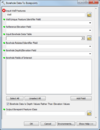
|[[File:AHGW Subsurface Analyst XS2D Editor - Transform XS2D Panel to GeoSection.png|100 px]] | |[[File:AHGW Subsurface Analyst XS2D Editor - Transform XS2D Panel to GeoSection.png|100 px]] | ||
|[[File:AHGW Subsurface Analyst XS2D Editor - Transform XS2D Well Detail Line.png|100 px]] | |[[File:AHGW Subsurface Analyst XS2D Editor - Transform XS2D Well Detail Line.png|100 px]] | ||
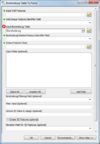
|[[File:AHGW Subsurface Analyst XS2D Editor - Transform XS2D Well Detail Polygon.png|100 px]] | |||
|[[File:AHGW Subsurface Analyst XS2D Editor - Create XS2D Line Feature Class.png|100 px]] | |||
|- | |||
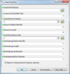
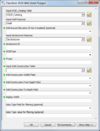
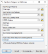
|[[File:AHGW Subsurface Analyst XS2D Editor - Transform Polygons to XS2D Lines.png|100 px]] | |||
|[[File:AHGW Subsurface Analyst XS2D Editor - Transform Points to XS2D Points.png|100 px]] | |||
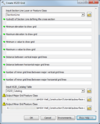
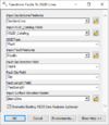
|[[File:AHGW Subsurface Analyst XS2D Editor - Transform Lines to XS2D Points.png|100 px]] | |||
|[[File:AHGW Arc Hydro Groundwater Toolkit dialog.png|100 px]] | |||
|[[File:Register AHGW dialog.png|75 px]] | |||
|[[File:AHGW Subsurface Analyst XS2D Editor - Transform GeoSection to XS2D Panel.png|100 px]] | |||
|[[File:AHGW Subsurface Analyst XS2D Editor - Transform Raster to XS2D Line.png|100 px]] | |||
|[[File:AHGW Subsurface Analyst XS2D Editor - Transform Faults to XS2D Lines.png|100 px]] | |||
|- | |||
|[[File:AHGW 2D Cross Section Wizard dialog Step 1.png|100 px]] | |||
|[[File:AHGW 2D Cross Section Wizard dialog Step 2.png|100 px]] | |||
|[[File:AHGW 2D Cross Section Wizard dialog Step 3.png|100 px]] | |||
|[[File:AHGW Make Time Series Statistics dialog.png|60 px]] | |||
|[[File:AHGW Add to Raster Series dialog.png|100 px]] | |||
|[[File:AHGW Assign Related Identifier dialog.png|100 px]] | |||
|[[File:AHGW HGU Color Manager dialog.jpg|100 px]] | |||
|[[File:AHGW HGU Color Manager dialog color palette.jpg|100 px]] | |||
|- | |||
|[[File:AHGW Time Series Grapher Setup dialog.png|100 px]] | |||
| | |||
| | |||
| | |||
| | |||
| | |||
| | |||
| | | | ||
|} | |} | ||
| Line 426: | Line 459: | ||
|[[File:Scalar to vector toolbox.png|thumb|100 px]] | |[[File:Scalar to vector toolbox.png|thumb|100 px]] | ||
|[[File:Whidbey Island showing Penn Cove and Admiralty Inlet.png|thumb|100 px]] | |[[File:Whidbey Island showing Penn Cove and Admiralty Inlet.png|thumb|100 px]] | ||
|- | |||
|[[File:CreateBridgeFootprintExample6a.png|thumb|100 px]] | |||
|[[File:Clean.jpg|thumb| 100 px]] | |||
| | |||
| | |||
| | |||
| | |||
| | |||
|} | |} | ||
{|class="mw-collapsible mw-collapsed" style="width:1050px; border:1px solid #D0E0FF; margin-bottom:0.4em;" | {|class="mw-collapsible mw-collapsed" style="width:1050px; border:1px solid #D0E0FF; margin-bottom:0.4em;" | ||
| Line 497: | Line 538: | ||
|[[File:GSDA EPA NHD StreamNetwork.png|thumb|100px]] | |[[File:GSDA EPA NHD StreamNetwork.png|thumb|100px]] | ||
|[[File:SchematicDisplayByValue.png|thumb|50 px]] | |[[File:SchematicDisplayByValue.png|thumb|50 px]] | ||
| | |[[File:PruneArcDirection.png|thumb|100 px]] | ||
| | |[[File:CreateBridgeFootprintExample6b.png|thumb|100 px]] | ||
|} | |} | ||
| Line 506: | Line 547: | ||
*[[File:DMI XML File.zip]] | *[[File:DMI XML File.zip]] | ||
*[[File:OmegaEM.zip]] | *[[File:OmegaEM.zip]] | ||
*[[File:Tip landuse lu codes.zip]] | |||
[[Category:Archived]] | [[Category:Archived]] | ||
[[Category:Jcreer|Archived]] | [[Category:Jcreer|Archived]] | ||
Latest revision as of 14:40, 16 July 2024
This page shows images that are not being used, but may still have value. Images that are not being used and are not likely to be used in the future have been or will be deleted.
If an image on this page is being used in another wiki article, removed the image from this page.
Icons, Logos, and Headers
| Files for icons and logos | |||||||||||||||||||
|---|---|---|---|---|---|---|---|---|---|---|---|---|---|---|---|---|---|---|---|

|

|
||||||
Dialogs
| Dialog images Group 1 | |||||
|---|---|---|---|---|---|
| Dialog images Group 2 | ||||||
|---|---|---|---|---|---|---|
| Dialog images Group 3 | ||||||
|---|---|---|---|---|---|---|
AHGW Dialogs
| AHGW Dialog images | |||||||
|---|---|---|---|---|---|---|---|

|

|

|

|
|
|

| |
|

|

|

|

|

|

|
|

|

|

|

|

|

|

| |

|
Graphs, Tables, and Equations
General Images
| Images Group 1 | ||||||
|---|---|---|---|---|---|---|
| Images Group 2 | ||||||
|---|---|---|---|---|---|---|
| Images Group 3 | ||||||
|---|---|---|---|---|---|---|


