SMS:Quick Tour - Polygon Attributes: Difference between revisions
From XMS Wiki
Jump to navigationJump to search
No edit summary |
No edit summary |
||
| (3 intermediate revisions by the same user not shown) | |||
| Line 3: | Line 3: | ||
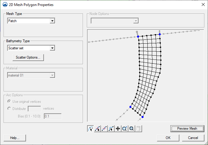
For each polygon, the type of element used to fill that polygon is controlled by the user. SMS supports adaptive tessellation which fills the area with triangles, patches which lines the region with mostly quadrilaterals and density meshing which builds elements based on underlying size functions. All elements in the polygon are assigned the material type for the polygon. All nodes generated in the polygon are assigned bathymetry from the specified source. | For each polygon, the type of element used to fill that polygon is controlled by the user. SMS supports adaptive tessellation which fills the area with triangles, patches which lines the region with mostly quadrilaterals and density meshing which builds elements based on underlying size functions. All elements in the polygon are assigned the material type for the polygon. All nodes generated in the polygon are assigned bathymetry from the specified source. | ||
[[Image:2D Mesh Poly Properties. | [[Image:2D Mesh Poly Properties.png]] | ||
[[SMS:Quick Tour - Network Creation| '''< Previous''']] | [[SMS:Quick Tour - Feature Stamping| ''' Next >''']] | [[SMS:Quick Tour - Network Creation| '''< Previous''']] | [[SMS:Quick Tour - Feature Stamping| ''' Next >''']] | ||
[[Category:SMS Quick Tour]] | |||
{{Navbox SMS Quick}} | |||
[[Category:SMS Quick Tour|Polygon]] | |||
[[Category:SMS Map]] | |||
[[Category:SMS 2D Mesh]] | |||
Latest revision as of 15:10, 8 August 2017
For each polygon, the type of element used to fill that polygon is controlled by the user. SMS supports adaptive tessellation which fills the area with triangles, patches which lines the region with mostly quadrilaterals and density meshing which builds elements based on underlying size functions. All elements in the polygon are assigned the material type for the polygon. All nodes generated in the polygon are assigned bathymetry from the specified source.
SMS – Quick Tour | ||
|---|---|---|
| Overview | Intro • Layout • Menu • Project Explorer • Edit Strip • Module • Tools • Macros • Help Strip • Background Images |  |
| Conceptual Models | Conceptual Models • Feature Objects • Network Creation • Polygon Attributes • Feature Stamping • Model Conversion | |
| Models | USACE-WAS Models • USACE-WAS to Learn More • FHWA Models • FESWMS to Learn More • Generic Model | |
| Functionalities | Coordinate Conversions • Scattered Data • Filtering • Calibration • Calibration Targets • Profiles • Observation Coverage • Data Calculator • Visualization • Animation • Support | |
| Aquaveo • SMS Tutorials • SMS Workflows | ||

