Category:SMS Map
From XMS Wiki
Jump to navigationJump to search
Articles related to the Map module in SMS.
Subcategories
This category has the following 3 subcategories, out of 3 total.
M
S
- SMS Map Dialogs (29 P, 65 F)
Pages in category "SMS Map"
The following 67 pages are in this category, out of 67 total.
A
C
F
J
M
Q
S
Media in category "SMS Map"
The following 138 files are in this category, out of 138 total.
 River Reach Att.jpg 336 × 425; 25 KB
 2D Mesh Poly Properties.png 697 × 485; 24 KB
 ActvityClassification.png 265 × 156; 5 KB
 ADCIRC DomainOptions.png 274 × 357; 9 KB
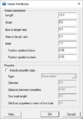 ADH Vessel.png 337 × 484; 18 KB
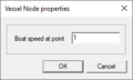 ADH VesselNode.png 245 × 147; 3 KB
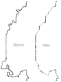
 AfterSourceArcRedistribution.png 295 × 365; 7 KB
 BeforeSourceArcRedistribution.png 295 × 365; 6 KB
 CartesianGridArcOptions.png 274 × 211; 5 KB
 Circdomain.png 354 × 237; 3 KB
 Clean.jpg 395 × 328; 9 KB
 CleanFigure1.png 530 × 367; 4 KB
 CleanFigure10.png 360 × 227; 2 KB
 CleanFigure11a.png 313 × 133; 3 KB
 CleanFigure11b.png 313 × 133; 3 KB
 CleanFigure11c.png 313 × 133; 4 KB
 CleanFigure11d.png 313 × 133; 4 KB
 CleanFigure12a.png 160 × 315; 2 KB
 CleanFigure12b.png 160 × 315; 2 KB
 CleanFigure13a.png 345 × 272; 4 KB
 CleanFigure13b.png 345 × 272; 5 KB
 CleanFigure14a.png 208 × 246; 2 KB
 CleanFigure14b.png 208 × 246; 2 KB
 CleanFigure15a.png 419 × 280; 4 KB
 CleanFigure15b.png 419 × 280; 5 KB
 CleanFigure15c.png 419 × 280; 5 KB
 CleanFigure15d.png 419 × 280; 5 KB
 CleanFigure16a.png 335 × 169; 8 KB
 CleanFigure16b.png 335 × 169; 8 KB
 CleanFigure16c.png 335 × 169; 9 KB
 CleanFigure16d.png 335 × 169; 9 KB
 CleanFigure2.png 478 × 303; 13 KB
 CleanFigure3a.png 180 × 200; 2 KB
 CleanFigure3b.png 180 × 200; 2 KB
 CleanFigure3c.png 180 × 200; 2 KB
 CleanFigure3d.png 180 × 200; 2 KB
 CleanFigure3e.png 180 × 200; 2 KB
 CleanFigure5a.png 251 × 360; 7 KB
 CleanFigure5b.png 251 × 360; 7 KB
 CleanFigure5c.png 251 × 360; 7 KB
 CleanFigure6a.png 440 × 315; 10 KB
 CleanFigure6b.png 440 × 315; 10 KB
 CleanFigure6c.png 440 × 315; 11 KB
 CleanFigure7a.png 541 × 232; 6 KB
 CleanFigure7b.png 541 × 232; 6 KB
 CleanFigure7c.png 541 × 232; 7 KB
 CleanFigure8.png 285 × 282; 3 KB
 CleanFigure9a.png 296 × 278; 5 KB
 CleanFigure9b.png 296 × 278; 6 KB
 CleanObjectsOptions.png 408 × 362; 13 KB
 CleanOptions.png 286 × 342; 10 KB
 SMS NewCoverage.png 355 × 446; 19 KB
 Create 1D Grid Frame Tool.svg 60 × 60; 4 KB
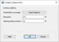 Create Contour Arcs.png 362 × 260; 8 KB
 Create Points Tool.svg 45 × 41; 2 KB
 Create Vertices tool.png 16 × 16; 330 bytes
 Example-1-end.png 940 × 674; 16 KB
 Example-1-start.png 878 × 654; 15 KB
 Example-2-end.png 936 × 653; 15 KB
 Example-3-end.png 1,005 × 640; 18 KB
 Example-3-start.png 1,005 × 679; 18 KB
 Example-4-end.png 876 × 583; 19 KB
 Example-4-start.png 862 × 603; 20 KB
 Example-5-end.png 843 × 636; 14 KB
 Example-5-start.png 730 × 648; 13 KB
 Example-6-end.png 799 × 601; 14 KB
 Example-6-start.png 855 × 602; 12 KB
 Example-7-end.png 924 × 592; 8 KB
 Example-7-start.png 751 × 453; 8 KB
 Example-8-end.png 973 × 591; 20 KB
 Example-8-start.png 1,234 × 684; 23 KB
 Example-9-end.png 858 × 726; 16 KB
 Example-9-start.png 1,040 × 796; 15 KB
 ExtractFeatures-AllChannelCenterlines.png 800 × 623; 217 KB
 ExtractFeatures-BanksfromCenterlines.png 600 × 326; 124 KB
 ExtractFeatures-CenterlinefromPoint.png 600 × 306; 77 KB
 ExtractFeatures-CentlineBankPoint.png 600 × 327; 69 KB
 ExtractFeatures-CrossSectionBankLocation.png 600 × 383; 42 KB
 ExtractFeatures-DigitalDam.png 476 × 302; 36 KB
 ExtractFeatures-SeparateChannels.png 500 × 273; 280 KB
 Feature Arc Attributes.jpg 258 × 188; 18 KB
 Featureobjects.png 434 × 290; 3 KB
 Filter Arc Segments Tool.jpg 285 × 222; 15 KB
 Filter Arcs Tool.jpg 285 × 222; 15 KB
 Flood plain domain.png 609 × 273; 3 KB
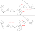
 Flow trace example for Floodway.png 526 × 519; 6 KB
 Islanddomain.png 235 × 231; 2 KB
 Map Data Set.png 1,001 × 638; 343 KB
 Map Module Icon.svg 52 × 56; 4 KB
 Map Module.png 16 × 16; 597 bytes
 Map to 2D grid.png 532 × 622; 28 KB
 Map to 2D mesh.png 639 × 310; 29 KB
 Map to Quadtree.png 532 × 587; 24 KB
 MapTo1D-Grid.png 371 × 365; 12 KB
 Offset Arcs Tool.png 271 × 305; 7 KB
 Polygons.png 465 × 416; 19 KB
 Project explorer coverages.png 201 × 251; 10 KB
 PruneArcDirection Example.png 1,913 × 686; 37 KB
 PruneArcDirection.png 872 × 766; 28 KB
 PruneArcExample.png 460 × 622; 8 KB
 Rectdomain.png 435 × 251; 3 KB
 Redistribute Vertices.png 313 × 440; 16 KB
 Redistvert.jpg 465 × 124; 7 KB
 Select 1D Grid Frame Tool.svg 60 × 66; 4 KB
 Select Feature Point or Node.png 16 × 16; 365 bytes
 Select Point tool.png 16 × 16; 418 bytes
 Select Point Tool.svg 53 × 51; 2 KB
 SelectArcType.png 352 × 458; 21 KB
 SelectIntersetingObjects.png 517 × 518; 22 KB
 Smooth Arcs Tool.png 271 × 250; 8 KB
 SMS Clean.png 274 × 318; 12 KB
 SMS Create Arc Tool.svg 60 × 60; 3 KB
 SMS Create Grid Frame Tool.svg 49 × 49; 4 KB
 SMS Create Vertex Tool.svg 60 × 60; 4 KB
 SMS FeatureObjectsQuick.jpg 500 × 383; 77 KB
 SMS Get Info Map.png 538 × 405; 14 KB
 SMS Map Display.png 817 × 573; 24 KB
 SMS Map Legend Options.png 402 × 219; 9 KB
 SMS Map to Scatter.png 274 × 446; 17 KB
 SMS Select Arc Group Tool.svg 59 × 62; 3 KB
 SMS Select Arc Tool.svg 60 × 60; 3 KB
 SMS Select Delete Data.png 476 × 407; 32 KB
 SMS Select Grid Frame Tool.svg 49 × 59; 4 KB
 SMS Select Node Tool.svg 54 × 57; 3 KB
 SMS Select Polygon Tool.svg 60 × 56; 4 KB
 SMS Select Vertex Tool.svg 60 × 66; 4 KB
 Snap crosshairs.png 389 × 199; 10 KB
 Snapping Examples.png 582 × 232; 121 KB
 SpecifyArcLength.png 274 × 151; 3 KB
 Stamp EndCap.png 404 × 601; 24 KB
 Stamp TopWidthSideSlope.png 257 × 190; 4 KB
 StampFeatures.png 281 × 258; 8 KB
 StampingArcAttributes.png 1,036 × 614; 39 KB
 StampingCoverageAttributes.png 257 × 352; 13 KB
 StormAttributes.png 253 × 333; 9 KB
 Trim-Extend Arc.png 261 × 129; 4 KB
 Typesoffeatureobjects.png 890 × 666; 45 KB
 WingWalls.jpg 353 × 202; 12 KB


