Category:GSDA: Difference between revisions
From XMS Wiki
Jump to navigationJump to search
No edit summary |
(archive) |
||
| (3 intermediate revisions by one other user not shown) | |||
| Line 1: | Line 1: | ||
Articles related to GSDA. | Articles related to GSDA. | ||
[[Category: | [[Category:GSDA Archived]] | ||
Latest revision as of 22:46, 22 July 2020
Articles related to GSDA.
Subcategories
This category has the following 3 subcategories, out of 3 total.
I
- GSDA Icons (1 F)
- GSDA Importing Data (32 F)
L
- GSDA Logos (15 F)
Media in category "GSDA"
The following 40 files are in this category, out of 40 total.
- GNISTable.png 423 × 244; 30 KB
- GSDA AndersonLandClassification.png 337 × 817; 88 KB
- GSDA EPA NHD StreamNetwork.png 490 × 360; 151 KB
- GSDA EPA Soil Type.png 400 × 152; 70 KB
- GSDA FlowRate v Time.png 561 × 356; 174 KB
- GSDA FormatLandUse.png 400 × 100; 14 KB
- GSDA Graph Stream Stage.png 565 × 321; 97 KB
- GSDA Historical.png 450 × 349; 26 KB
- GSDA Hydrograph ProvoRiver.png 450 × 342; 91 KB
- GSDA Land Use.png 471 × 241; 252 KB
- GSDA NRCS STATSGO Soil Type.png 343 × 426; 248 KB
- GSDA PrecipitationNOAA.png 402 × 236; 223 KB
- GSDA PrecipitationNRCS.png 452 × 628; 347 KB
- GSDA PrecipitationPRISM.png 402 × 503; 265 KB
- GSDA Soil Legend.png 299 × 224; 2 KB
- GSDA ThiessenWatershed.png 450 × 281; 42 KB
- GSDA TIN Elevations.png 286 × 229; 111 KB
- GSDA TIN non-overlapping.png 400 × 283; 101 KB
- GSDA TIN Oblique.png 400 × 246; 174 KB
- GSDA TIN SpacedCloser.png 238 × 330; 51 KB
- GSDA TIN Watershed.png 259 × 230; 155 KB
- GSDA7.5Quad.png 450 × 310; 297 KB
- GSDACoordConvFig1.png 448 × 314; 247 KB
- GSDACoordConvFig2.png 448 × 310; 245 KB
- GSDADraper7.5Quad.png 502 × 346; 386 KB
- GSDAWharfDOQ.png 502 × 322; 205 KB
- GSSHA Block grid.png 283 × 185; 6 KB
- GSSHA Cell Fill Block Style Digital Dams.jpg 302 × 197; 28 KB
- GSSHA Contaminants.jpg 1,074 × 397; 11 KB
- GSSHA Embankment Arc.jpg 572 × 524; 12 KB
- GSSHA flow vectors.png 307 × 216; 14 KB
- GSSHA Lakes and Wetlands.jpg 486 × 439; 44 KB
- GSSHA Smooth grid.png 281 × 179; 4 KB
- GSSHA Solution Data.jpg 653 × 398; 57 KB
- GSSHARadarImage.jpg 375 × 601; 59 KB
- GSSHASnowmelt.png 641 × 458; 46 KB
- GSSHAStreamIndexMap.jpg 364 × 409; 33 KB
- Tip landuse lu codes.zip ; 832 bytes
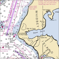
- Whidbey Island showing Penn Cove and Admiralty Inlet.png 402 × 402; 271 KB
- WMS Project Explorer with two GSSHA simulations.png 241 × 923; 25 KB


