Category:GSDA Importing Data
From XMS Wiki
Jump to navigationJump to search
| This contains information for a feature that is not currently supported. Technical support is not available for projects using this feature. |
GSDA Importing data articles
Media in category "GSDA Importing Data"
The following 32 files are in this category, out of 32 total.
- GSDA 60yearsGraph.png 450 × 352; 185 KB
- GSDA CatalogingUnits.png 452 × 276; 184 KB
- GSDA EPA LandUse.png 400 × 203; 196 KB
- GSDA EPA NHD StreamNetwork.png 490 × 360; 151 KB
- GSDA EPA Soil Type.png 400 × 152; 70 KB
- GSDA ESRI1995.png 483 × 284; 188 KB
- GSDA NRCS STATSGO Soil Type.png 343 × 426; 248 KB
- GSDA PrecipitationNOAA.png 402 × 236; 223 KB
- GSDA SelectionBox.png 328 × 294; 208 KB
- GSDA SHPdirectory.png 459 × 226; 6 KB
- GSDA SNOTEL Report.png 452 × 567; 156 KB
- GSDA SnotelNarrative.png 402 × 526; 171 KB
- GSDA StreamFlowGraph.png 584 × 531; 203 KB
- GSDA TabulatedCSVdata.png 450 × 349; 124 KB
- GSDA UCCdata.png 452 × 288; 95 KB
- GSDA UCCmaps.png 409 × 426; 296 KB
- GSDA USDA April2000.png 452 × 571; 160 KB
- GSDA USDA FlowChart.png 450 × 377; 109 KB
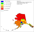
- GSDA USDA-NRCS Alaska.png 402 × 374; 90 KB
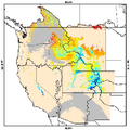
- GSDA USDA-NRCS SnowCover.png 450 × 451; 191 KB
- GSDA UtahArcView.png 458 × 566; 492 KB
- GSDA YearGraph.png 450 × 348; 140 KB
- GSDA ZoomArea.png 318 × 304; 233 KB
- GSDA ZoomTrack.png 346 × 238; 221 KB
- GSDA ZoomWestBuildings.png 300 × 164; 118 KB
- GSDADoylestownIn.png 502 × 332; 315 KB
- GSDADoylestownOut.png 452 × 608; 588 KB
- GSDAObtainingDEMData.png 393 × 523; 243 KB
- GSDAObtainingDOQData.png 502 × 377; 137 KB
- GSDATerraServerDeltaCenter.png 297 × 283; 148 KB
- GSDATerraServerSLC.png 333 × 358; 223 KB
- Utah's precipitation map.png 400 × 580; 359 KB


