Category:WMS GIS Dialogs: Difference between revisions
From XMS Wiki
Jump to navigationJump to search
(Created page with "Files and articles related to dialogs in the GIS module Category:WMS GIS Category:WMS Dialogs") |
No edit summary |
||
| Line 1: | Line 1: | ||
Files and articles related to dialogs in the GIS module | Files and articles related to dialogs in the GIS module | ||
[[Category:WMS GIS]] | [[Category:WMS GIS|Dialogs]] | ||
[[Category:WMS Dialogs]] | [[Category:WMS Dialogs|GIS]] | ||
Latest revision as of 17:15, 14 December 2015
Files and articles related to dialogs in the GIS module
Pages in category "WMS GIS Dialogs"
The following 8 pages are in this category, out of 8 total.
Media in category "WMS GIS Dialogs"
The following 18 files are in this category, out of 18 total.
- Add Data Dialog.jpg 507 × 340; 47 KB
- GIS FeatureToGeodatabase.png 493 × 396; 14 KB
- GIS LayerProperties.png 642 × 441; 38 KB
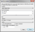
- GIS Select by Location.png 423 × 384; 17 KB
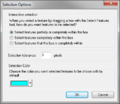
- GIS Selection Options.png 396 × 342; 15 KB
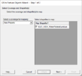
- GIS to Feature Objects Wizard -- Step 1 of 2.jpg 740 × 485; 31 KB
- GIS to Feature Step1.png 479 × 445; 13 KB
- GISchecklayers.jpg 276 × 140; 12 KB
- GISidentify.jpg 295 × 191; 18 KB
- GISquery wizard.png 487 × 352; 21 KB
- GISquery wizard2.png 487 × 352; 20 KB
- GISquery wizard3.png 487 × 352; 22 KB
- Join Table.png 338 × 243; 9 KB
- JoinSsurgoData.png 849 × 550; 229 KB
- Map Properties.jpg 487 × 594; 37 KB
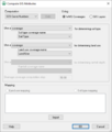
- WMS Compute GIS Attributes.png 481 × 568; 11 KB
- WMS GIS to Feature Objects Wizard1.png 479 × 390; 7 KB
- WMS GIS to Feature Objects Wizard2.png 479 × 390; 35 KB


