Category:WMS GIS
From XMS Wiki
Jump to navigationJump to search
Articles related to the GIS module in WMS.
Subcategories
This category has the following 3 subcategories, out of 3 total.
Pages in category "WMS GIS"
The following 22 pages are in this category, out of 22 total.
F
Q
Media in category "WMS GIS"
The following 36 files are in this category, out of 36 total.
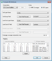
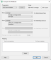
- Compute GIS Attributes 11.1.png 495 × 574; 20 KB
- CorineLandUseTable.txt ; 2 KB
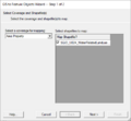
- GIS FeatureToGeodatabase.png 493 × 396; 14 KB
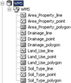
- GIS items in WMS.png 739 × 486; 486 KB
- GIS LayerProperties.png 642 × 441; 38 KB
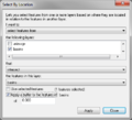
- GIS Select by Location.png 423 × 384; 17 KB
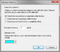
- GIS Selection Options.png 396 × 342; 15 KB
- GIS to Feature Objects Wizard -- Step 1 of 2.jpg 740 × 485; 31 KB
- GIS to Feature Step1.png 479 × 445; 13 KB
- GISquery wizard.png 487 × 352; 21 KB
- GISquery wizard2.png 487 × 352; 20 KB
- GISquery wizard3.png 487 × 352; 22 KB
- GISshapefileExample.jpg 1,181 × 719; 187 KB
- GlobalLandUseTable.txt ; 2 KB
- Join Table.png 338 × 243; 9 KB
- JoinSsurgoData.png 849 × 550; 229 KB
- LidarGslNorth.png 1,928 × 1,048; 218 KB
- Map Properties.jpg 487 × 594; 37 KB
- MapProperties AddCoordIcon.png 37 × 22; 1 KB
- MapProperties AddFavorIcon.png 24 × 23; 695 bytes
- MapProperties ClearSearchIcon.png 22 × 23; 915 bytes
- MapProperties SearchIcon.png 24 × 25; 899 bytes
- MapProperties SpacialFiltersIcon.png 41 × 27; 835 bytes
- NLCD2006LuCodes.txt ; 746 bytes
- NLCD2015LuCodes.txt ; 644 bytes
- VectorLuCodes.txt ; 1 KB
- WMS ArcGISexample.jpg 1,146 × 628; 244 KB
- WMS Compute GIS Attributes.png 481 × 568; 11 KB
- WMS GIS to Feature Objects Wizard1.png 479 × 390; 7 KB
- WMS GIS to Feature Objects Wizard2.png 479 × 390; 35 KB
- WMS GISdataExample.png 256 × 400; 21 KB
- WMS JoinTableShapefile.jpg 738 × 558; 88 KB
- WMS Web tile.png 1,440 × 760; 1.86 MB
- WMSArcHydro001.png 122 × 81; 6 KB
- WMSArcHydro002.png 196 × 432; 38 KB
- WMSGeodatabase001.png 192 × 224; 18 KB
