Category:GSDA Importing Data
From XMS Wiki
Jump to navigationJump to search
GSDA Importing data articles
Media in category "GSDA Importing Data"
The following 32 files are in this category, out of 32 total.
- GSDA 60yearsGraph.png 450 × 352; 185 KB
- GSDA CatalogingUnits.png 452 × 276; 184 KB
- GSDA EPA LandUse.png 400 × 203; 196 KB
- GSDA EPA NHD StreamNetwork.png 490 × 360; 151 KB
- GSDA EPA Soil Type.png 400 × 152; 70 KB
- GSDA ESRI1995.png 483 × 284; 188 KB
- GSDA NRCS STATSGO Soil Type.png 343 × 426; 248 KB
- GSDA PrecipitationNOAA.png 402 × 236; 223 KB
- GSDA SelectionBox.png 328 × 294; 208 KB
- GSDA SHPdirectory.png 459 × 226; 6 KB
- GSDA SNOTEL Report.png 452 × 567; 156 KB
- GSDA SnotelNarrative.png 402 × 526; 171 KB
- GSDA StreamFlowGraph.png 584 × 531; 203 KB
- GSDA TabulatedCSVdata.png 450 × 349; 124 KB
- GSDA UCCdata.png 452 × 288; 95 KB
- GSDA UCCmaps.png 409 × 426; 296 KB
- GSDA USDA April2000.png 452 × 571; 160 KB
- GSDA USDA FlowChart.png 450 × 377; 109 KB
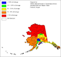
- GSDA USDA-NRCS Alaska.png 402 × 374; 90 KB
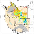
- GSDA USDA-NRCS SnowCover.png 450 × 451; 191 KB
- GSDA UtahArcView.png 458 × 566; 492 KB
- GSDA YearGraph.png 450 × 348; 140 KB
- GSDA ZoomArea.png 318 × 304; 233 KB
- GSDA ZoomTrack.png 346 × 238; 221 KB
- GSDA ZoomWestBuildings.png 300 × 164; 118 KB
- GSDADoylestownIn.png 502 × 332; 315 KB
- GSDADoylestownOut.png 452 × 608; 588 KB
- GSDAObtainingDEMData.png 393 × 523; 243 KB
- GSDAObtainingDOQData.png 502 × 377; 137 KB
- GSDATerraServerDeltaCenter.png 297 × 283; 148 KB
- GSDATerraServerSLC.png 333 × 358; 223 KB
- Utah's precipitation map.png 400 × 580; 359 KB


