Get Online Maps
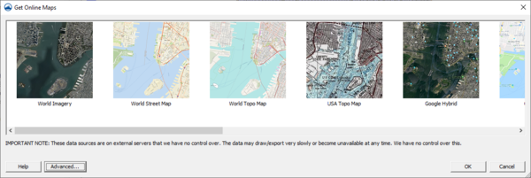
The Get Online Maps button allows you to select online data from a variety of different sources. Once online maps has been selected, the data resolution will be automatically adjusted based on your zoom parameters. Online maps can only be viewed in plan view.
Online maps are raster data sets that can contain imagery, elevation, or land use information. If you have online maps in your program, you can right-click on each of the maps to convert them to static images that can be saved to your local hard drive. You can convert or interpolate online maps containing elevation data to various elevation formats.
Note that online data sources are on external servers that we have no control over. The data may draw/export very slowly or become unavailable at any time. We have no control over this.
The Advanced button allows you to select from other data sources and to use other online data query functions that may not be fully supported. In the Advanced dialog, the Add Sources From File button allows you to add new Web Map Service (WMS) sources from an external text file.
