WMS:What's new in WMS version 9.0
The WMS software development team is excited about the release of WMS 8.5! This page lists the exciting new features that have been added to WMS 8.5.
What's new in WMS 8.5
Updated Interfaces
The NSS (National Streamflow Statistics) interface has been updated to use the latest NSS database. The MODRAT interface has also been updated. Renumbering has been improved in the MODRAT interface and several issues have been fixed. Several new features and enhancements have been added to the GSSHA interface. First, the storm and tile drain modeling capability of GSSHA has been improved by adding the capability to add multiple pipes in a "superlink", which represents a network of pipes in GSSHA. The algorithm for determining embankments has also been reworked to make the algorithm more efficient and more accurate. The GSSHA tutorials have also been updated and improved to include the latest enhancements in the GSSHA code. Also, GSSHA itself has been reworked to make the program more stable.
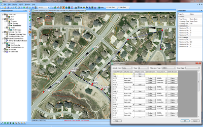
FHWA HY-12 Storm Drain Modeling
WMS now includes an interface to FHWA's HY-12 storm drain modeling program. This interface allows you to create a storm drain layout and assign rational method computations, curbs and gutters, access holes, pipes, channels, and other storm drain network features to the storm drain layout. Much of the data can be computed automatically using the interface, and other data values can be entered in the easy-to-use windows. The other storm drain modeling interfaces, including the SWMM and xp-swmm interfaces, have also been upgraded to make your model easier to build and maintain.
Online Image (Web Map Service) Capabilities
- Availability of online images using the Get Online Maps tool
Improved Web Service Tools
- Web service tool improvements
Support of New File Formats
- Support of several new GIS and CAD file formats for file import and export through the "vector image" option
FHWA HY-8 7.3 and Hydraulic Toolbox 3.0 Support
- Support new versions of HY-8 (7.3) and the Hydraulic Toolbox (3.0)
Bug fixes
To view the list of bugs fixed in WMS 8.5, visit the WMS bugfix page.

