File:GSDAObtainingDEMData.png: Difference between revisions
From XMS Wiki
Jump to navigationJump to search
No edit summary |
No edit summary |
||
| Line 1: | Line 1: | ||
[[Category:DEM]] | [[Category:DEM]] | ||
[[Category:GSDA Importing Data]] | [[Category:GSDA Importing Data]] | ||
Red areas are 60 meters in elevation and the blue areas are 200 meters in elevation | Red areas are 60 meters in elevation and the blue areas are 200 meters in elevation | ||
Latest revision as of 14:25, 15 May 2017
Red areas are 60 meters in elevation and the blue areas are 200 meters in elevation
File history
Click on a date/time to view the file as it appeared at that time.
| Date/Time | Thumbnail | Dimensions | User | Comment | |
|---|---|---|---|---|---|
| current | ★ Approved revision 13:13, 10 May 2008 | 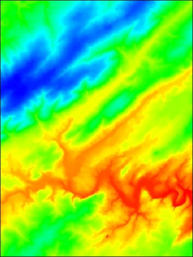 | 393 × 523 (243 KB) | Eshaw (talk | contribs) |
You cannot overwrite this file.
File usage
The following page uses this file: