Search results
From XMS Wiki
Jump to navigationJump to search
Page title matches
- Icons for modules in SMS, GMS, and WMS. [[Category:Icons]]67 members (25 subcategories, 42 files) - 14:46, 10 May 2017
- Icons from toolbars in the GMS Solids Module. [[Category:Icons]]7 members (0 subcategories, 7 files) - 16:56, 1 June 2017
- Icons used in the Hydraulic/River module. [[Category:Icons]]18 members (1 subcategory, 17 files) - 14:44, 10 May 2017
- Icons used in the Hdydrologic module. [[Category:Icons]]16 members (1 subcategory, 15 files) - 14:45, 10 May 2017
- Icons used in the TIN Module in GMS [[Category:Icons]]13 members (0 subcategories, 13 files) - 14:56, 10 May 2017
- Icons used in the Scatter module (2D Scatter Points, 3D Scatter Point, 2D Scatter, 3D Scatter, etc.). [[Category:Icons]]30 members (1 subcategory, 29 files) - 14:49, 10 May 2017
- #REDIRECT [[:Category:Solids Module Icons]]0 members (0 subcategories, 0 files) - 16:56, 1 June 2017
- Icons which appear on the [[WMS:GIS Tools|WMS GIS Module toolbar]]. [[Category:Icons]]6 members (0 subcategories, 6 files) - 14:58, 10 May 2017
- Icons used in the [[WMS:Drainage Tools|WMS Drainage Module toolbar]]. [[Category:Icons]]16 members (0 subcategories, 16 files) - 14:58, 10 May 2017
- Icons used in the [[WMS:Terrain Data Tools|WMS Terrain Data Module toolbar]]. [[Category:Icons]]21 members (0 subcategories, 21 files) - 15:06, 10 May 2017
- Icons which appear on the [[WMS:Map Tools|WMS Map Module toolbar]]. [[Category:Icons]]18 members (0 subcategories, 18 files) - 15:06, 10 May 2017
- Icons used in the [[WMS:Hydraulic Modeling|WMS Hydraulic Modeling toolbar]]. [[Category:Icons]]16 members (0 subcategories, 16 files) - 15:06, 10 May 2017
- Icons used in the [[WMS:Hydrologic Modeling Tools|WMS Hydrologic Modeling toolbar [[Category:Icons]]14 members (0 subcategories, 14 files) - 15:06, 10 May 2017
- Icons used in the [[WMS:Drainage Tools|WMS Drainage Module toolbar]]. [[Category:Icons]]14 members (0 subcategories, 14 files) - 14:57, 10 May 2017
- Icons used in the [[WMS:2D Scatter Point Module|WMS 2D Scatter Point Module toolbar]]. [[Category:Icons]]4 members (0 subcategories, 4 files) - 14:58, 10 May 2017
Page text matches
- Icons used in the annotation module [[Category:Icons]]22 members (3 subcategories, 19 files) - 14:20, 10 May 2017

File:Drainage Module Icon.svg Drainage Module icon in WMS. Replacing [[File:Drainage Module icon in WMS.png]](60 × 64 (5 KB)) - 20:36, 15 November 2017
File:Hydraulic Module Icon.svg Icon for the Hydraulic Modeling Module (river module) in WMS. Replacing [[File:Hydraulic Modeling Module icon in WMS.png]](49 × 60 (5 KB)) - 15:40, 8 June 2017- Icons used in the SMS Quadtree module. [[Category:Icons]]4 members (0 subcategories, 4 files) - 14:48, 10 May 2017

File:SMS Select Nodestring Tool.svg [[Category:Nodes, Points, and Vertices Icons]] [[Category:Arc and Line Icons]](60 × 51 (3 KB)) - 16:17, 6 November 2017
File:WMSIcon 2D Scatter Point Module.png 2-D Scatter Point Module icon for WMS. [[Category:Module Icons]](16 × 16 (410 bytes)) - 20:48, 2 March 2018- Icons used in the Hdydrologic module. [[Category:Icons]]16 members (1 subcategory, 15 files) - 14:45, 10 May 2017

File:Hydraulic Modeling Module icon in WMS.png Icon for the Hydraulic Modeling Module (river module) in WMS. [[Category:Module Icons]](13 × 16 (423 bytes)) - 18:46, 18 June 2018
File:WMSIcon Select Feature Vertex.png [[Category:Arc and Line Icons]] [[Category:Map Icons]](16 × 16 (546 bytes)) - 16:45, 16 January 2018
File:Annotation Module Icon.svg Icon for the Annotations Module in SMS. [[Category:Module Icons]](60 × 61 (4 KB)) - 14:08, 19 September 2017
File:WMS SelectVertexTool.svg [[Category:Arc and Line Icons]] [[Category:Map Icons]](60 × 66 (4 KB)) - 16:45, 16 January 2018
File:UGrid Icon Unlocked.svg Icon for the UGrid module in SMS [[Category:Module Icons]](56 × 60 (4 KB)) - 14:45, 14 August 2017
File:WMS TerrainIcon.svg Icon for the WMS Terrain Data module. Replacing [[File:WMSIcon Terrain Data Module.png]](60 × 60 (6 KB)) - 21:40, 22 March 2018
File:WMSIcon Select Hydraulic Link.png [[Category:Triangle Icons]] [[Category:WMS Hydraulic Modeling Module Tool Icons]](11 × 16 (491 bytes)) - 16:26, 19 January 2018
File:2D Grid Icon.svg Icon used for the Cartesian/2-D Grid Module in XMS (GMS, SMS, and WMS). Replacing [[File:2D Grid Module icon.png]](60 × 60 (7 KB)) - 16:50, 27 July 2017
File:Hydrologic Module Icon.svg WMS Hydrologic Modeling module icon. Also used as the Hydrologic Coverage Tree icon in the Project Explore Replacing [[File:Hydrologic Modeling Module in WMS.png]](56 × 60 (9 KB)) - 15:32, 8 June 2017- Icons used in the Hydraulic/River module. [[Category:Icons]]18 members (1 subcategory, 17 files) - 14:44, 10 May 2017
- Icons used in the TIN Module in GMS [[Category:Icons]]13 members (0 subcategories, 13 files) - 14:56, 10 May 2017
- [[Category:Icons]] [[Category:Module Icons]]22 members (0 subcategories, 22 files) - 14:20, 10 May 2017

File:Solid Module Icon.svg Icon for the Solid module. [[Category:Project Explorer Icons]](60 × 60 (5 KB)) - 14:14, 21 August 2017
File:2D Mesh Icon.svg Icon for the 2D Mesh Module in GMS and SMS. [[Category:Module Icons]](56 × 60 (4 KB)) - 14:21, 29 August 2017
File:WMSIcon Select Feature Point.png [[Category:Arc and Line Icons]] [[Category:Map Icons]](16 × 16 (502 bytes)) - 16:47, 16 January 2018
File:GMS Select Triangle Tool.svg [[Category:Mesh Icons]] [[Category:Triangle Icons]](60 × 59 (3 KB)) - 14:38, 23 August 2017
File:WMS SelectHydrographTool.svg [[Category:WMS Hydrologic Modeling Module Tool Icons]] [[Category:WMS 2D Grid Module Tool Icons]](56 × 66 (5 KB)) - 16:54, 16 January 2018
File:GMS Swap Edge Tool.svg [[Category:Mesh Icons]] [[Category:Triangle Icons]](60 × 60 (4 KB)) - 14:39, 23 August 2017
File:WMS SelectPoints.svg [[Category:Arc and Line Icons]] [[Category:Map Icons]](56 × 59 (3 KB)) - 16:47, 16 January 2018
File:WMS HydraulicLinkTool.svg [[Category:Triangle Icons]] [[Category:WMS Hydraulic Modeling Module Tool Icons]](41 × 59 (3 KB)) - 16:58, 18 January 2018
File:HydrologicStationData.svg [[Category:Hydrologic Module Icons]] [[Category:WMS Hydrologic Modeling Module Tool Icons]](52 × 60 (4 KB)) - 20:36, 15 November 2017
File:UGrid Module Icon.svg Icon for the UGrid module [[Category:Module Icons]](56 × 56 (7 KB)) - 14:27, 22 August 2017
File:WMSIcon Select Hydrograph.png [[Category:WMS Hydrologic Modeling Module Tool Icons]] [[Category:WMS 2D Grid Module Tool Icons]](16 × 16 (493 bytes)) - 16:56, 16 January 2018- Icons used in the map module. [[Category:Icons]]60 members (3 subcategories, 57 files) - 14:37, 17 October 2017

File:WMSIcon GIS Module.png Icon for the GIS Module in GMS, SMS and WMS. [[Category:Module Icons]](16 × 16 (767 bytes)) - 22:41, 15 June 2017
File:2D Grid Module icon.png Icon used for the Cartesian/2-D Grid Module in XMS (GMS, SMS, and WMS). [[Category:Module Icons]](16 × 16 (357 bytes)) - 20:31, 2 March 2018- Icons from toolbars in the GMS Solids Module. [[Category:Icons]]7 members (0 subcategories, 7 files) - 16:56, 1 June 2017

File:3D Scatter Icon.svg [[Category:Module Icons]] [[Category:Scatter Module Icons]](60 × 60 (9 KB)) - 14:35, 21 August 2017
File:GMS Create Triangle Tool.svg [[Category:Mesh Icons]] [[Category:Triangle Icons]](60 × 30 (2 KB)) - 14:28, 23 August 2017
File:WMSGISRasterImageTreeIcon.png [[Category:Project Explorer Icons]] [[Category:GIS Icons]](16 × 18 (625 bytes)) - 16:04, 2 March 2017
File:Hydrologic Modeling Module in WMS.png WMS Hydrologic Modeling module icon. Also used as the Hydrologic Coverage Tree icon in the Project Explore [[Category:Module Icons]](16 × 16 (429 bytes)) - 15:12, 8 June 2017
File:SMS Create Nodestring Tool.svg [[Category:Nodes, Points, and Vertices Icons]] [[Category:Arc and Line Icons]](60 × 26 (3 KB)) - 14:18, 18 September 2017
File:Quadtree Mod Icon.svg Icon for the Quadtree Module in SMS. [[Category:Module Icons]](56 × 56 (6 KB)) - 14:20, 18 September 2017- Icons used in the [[WMS:2D Scatter Point Module|WMS 2D Scatter Point Module toolbar]]. [[Category:Icons]]4 members (0 subcategories, 4 files) - 14:58, 10 May 2017

File:Drainage Module icon in WMS.png Drainage Module icon in WMS. [[Category:Module Icons]](16 × 16 (884 bytes)) - 15:11, 8 June 2017
File:Select Cross Section Tool.svg [[Category:3D Grid Icons]] [[Category:Borehole Icons]](60 × 62 (4 KB)) - 14:33, 23 August 2017
File:2D Scatter Icon.svg [[Category:Module Icons]] [[Category:Project Explorer Icons]](60 × 60 (4 KB)) - 20:48, 2 March 2018
File:Contour Labels Tool.svg [[Category:Mesh Icons]] [[Category:2D Grid Icons]](60 × 60 (5 KB)) - 15:44, 25 May 2017
File:Select Object Tool.svg [[Category:Map Icons]] [[Category:Selection Arrow Icons]](26 × 51 (2 KB)) - 15:59, 7 November 2017
File:SMS Select Mesh Element Tool.svg [[Category:Mesh Icons]] [[Category:Triangle Icons]](60 × 63 (3 KB)) - 14:01, 18 September 2017
File:Select Vertex String Tool.svg [[Category:Nodes, Points, and Vertices Icons]] [[Category:Arc and Line Icons]](60 × 26 (3 KB)) - 14:39, 23 August 2017
File:Select Particle Tool.svg Select Particles Tool icon in GMS's UGrid module. [[Category:Nodes, Points, and Vertices Icons]](50 × 59 (4 KB)) - 14:28, 18 September 2017
File:WMS SelectTrianglesTool.svg [[Category:Mesh Icons]] [[Category:Triangle Icons]](60 × 63 (3 KB)) - 16:45, 18 January 2018- Icons used in the 2D and 3D Mesh modules in GMS, SMS, and WMS. [[Category:Icons]]54 members (0 subcategories, 54 files) - 14:46, 10 May 2017
- Icons used in the GIS Module [[Category:Icons]]45 members (1 subcategory, 44 files) - 14:34, 10 May 2017

File:WMSIcon Select Triangles.png [[Category:Mesh Icons]] [[Category:Triangle Icons]](16 × 16 (501 bytes)) - 16:27, 19 January 2018
File:GIS Module Icon.svg Icon for the GIS Module in GMS, SMS and WMS. Replacing [[File:WMSIcon GIS Module.png]](60 × 60 (381 KB)) - 16:50, 27 July 2017
File:WMS ContourLabelsTool.svg [[Category:2D Grid Icons]] [[Category:WMS Terrain Module Tool Icons]](55 × 56 (152 KB)) - 20:00, 22 January 2018- Icons used in the Cartesian 2D Grid module in GMS, SMS, and WMS. {{DEFAULTSORT:Grid icons, 2D}}47 members (1 subcategory, 46 files) - 14:35, 10 May 2017

File:HydraulicCrossSection.svg [[Category:WMS Hydraulic Modeling Module Tool Icons]] [[Category:Hydraulic Module Icons]](52 × 52 (3 KB)) - 17:03, 16 November 2017
File:HydraulicNode.svg [[Category:WMS Hydraulic Modeling Module Tool Icons]] [[Category:Hydraulic Module Icons]](52 × 52 (3 KB)) - 17:04, 16 November 2017
File:HydraulicReach.svg [[Category:WMS Hydraulic Modeling Module Tool Icons]] [[Category:Hydraulic Module Icons]](52 × 52 (3 KB)) - 17:04, 16 November 2017
File:HydraulicLink.svg [[Category:WMS Hydraulic Modeling Module Tool Icons]] [[Category:Hydraulic Module Icons]](52 × 52 (3 KB)) - 17:04, 16 November 2017- Icons related to tools in the 3D grid module in GMS. {{DEFAULTSORT:Grid icons, 3D}}17 members (0 subcategories, 17 files) - 14:35, 10 May 2017

File:Select Point Tool.svg [[Category:Map Icons]] [[Category:Nodes, Points, and Vertices Icons]](53 × 51 (2 KB)) - 14:56, 27 June 2017
File:WMSIcon Contour Labels.png [[Category:2D Grid Icons]] [[Category:WMS Terrain Module Tool Icons]](16 × 16 (728 bytes)) - 15:07, 23 January 2018
File:3D Mesh Icon.svg Icon for the 3D mesh module. [[Category:Module Icons]](60 × 60 (5 KB)) - 14:34, 21 August 2017
File:WMSIcon Select Feature Arc.png [[Category:Nodes, Points, and Vertices Icons]] [[Category:Arc and Line Icons]](16 × 16 (513 bytes)) - 16:42, 16 January 2018
File:Select Point tool.png [[Category:Map Icons]] [[Category:Nodes, Points, and Vertices Icons]](16 × 16 (418 bytes)) - 20:33, 27 April 2018
File:WMSIcon Create Feature Vertex.png [[Category:Nodes, Points, and Vertices Icons]] [[Category:Arc and Line Icons]](16 × 16 (446 bytes)) - 16:51, 16 January 2018- 1D grid icons. {{DEFAULTSORT:Grid icons, 1D}}13 members (0 subcategories, 13 files) - 14:35, 10 May 2017

File:TIN Module Icon.svg Icon for the TIN module. It is also used in the Project Explorer to indicate TINs in the project tr [[Category:TIN Module Icons]](60 × 60 (4 KB)) - 14:30, 28 August 2017
File:External text MF6.png [[Category:Module Icons]] [[Category:Project Explorer Icons]](24 × 32 (685 bytes)) - 14:44, 4 August 2022
File:WMS SelectArcTool.svg [[Category:Nodes, Points, and Vertices Icons]] [[Category:Arc and Line Icons]](60 × 60 (3 KB)) - 16:41, 16 January 2018
File:Create Vertices tool.png [[Category:Map Icons]] [[Category:Nodes, Points, and Vertices Icons]](16 × 16 (330 bytes)) - 20:31, 27 April 2018
File:Hydrologic Module Folder.svg [[Category:Project Explorer Icons]] [[Category:Folder Icons]](60 × 60 (15 KB)) - 15:41, 8 June 2017
File:Particle Set Icon.svg SMS Particle Module Icon [[Category:Module Icons]](56 × 63 (5 KB)) - 14:46, 17 October 2017- Icons used in the [[WMS:Hydraulic Modeling|WMS Hydraulic Modeling toolbar]]. [[Category:Icons]]16 members (0 subcategories, 16 files) - 15:06, 10 May 2017

File:WMS CreateVertexTool.svg [[Category:Nodes, Points, and Vertices Icons]] [[Category:Arc and Line Icons]](60 × 60 (3 KB)) - 16:49, 16 January 2018
File:WMS CreateBreaklineTool.svg [[Category:Arc and Line Icons]] [[Category:Mesh Icons]](75 × 75 (3 KB)) - 16:09, 19 January 2018
File:WMSIcon Terrain Data Module.png Icon for the WMS Terrain Data module [[Category:Module Icons]](16 × 16 (493 bytes)) - 23:37, 24 January 2018
File:Create Points Tool.svg [[Category:Map Icons]] [[Category:Nodes, Points, and Vertices Icons]](45 × 41 (2 KB)) - 15:30, 26 May 2017- Icons which appear on the [[WMS:Map Tools|WMS Map Module toolbar]]. [[Category:Icons]]18 members (0 subcategories, 18 files) - 15:06, 10 May 2017
- Icons related to UGrid tools. [[Category:Icons]]38 members (0 subcategories, 38 files) - 14:57, 10 May 2017

File:Select Object tool.png [[Category:Selection Arrow Icons]] [[Category:WMS GIS Module Tool Icons]](9 × 16 (339 bytes)) - 14:25, 1 May 2018
File:WMSIcon Create Breakline.png [[Category:Arc and Line Icons]] [[Category:Mesh Icons]](16 × 16 (357 bytes)) - 16:23, 19 January 2018
File:WMSIcon Create Feature Arc.png [[Category:Nodes, Points, and Vertices Icons]] [[Category:Arc and Line Icons]](16 × 16 (448 bytes)) - 16:49, 16 January 2018
File:3D Grid Icon.svg Icon for the 3D Grid Module. [[Category:Module Icons]](60 × 60 (6 KB)) - 14:20, 28 August 2017
File:TUFLOW Select Cell Grid Points Tool.svg Select Cell Grid Point tool in the Cartesian Grid module when TUFLOW or WAM is the active model. [[Category:TUFLOW Icons]](60 × 60 (6 KB)) - 17:50, 6 November 2017
File:Hydraulic Folder Icon.svg [[Category:Project Explorer Icons]] [[Category:Folder Icons]](60 × 60 (10 KB)) - 15:40, 8 June 2017
File:Cross Section Folder.svg [[Category:Project Explorer Icons]] [[Category:Folder Icons]](60 × 60 (9 KB)) - 13:57, 22 August 2017
File:WMSIcon Select Feature Line Branch.png [[Category:Arc and Line Icons]] [[Category:WMS Map Module Tool Icons]](16 × 16 (757 bytes)) - 16:53, 16 January 2018- Icons used in the particle module and in particle processes in both GMS and SMS. [[Category:Icons]]9 members (0 subcategories, 9 files) - 22:44, 12 June 2017

File:WMS CreateArcsTool.svg [[Category:Nodes, Points, and Vertices Icons]] [[Category:Arc and Line Icons]](60 × 60 (3 KB)) - 16:48, 16 January 2018
File:SMS 3D Cartesian Grid Module Icon.png SMS 3D Cartesian Grid Module Icon [[Category:Module Icons]](16 × 16 (633 bytes)) - 14:11, 7 July 2017
File:Solids Folder.svg [[Category:Project Explorer Icons]] [[Category:Folder Icons]](60 × 60 (10 KB)) - 14:29, 21 August 2017
File:2D Mesh Folder.svg Project explorer folder item for the 2D mech module. [[Category:Project Explorer Icons]](60 × 60 (9 KB)) - 15:31, 28 August 2017
File:Ugrid-quadtree.png [[Category:Module Icons]] [[Category:Project Explorer Icons]](20 × 20 (217 bytes)) - 15:21, 10 August 2021- Icons on the [[WMS:Drawing Tools|Annotation Toolbar]] (Drawing Tools) in WMS. [[Category:Icons]]16 members (0 subcategories, 14 files) - 14:58, 10 May 2017

File:Select Scatter Set Tool.svg [[Category:Scatter Module Icons]] [[Category:Nodes, Points, and Vertices Icons]](60 × 66 (3 KB)) - 14:55, 21 August 2017
File:1D-River-Module-Icon.svg SMS 1D-River Module Icon [[Category:Module Icons]](60 × 60 (4 KB)) - 15:10, 14 September 2017- Icons used in the [[WMS:Hydrologic Modeling Tools|WMS Hydrologic Modeling toolbar [[Category:Icons]]14 members (0 subcategories, 14 files) - 15:06, 10 May 2017

File:Ugrid inactive.png [[Category:Module Icons]] [[Category:Project Explorer Icons]](30 × 31 (412 bytes)) - 14:44, 4 August 2022
File:WMSIcon Select River Reach.png [[Category:WMS Hydraulic Modeling Module Tool Icons]] [[Category:Hydraulic Module Icons]](12 × 16 (585 bytes)) - 16:27, 19 January 2018
File:3D Scatter Inactive.svg [[Category:Project Explorer Icons]] [[Category:Scatter Module Icons]](60 × 60 (13 KB)) - 19:41, 10 November 2017- Icons used in the [[WMS:Drainage Tools|WMS Drainage Module toolbar]]. [[Category:Icons]]14 members (0 subcategories, 14 files) - 14:57, 10 May 2017
- Icons used in the [[WMS:Drainage Tools|WMS Drainage Module toolbar]]. [[Category:Icons]]16 members (0 subcategories, 16 files) - 14:58, 10 May 2017

File:WMSIcon Select Feature Polygon.png [[Category:Polygon Icons]] [[Category:WMS Map Module Tool Icons]](16 × 16 (576 bytes)) - 16:43, 16 January 2018- Icons which appear on the [[WMS:GIS Tools|WMS GIS Module toolbar]]. [[Category:Icons]]6 members (0 subcategories, 6 files) - 14:58, 10 May 2017

File:FESWMS Select Pier Tool.svg Select Pier tool in the mesh module when FESWMS is the active model. [[Category:Mesh Icons]](60 × 60 (8 KB)) - 17:03, 22 June 2017
File:WMS SelectLineBranchTool.svg [[Category:Arc and Line Icons]] [[Category:WMS Map Module Tool Icons]](56 × 60 (157 KB)) - 16:52, 16 January 2018
File:WMS SelectPolygonTool.svg [[Category:Polygon Icons]] [[Category:WMS Map Module Tool Icons]](60 × 56 (4 KB)) - 16:43, 16 January 2018
File:WMS SelectDiversionTool.svg [[Category:WMS Hydrologic Modeling Module Tool Icons]] [[Category:Hydrologic Module Icons]](60 × 60 (154 KB)) - 16:57, 16 January 2018
File:UGrid Alt Icon.png [[Category:Module Icons]] [[Category:Project Explorer Icons]](24 × 24 (257 bytes)) - 18:32, 23 June 2021
File:Ugrid locked.png [[Category:Module Icons]] [[Category:Project Explorer Icons]](30 × 31 (455 bytes)) - 14:44, 4 August 2022
File:WMSIcon Select Features.png [[Category:WMS GIS Module Tool Icons]] [[Category:Selection Arrow Icons]](16 × 16 (453 bytes)) - 18:24, 22 October 2015
File:Scatter Link.svg [[Category:Scatter Module Icons]] [[Category:Project Explorer Icons]](60 × 66 (4 KB)) - 14:21, 9 August 2017
File:WMSIcon Select River Cross Section.png [[Category:WMS Hydraulic Modeling Module Tool Icons]] [[Category:Hydraulic Module Icons]](10 × 16 (524 bytes)) - 16:26, 19 January 2018
File:Ugrid lock.png [[Category:Module Icons]] [[Category:Project Explorer Icons]](30 × 32 (466 bytes)) - 18:54, 19 July 2022
File:Ugrid lock 3D.png [[Category:Module Icons]] [[Category:Project Explorer Icons]](32 × 32 (1 KB)) - 14:30, 11 July 2022
File:Borehole Module Icon.svg Icon for the Boreholes module. [[Category:Module Icons]](58 × 60 (6 KB)) - 14:44, 21 August 2017
File:WMS SelectOutletTool.svg [[Category:WMS Hydrologic Modeling Module Tool Icons]] [[Category:Hydrologic Module Icons]](49 × 59 (5 KB)) - 23:26, 17 January 2018
File:WMS SelectBasinTool.svg [[Category:WMS Hydrologic Modeling Module Tool Icons]] [[Category:Hydrologic Module Icons]](52 × 62 (4 KB)) - 23:26, 17 January 2018
File:Select Solid Face Tool.svg [[Category:Solids Module Icons]] [[Category:Selection Arrow Icons]](60 × 64 (5 KB)) - 14:30, 21 August 2017
File:Select Segment Tool.svg [[Category:Borehole Icons]] [[Category:Selection Arrow Icons]](45 × 62 (6 KB)) - 14:40, 21 August 2017
File:Scalar Dataset Inactive.svg [[Category:Project Explorer Icons]] [[Category:Scatter Module Icons]](52 × 53 (7 KB)) - 14:47, 17 October 2017
File:Ugrid lock incactive.png [[Category:Module Icons]] [[Category:Project Explorer Icons]](30 × 32 (439 bytes)) - 14:48, 11 July 2022
File:Scalar Dataset Active.svg [[Category:Project Explorer Icons]] [[Category:Scatter Module Icons]](52 × 53 (6 KB)) - 14:43, 17 October 2017- Icons used in the [[WMS:Terrain Data Tools|WMS Terrain Data Module toolbar]]. [[Category:Icons]]21 members (0 subcategories, 21 files) - 15:06, 10 May 2017

File:Scatter Inactive.svg [[Category:Project Explorer Icons]] [[Category:Scatter Module Icons]](60 × 60 (4 KB)) - 20:30, 22 August 2017
File:WMSIcon Select Hydraulic Node.png [[Category:WMS Hydraulic Modeling Module Tool Icons]] [[Category:Hydraulic Module Icons]](10 × 16 (336 bytes)) - 16:26, 19 January 2018
File:Dataset Cells Active.svg [[Category:Project Explorer Icons]] [[Category:Scatter Module Icons]](60 × 60 (7 KB)) - 14:57, 23 August 2017
File:Dataset Cells Inactive.svg [[Category:Project Explorer Icons]] [[Category:Scatter Module Icons]](60 × 60 (7 KB)) - 14:48, 17 October 2017
File:Dataset Points Active.svg [[Category:Project Explorer Icons]] [[Category:Scatter Module Icons]](60 × 60 (7 KB)) - 14:58, 23 August 2017
File:Dataset Points Inactive.svg [[Category:Project Explorer Icons]] [[Category:Scatter Module Icons]](60 × 60 (7 KB)) - 14:48, 17 October 2017
File:WMSIcon Select Diversion.png [[Category:WMS Hydrologic Modeling Module Tool Icons]] [[Category:Hydrologic Module Icons]](16 × 16 (560 bytes)) - 16:58, 16 January 2018
File:WMS SelectRiverReachTool.svg [[Category:WMS Hydraulic Modeling Module Tool Icons]] [[Category:Hydraulic Module Icons]](45 × 59 (3 KB)) - 16:48, 18 January 2018
File:WMS SwapTriangleEdgesTool.svg [[Category:Triangle Icons]] [[Category:Mesh Icons]](60 × 60 (6 KB)) - 16:43, 18 January 2018
File:WMSIcon Swap Triangle Edges.png [[Category:Triangle Icons]] [[Category:Mesh Icons]](16 × 16 (400 bytes)) - 16:27, 19 January 2018
File:SMS Select 1D Grid Frame Tool Old.svg The icon for the '''Select 1D Grid Frame''' tool in the Map Module [[Category:1D Grid icons]](52 × 52 (3 KB)) - 14:57, 5 September 2017
File:WMSIcon Select Outlet.png [[Category:WMS Hydrologic Modeling Module Tool Icons]] [[Category:Hydrologic Module Icons]](16 × 16 (596 bytes)) - 16:26, 19 January 2018
File:WMSIcon Select Basin.png [[Category:WMS Hydrologic Modeling Module Tool Icons]] [[Category:Hydrologic Module Icons]](16 × 16 (304 bytes)) - 16:25, 19 January 2018
File:3D Grid Inactive.svg Icon for the 3D Grid Module. [[Category:Project Explorer Icons]](60 × 60 (5 KB)) - 14:48, 20 July 2017
File:Raster Module icon.png [[Category:Module Icons]] [[Category:Changing Icons]](15 × 15 (660 bytes)) - 22:41, 15 June 2017
File:WMS SelectHydraulicNodeTool.svg [[Category:WMS Hydraulic Modeling Module Tool Icons]] [[Category:Hydraulic Module Icons]](37 × 55 (3 KB)) - 16:51, 18 January 2018
File:Select Solids Tool.svg [[Category:Solids Module Icons]] [[Category:Selection Arrow Icons]](60 × 59 (5 KB)) - 14:42, 21 August 2017
File:Curvilnear Grid Model Icon.svg Curvilinear grid module icon in SMS [[Category:Module Icons]](60 × 60 (7 KB)) - 20:01, 13 June 2017
File:Hydraulic Schematic Data folder icon in Project Explorer.png [[Category:Project Explorer Icons]] [[Category:Folder Icons]](16 × 16 (547 bytes)) - 15:38, 8 June 2017
File:Hydrologic Tree folder icon in Project Explorer.png [[Category:Project Explorer Icons]] [[Category:Folder Icons]](16 × 16 (561 bytes)) - 15:35, 8 June 2017
File:Select TIN Tool.svg [[Category:Selection Arrow Icons]] [[Category:TIN Module Icons]](60 × 66 (5 KB)) - 14:55, 21 August 2017
File:Create Cross Section Tool.svg [[Category:3D Grid Icons]] [[Category:Borehole Icons]](60 × 52 (4 KB)) - 14:27, 23 August 2017
File:Vector Dataset Active.svg [[Category:Project Explorer Icons]] [[Category:Scatter Module Icons]](53 × 53 (6 KB)) - 14:44, 17 October 2017
File:Vector Dataset Inactive.svg [[Category:Project Explorer Icons]] [[Category:Scatter Module Icons]](53 × 52 (5 KB)) - 14:45, 17 October 2017
File:WMS SelectRiverCrossSectionTool.svg [[Category:WMS Hydraulic Modeling Module Tool Icons]] [[Category:Hydraulic Module Icons]](38 × 55 (3 KB)) - 16:50, 18 January 2018
File:WMS SelectCellTool.svg [[Category:2D Grid Icons]] [[Category:Selection Arrow Icons]](60 × 66 (5 KB)) - 16:59, 18 January 2018
File:WMS SelectGridColumnTool.svg [[Category:2D Grid Icons]] [[Category:Selection Arrow Icons]](60 × 66 (5 KB)) - 16:55, 18 January 2018
File:WMS SelectGridRowTool.svg [[Category:2D Grid Icons]] [[Category:Selection Arrow Icons]](60 × 66 (5 KB)) - 16:53, 18 January 2018
File:TIN Folder.svg [[Category:Project Explorer Icons]] [[Category:Folder Icons]](60 × 60 (9 KB)) - 14:51, 23 August 2017- Icons used in the Raster module. [[Category:Icons]]22 members (0 subcategories, 22 files) - 14:48, 10 May 2017
- #redirect [[Category:TIN Module Icons]]0 members (0 subcategories, 0 files) - 16:28, 23 May 2017
- #REDIRECT [[:Category:Solids Module Icons]]0 members (0 subcategories, 0 files) - 16:56, 1 June 2017

File:SMS Create Linear Triangle Element Tool.svg [[Category:Mesh Icons]] [[Category:Triangle Icons]](60 × 60 (3 KB)) - 14:12, 11 September 2017
File:WMSIcon Select Grid Row tool.png [[Category:2D Grid Icons]] [[Category:Selection Arrow Icons]](16 × 16 (399 bytes)) - 16:26, 19 January 2018
File:WMSIcon Select Grid Column tool.png [[Category:2D Grid Icons]] [[Category:Selection Arrow Icons]](16 × 16 (406 bytes)) - 16:26, 19 January 2018
File:Rectangle Annotation Tool.svg [[Category:Annotation Icons]] [[Category:Arc and Line Icons]](60 × 34 (2 KB)) - 14:18, 29 August 2017
File:Oval Annotation Tool.svg [[Category:Annotation Icons]] [[Category:Arc and Line Icons]](60 × 49 (3 KB)) - 14:19, 29 August 2017
File:WMSIcon Select Cell.png [[Category:2D Grid Icons]] [[Category:Selection Arrow Icons]](16 × 16 (376 bytes)) - 16:25, 19 January 2018
File:3D Scatter Folder.svg [[Category:Project Explorer Icons]] [[Category:Folder Icons]](60 × 60 (40 KB)) - 14:31, 21 August 2017- Icons used in the Scatter module (2D Scatter Points, 3D Scatter Point, 2D Scatter, 3D Scatter, etc.). [[Category:Icons]]30 members (1 subcategory, 29 files) - 14:49, 10 May 2017
- ...ons is for manipulating the display. The second set of icons is a group of module-specific tools that are used for creating and editing objects in the graphi ...function of the active module. A unique set of tools is provided for each module.721 bytes (121 words) - 18:43, 10 April 2017

File:WMS SelectGagesTool.svg [[Category:2D Grid Icons]] [[Category:Selection Arrow Icons]](60 × 66 (6 KB)) - 17:02, 18 January 2018
File:SMS Swap Edge Tool.svg [[Category:Mesh Icons]] [[Category:Triangle Icons]](60 × 60 (4 KB)) - 14:02, 18 September 2017
File:2D Scatter Folder.svg [[Category:Project Explorer Icons]] [[Category:Folder Icons]](60 × 60 (9 KB)) - 15:32, 28 August 2017
File:Annotation Line Icon.svg [[Category:Annotation Icons]] [[Category:Arc and Line Icons]](48 × 50 (2 KB)) - 16:00, 6 March 2018
File:Select Centerline Tool.svg [[Category:Selection Arrow Icons]] [[Category:Hydraulic Module Icons]](60 × 57 (3 KB)) - 15:10, 14 September 2017
File:WMSIcon Select Features - inactive.png [[Category:WMS GIS Module Tool Icons]] [[Category:Selection Arrow Icons]](16 × 16 (504 bytes)) - 17:51, 22 October 2015
File:Hydrologic Coverage Tree in Project Explorer - inactive.png [[Category:Project Explorer Icons]] [[Category:Hydrologic Module Icons]](16 × 16 (383 bytes)) - 19:37, 13 September 2016
File:WMS CreateTriangleTool.svg [[Category:Triangle Icons]] [[Category:WMS Terrain Module Tool Icons]](76 × 76 (2 KB)) - 16:09, 19 January 2018
File:UGrid 3D Locked Inactive.svg Icon for the UGrid module in the Project Explorer. This icon has a lock on it and is inactive [[Category:Project Explorer Icons]](60 × 60 (8 KB)) - 19:34, 9 June 2017
File:Map to 2D Scatter Macro.svg [[Category:Map To Macro Icons]] [[Category:Scatter Module Icons]](60 × 60 (6 KB)) - 14:08, 22 August 2017
File:1D Grid Icon.svg [[Category:Module Icons]] [[Category:1D Grid icons]](60 × 51 (4 KB)) - 14:53, 5 September 2017
File:Map Module Icon.svg Icon for the Map Module in SMS, GMS, and WMS. Replacing [[File:Map Module.png]](52 × 56 (4 KB)) - 16:50, 27 July 2017
File:WMSIcon Select Gages.png [[Category:2D Grid Icons]] [[Category:Selection Arrow Icons]](16 × 16 (665 bytes)) - 16:26, 19 January 2018
File:Line Annotation Tool.svg [[Category:Annotation Icons]] [[Category:Arc and Line Icons]](47 × 49 (2 KB)) - 14:19, 29 August 2017
File:Select Annotation Object Tool.svg [[Category:Annotation Icons]] [[Category:Selection Arrow Icons]](60 × 61 (4 KB)) - 14:08, 19 September 2017
File:3D Grid Folder.svg Project explorer folder icon for the 3D Grid Module. [[Category:Project Explorer Icons]](60 × 60 (12 KB)) - 14:32, 21 August 2017
File:UGrid 2D Locked.svg Icon for the UGrid module in the Project Explorer. This icon has a lock on it. [[Category:Project Explorer Icons]](60 × 60 (5 KB)) - 14:59, 20 July 2017
File:UGrid 3D Locked.svg Icon for the UGrid module in the Project Explorer. This icon has a lock on it. [[Category:Project Explorer Icons]](60 × 60 (8 KB)) - 14:25, 22 August 2017
File:Conceptual Model Icon.svg Also sometimes referred to as the Map module. [[Category:Project Explorer Icons]](56 × 60 (8 KB)) - 14:23, 22 August 2017
File:FESWMS Create Pier Tool.svg Create Pier tool in the mesh module when FESWMS is the active model. [[Category:Mesh Icons]](60 × 60 (7 KB)) - 17:03, 22 June 2017
File:Map Module.png Icon for the Map Module in SMS, GMS, and WMS. [[Category:Module Icons]](16 × 16 (597 bytes)) - 19:20, 2 March 2018
File:TABS Create Control Structure Tool.svg Create Control Structure tool in the mesh module when TABS is the active model. [[Category:Mesh Icons]](60 × 60 (3 KB)) - 17:03, 22 June 2017
File:TIN Module Inactive Icon.svg [[Category:Project Explorer Icons]] [[Category:TIN Module Icons]](60 × 60 (3 KB)) - 15:51, 9 November 2017
File:WMSIcon Create Triangle.png [[Category:Triangle Icons]] [[Category:WMS Terrain Module Tool Icons]](16 × 16 (371 bytes)) - 16:23, 19 January 2018
File:SMS Select Cross Section Tool.svg [[Category:Selection Arrow Icons]] [[Category:Hydraulic Module Icons]](53 × 47 (3 KB)) - 14:39, 18 September 2017
File:Map to TIN Macro.svg [[Category:Map To Macro Icons]] [[Category:TIN Module Icons]](60 × 60 (6 KB)) - 14:14, 22 August 2017
File:Contour label.png [[Category:Mesh Icons]] [[Category:Scatter Module Icons]](16 × 16 (493 bytes)) - 15:02, 17 August 2017
File:Add Contour Labels Tool.svg [[Category:Mesh Icons]] [[Category:Scatter Module Icons]](60 × 60 (2 KB)) - 15:01, 17 August 2017
File:WMSIcon Select DEM Points.png [[Category:WMS Terrain Module Tool Icons]] [[Category:Selection Arrow Icons]](15 × 16 (434 bytes)) - 16:22, 19 January 2018
File:WMS SelectDEMpointsTool.svg [[Category:WMS Terrain Module Tool Icons]] [[Category:Selection Arrow Icons]](41 × 55 (8 KB)) - 16:09, 19 January 2018
File:Terrain Folder.svg [[Category:WMS Terrain Module Tool Icons]] [[Category:Project Explorer Icons]](60 × 60 (10 KB)) - 16:03, 8 June 2017
File:Select UGrid Cell Tool.svg [[Category:Selection Arrow Icons]] [[Category:Mesh Icons]](45 × 59 (4 KB)) - 14:46, 23 August 2017
File:Identify Tool.svg [[Category:WMS GIS Module Tool Icons]] [[Category:GIS Icons]](60 × 60 (3 KB)) - 21:13, 19 September 2017
File:Identify tool icon.png [[Category:WMS GIS Module Tool Icons]] [[Category:GIS Icons]](15 × 16 (430 bytes)) - 14:22, 1 May 2018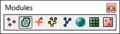
File:WMSmodulebar.png The Module palette in WMS. For the non-palette version, see [[:File:Module toolbar in WMS.png]]. [[Category:Toolbar icons]](200 × 57 (5 KB)) - 17:02, 2 March 2018
File:SMS Select Cell Cell Tool.svg SMS CGrid Select Cell Tool Icon in the Cartesian Grid module. [[Category:2D Grid Icons]](60 × 70 (8 KB)) - 14:49, 27 June 2017
File:WMS CreateGagesTool.svg [[Category:2D Grid Icons]] [[Category:WMS 2D Grid Module Tool Icons]](60 × 60 (5 KB)) - 17:00, 18 January 2018
File:Hydrologic Inactive Icon.svg [[Category:Project Explorer Icons]] [[Category:Hydrologic Module Icons]](56 × 60 (9 KB)) - 14:47, 28 May 2019
File:WMSIcon Create Gages.png [[Category:2D Grid Icons]] [[Category:WMS 2D Grid Module Tool Icons]](16 × 16 (601 bytes)) - 16:24, 19 January 2018- ...splays icons used in XMS. Also for links to files and templates containing icons. *When looking for a tool icon, check the subcategory for the correct module.76 members (76 subcategories, 0 files) - 14:19, 10 May 2017

File:Tool ContourLabels.png [[Category:TIN Module Icons]](16 × 16 (278 bytes)) - 16:43, 3 March 2017
File:DEM Data icon in Project Explorer.png DEM Data icon used in the Project Explorer in WMS. It is part of the Terrain module. [[Category:Project Explorer Icons]](15 × 15 (305 bytes)) - 14:22, 15 August 2016
File:Module toolbar in WMS.png The Module toolbar in WMS. For the palette version, see [[:File:WMSmodulebar.jpg]]. [[Category:Toolbar icons]](185 × 24 (3 KB)) - 19:22, 2 March 2018
File:Set Contour Min Max tool in WMS.png [[Category:WMS Terrain Module Tool Icons]](16 × 16 (675 bytes)) - 15:07, 23 January 2018
File:Scale Bar Annotation Tool.svg [[Category:Annotation Icons]] The Create Scale Bar tool icon for the Annotations module in SMS(60 × 41 (4 KB)) - 14:22, 29 August 2017
File:Text Annotation Tool.svg [[Category:Annotation Icons]] The Create Text Object tool icon for the Annotations module in SMS(46 × 51 (3 KB)) - 14:22, 19 September 2017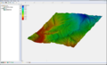
File:Raster4.png [[Category:Changing Icons]] Raster Module Example(800 × 486 (172 KB)) - 16:55, 27 July 2017
File:North Arrow Annotation Tool.svg [[Category:Annotation Icons]] The Create Annotation North Arrow tool icon for the Annotations module(52 × 52 (3 KB)) - 14:20, 29 August 2017
File:Module toolbar.png Example of the Module toolbar. [[Category:Toolbar icons]](280 × 27 (6 KB)) - 15:24, 28 July 2017
File:Create Cartesian Grid Tool.svg The Create Cartesian Grid tool in the Cartesian Grid module in SMS [[Category:2D Grid Icons]](60 × 60 (5 KB)) - 14:50, 20 June 2017
File:Object Annotation Tool.svg [[Category:Annotation Icons]] The Add Annotation Image tool icon for the Annotations module in SMS(60 × 45 (5 KB)) - 14:21, 29 August 2017
File:WMS FlowPathTool.svg [[Category:WMS Drainage Module Tool Icons]](30 × 45 (3 KB)) - 23:27, 17 January 2018
File:WMSIcon Move Basin Labels.png [[Category:WMS Drainage Module Tool Icons]](16 × 16 (767 bytes)) - 16:24, 19 January 2018
File:WMSIcon Flow Path.png [[Category:WMS Drainage Module Tool Icons]](10 × 16 (469 bytes)) - 16:24, 19 January 2018
File:Create Groin Tool.svg 1D Grid Module Create Jetty/Groin tool [[Category:1D Grid icons]](60 × 60 (3 KB)) - 14:21, 11 September 2017
File:WMS SelectDrainageUnitTool.svg [[Category:WMS Drainage Module Tool Icons]](60 × 66 (7 KB)) - 23:26, 17 January 2018
File:WMS MoveBasinLabels.svg [[Category:WMS Drainage Module Tool Icons]](60 × 64 (7 KB)) - 23:27, 17 January 2018
File:WMSIcon Select Drainage Unit.png [[Category:WMS Drainage Module Tool Icons]](16 × 16 (830 bytes)) - 16:25, 19 January 2018
File:Create Outlet Point tool in WMS.png [[Category:WMS Drainage Module Tool Icons]](16 × 16 (554 bytes)) - 16:24, 19 January 2018
File:Create Breakwater Tool.svg 1D Grid Module Create Breakwater Tool [[Category:1D Grid icons]](60 × 60 (3 KB)) - 14:20, 11 September 2017
File:Create Seawall Tool.svg 1D Grid Module Create Seawall tool [[Category:1D Grid icons]](60 × 60 (4 KB)) - 14:21, 11 September 2017
File:DEM Data Icon.svg DEM Data icon used in the Project Explorer in WMS. It is part of the Terrain module. [[Category:Project Explorer Icons]](53 × 53 (11 KB)) - 15:48, 1 June 2017
File:Create Borehole Tool.svg [[Category:Borehole Icons]] ...ol. This is not the same as Icon_BH.png which is the icon for the Borehole module.(22 × 60 (5 KB)) - 14:43, 21 August 2017- ...rmation on 1D Hyd Centerline and 1D Hyd Cross Section coverages in the Map module. ...Manager'', or extraction from topographic data in the [[SMS:Map Module|Map Module]].-->3 KB (483 words) - 22:16, 24 March 2022
- Icons in current use in WMS. :Note: When adding icons to documents, please click on the icon on this page to go to were the icon13 KB (2,003 words) - 14:12, 2 November 2021

File:WMS SetContourMinMaxIcon.svg [[Category:WMS Terrain Module Tool Icons]](52 × 52 (150 KB)) - 19:59, 22 January 2018
File:WMS CreateOutletPointTool.svg [[Category:WMS Drainage Module Tool Icons]](45 × 45 (4 KB)) - 23:27, 17 January 2018- * Updated icons to higher resolution. ==Module Features==1 KB (153 words) - 15:54, 16 May 2018
- ...ion icons of the schematic for an HEC-RAS model. In the Hydraulic Modeling module the schematic is generally used as the view of the model. * [[SMS:1D River Module|1D River Module]]1 KB (167 words) - 14:05, 12 June 2019
- Icons in current use in SMS. :Note: When adding icons to documents, please click on the icon on this page to go to were the icon19 KB (3,142 words) - 23:18, 5 December 2023
- Icons in current use in GMS. :Note: When adding icons to documents, please click on the icon on this page to go to were the icon26 KB (4,335 words) - 23:47, 5 December 2023
- ...re available in the dynamic portion of the tool palette whenever the Solid module is activated. Only one tool is active at any given time. The action that ta ...is selected by selecting the icon. When a different tool is selected, the icons disappear.3 KB (480 words) - 15:19, 6 September 2017
- [[File:WMSIcon Drainage Palette.png|thumb|right|The toolbar for the Drainage module.]] ...has a variety of tools useful for editing and creating objects within that module. The tools are described below.3 KB (434 words) - 23:00, 13 May 2021
- ...up, known as the [[WMS:Dynamic Tool Palette|Dynamic Tools]], is a group of module-specific tools that are used for creating and editing objects in the graphi933 bytes (144 words) - 15:47, 11 April 2017
- ...these tools is described in the information on River Coverages in the Map module. ...nly major model supported is [[SMS:HEC-RAS 11.2 and earlier|HEC-RAS]]. The module includes tools for visualizing results computed for cross sections and reac8 KB (1,328 words) - 21:48, 24 March 2022
- #[[GMS:UGrid_Module|Unstructured Grid module]] ...ernative to TINs for getting elevations of drains and other BCs in the map module.2 KB (314 words) - 14:29, 12 September 2016
- Support for reading and writing LandXML files from the hydraulic modeling module for the SWMM, HY12, and EPANET models has been added. === Higher Resolution Icons ===3 KB (428 words) - 23:13, 9 January 2023
- ...ion icons of the schematic for an HEC-RAS model. In the Hydraulic Modeling module the schematic is generally used as the view of the model.1 KB (162 words) - 16:58, 13 June 2018
- [[File:WMSIcon 2D Grid Palette.png|thumb|right|The toolbar for the 2D Grid module.]] ...has a variety of tools useful for editing and creating objects within that module. The tools are described below.4 KB (618 words) - 17:02, 18 January 2018
- ...owing tools appear in the dynamic portion of the tool palette when the TIN module is active. Only one tool is active at any given time. The action that takes ...by double-clicking on the TIN icon. When a different tool is selected, the icons disappear.5 KB (776 words) - 15:18, 6 September 2017
- *[[GMS:TIN Module|TINs]] *[[GMS:2D Mesh Module|2D Meshes]]9 KB (1,459 words) - 17:14, 3 May 2022
- ...of the [[GMS:Toolbars|Tool Palette]] when the [[GMS:3D Mesh Module|3D Mesh module]] is active. Only one tool is active at any given time. The action that tak ...uming the cross sections were created in plan view). As a general rule the icons are placed in the center of the first line segment used to cut the cross se10 KB (1,682 words) - 15:02, 6 September 2017
- *[[SMS:Scatter Module|Scattered Datasets]] *[[SMS:Mesh Module|2D Meshes]]7 KB (1,143 words) - 14:25, 10 July 2018


