Search results
From XMS Wiki
Jump to navigationJump to search
Page title matches
- ...ata.jpg|thumb|none|left|550 px|HY8 Modeling Wizard showing the ''Watershed Data'' step.]] ...ershed Data'' step is used for defining how to read data into WMS. Obtain data using the WMS web service client, a catalog file, or by simply opening file937 bytes (142 words) - 15:08, 20 October 2017
- #REDIRECT [[WMS:Watershed Data]]32 bytes (4 words) - 19:39, 25 September 2013
- #REDIRECT [[WMS:Watershed Data]]32 bytes (4 words) - 19:39, 25 September 2013
- #REDIRECT [[WMS:Watershed Data]]32 bytes (4 words) - 19:39, 25 September 2013
- #REDIRECT [[WMS:Watershed Data]]32 bytes (4 words) - 19:39, 25 September 2013
Page text matches
- ...ata.jpg|thumb|none|left|550 px|HY8 Modeling Wizard showing the ''Watershed Data'' step.]] ...ershed Data'' step is used for defining how to read data into WMS. Obtain data using the WMS web service client, a catalog file, or by simply opening file937 bytes (142 words) - 15:08, 20 October 2017
File:HydrologicModelingWizardWatershedData.png The watershed data step HY8 Modeling Wizard showing the Watershed Data step.(667 × 508 (52 KB)) - 20:52, 5 January 2024- ...exists in a GIS, WMS allows the user to use these data to set up complete watershed models.530 bytes (85 words) - 15:51, 11 April 2017
- ...hed.png|thumb|none|left|500 px|HY8 Modeling Wizard showing the ''Delineate Watershed'' step]] The ''Delineate Watershed'' step is used to delineate a watershed.2 KB (230 words) - 18:05, 15 January 2024
- #REDIRECT [[WMS:Watershed Data]]32 bytes (4 words) - 19:39, 25 September 2013
- #REDIRECT [[WMS:Watershed Data]]32 bytes (4 words) - 19:39, 25 September 2013
- #REDIRECT [[WMS:Watershed Data]]32 bytes (4 words) - 19:39, 25 September 2013
- #REDIRECT [[WMS:Watershed Data]]32 bytes (4 words) - 19:39, 25 September 2013
- [[WMS:Watershed Data|Watershed Data]] · [[WMS:Download Data (Web Service Client)|Download Data (Web Service Client)]] ·1 KB (148 words) - 14:52, 11 April 2017
- [[WMS:Watershed Data|Watershed Data]] · [[WMS:Download Data (Web Service Client)|Download Data (Web Service Client)]] ·2 KB (201 words) - 14:52, 11 April 2017
- ...one|left|550 px|HY8 Modeling Wizard showing the ''Define Land Use and Soil Data'' step.]] ...Map module. WMS uses the boundary of the watershed to clip the shapefile data for the selected files.739 bytes (110 words) - 15:20, 20 October 2017
- ...logic Computations'' step is used to compute hydrologic parameters for the watershed and sub-basins. ...a dialog where attributes are computed from the land use and/or soil type data.934 bytes (128 words) - 15:20, 20 October 2017
- ...s or shaded data in oblique view. See the adjacent images for examples of data displayed in plan and oblique view with display order turned off and on. Image:DisplayOrderOffPlanView.png|A plan view of a delineated watershed with display order turned '''off'''. Notice several contours and other obj2 KB (275 words) - 15:24, 28 September 2017
- ...sin boundaries, arcs representing a stream network, and nodes representing watershed and sub-basin outlet points. ...ts are correct, or simply used as a scaled schematic representation of the watershed (in such cases area and length values would have to be determined by some o1 KB (223 words) - 16:14, 24 February 2016
- ...elationship relating lag time and time of concentration (Overview of Basin Data Equation) to compute lag time (and the other way around) from any of the ti :''L'' = hydraulic length of watershed in feet.1 KB (176 words) - 15:14, 29 September 2017
- :''C<sub>t</sub>'' = coefficient of watershed topography based on watershed slope. :''T<sub>LAG</sub>'' = watershed lag time in hours.818 bytes (127 words) - 15:15, 29 September 2017
- ...ill act like a "cookie cutter" in stamping out the region of the elevation data inside the polygon and then enforce the stream lines as triangle edges.691 bytes (111 words) - 15:49, 11 April 2017
- :''T<sub>LAG</sub>'' = watershed lag time in hours. :''C<sub>t</sub>'' = coefficient accounting for differences in watershed slope and storage.1 KB (182 words) - 15:11, 29 September 2017
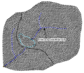
File:TriangulatedDrainageCoverage.png ...watershed delineation. However, when triangulating a set of scattered xyz data, it is difficult if not impossible to ensure that triangle edges conform to(329 × 285 (18 KB)) - 14:19, 3 May 2016
File:GSDA EPA Soil Type.png [[Category:GSDA Importing Data]] EPA soil type for an EPA watershed near Provo, Utah.(400 × 152 (70 KB)) - 14:32, 1 November 2017

