Category:AHGW Images
From XMS Wiki
Jump to navigationJump to search
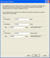
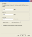
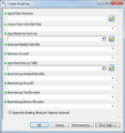
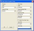
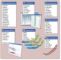
Images and icons used in Arc Hydro Groundwater.
Subcategories
This category has the following 4 subcategories, out of 4 total.
Pages in category "AHGW Images"
The following 4 pages are in this category, out of 4 total.
Media in category "AHGW Images"
The following 158 files are in this category, out of 158 total.
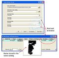
- Add to Rster Sries.png 318 × 415; 15 KB
- AHGW - GeoSections showing the default clip and fill options.png 866 × 434; 29 KB
- AHGW - MODFLOW Analyst Toolbar floating.png 871 × 43; 6 KB
- AHGW - MODFLOW Analyst Toolbar.png 884 × 26; 4 KB
- AHGW - Sample horizons ordered by HorizonID values.png 574 × 357; 14 KB
- AHGW - Using the clip option for the top horizon.png 864 × 389; 18 KB
- AHGW - Using the clip option on other horizons.png 864 × 385; 14 KB
- AHGW - Using the fill option on horizons.png 864 × 376; 15 KB
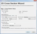
- AHGW 2D Cross Section Wizard dialog Step 1.png 609 × 573; 45 KB
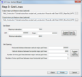
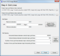
- AHGW 2D Cross Section Wizard dialog Step 2.png 609 × 573; 44 KB
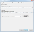
- AHGW 2D Cross Section Wizard dialog Step 3.png 609 × 573; 44 KB
- AHGW 3D borelines visualization.png 440 × 261; 124 KB
- AHGW 3D GeoSection features example.jpg 525 × 290; 23 KB
- AHGW 3D geovolumes Ssa3.png 440 × 280; 80 KB
- AHGW Add Borehole Image Wizard results example v3 2 0.png 828 × 601; 111 KB
- AHGW Add to Raster Series dialog.png 486 × 360; 25 KB
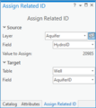
- AHGW Assign Related Identifier dialog.png 432 × 204; 17 KB
- AHGW Attributes of SectionLine dialog example.jpg 680 × 253; 22 KB
- AHGW Attributes XS2D Panel example.jpg 1,192 × 306; 158 KB
- AHGW BAS6 component used by the Build MODFLOW Cell3D tool.jpg 850 × 147; 28 KB
- AHGW Basic tables for the BuildMODFLOW Cell3D tool.jpg 511 × 135; 15 KB
- AHGW Borehole Editor Advanced dialog.png 942 × 673; 80 KB
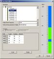
- AHGW Borehole Editor dialog.jpg 597 × 646; 72 KB
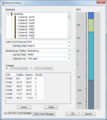
- AHGW Borehole Editor dialog.png 556 × 624; 51 KB
- AHGW BoreLines example.jpg 717 × 367; 24 KB
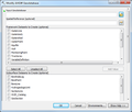
- AHGW Color Manager Setup (Advanced) dialog.png 279 × 134; 14 KB
- AHGW Create Blank AHGW Geodatabase dialog v3 1 0.png 403 × 500; 64 KB
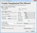
- AHGW Create Geophysical Plot Wizard (wells) dialog Step 1.png 622 × 566; 57 KB
- AHGW Create Geophysical Plot Wizard (wells) dialog Step 2.png 622 × 566; 221 KB
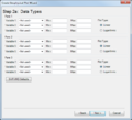
- AHGW Create Geophysical Plot Wizard (wells) dialog Step 2a.png 622 × 566; 43 KB
- AHGW Create Geophysical Plot Wizard (wells) dialog Step 3.png 622 × 566; 60 KB
- AHGW Create Geophysical Plot Wizard (wells) dialog Step 4.png 622 × 566; 56 KB
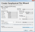
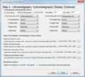
- AHGW Create Geophysical Plot Wizard dialog step 1.png 622 × 566; 47 KB
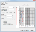
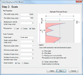
- AHGW Create Geophysical Plot Wizard dialog step 2.png 622 × 566; 45 KB
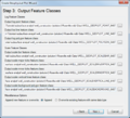
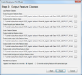
- AHGW Create Geophysical Plot Wizard dialog step 3.png 622 × 566; 50 KB
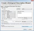
- AHGW Create Lithological Description Wizard dialog Step 1.png 622 × 566; 59 KB
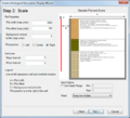
- AHGW Create Lithological Description Wizard dialog Step 2.png 622 × 566; 96 KB
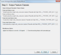
- AHGW Create Lithological Description Wizard dialog Step 3.png 622 × 566; 43 KB
- AHGW Create Non-vertical Borelines.png 366 × 452; 6 KB
- AHGW Create XS2D Panel Feature Class dialog.jpg 494 × 234; 37 KB
- AHGW Create XS2D Point Feature Class dialog v3 2 0.png 615 × 298; 28 KB
- AHGW cross section 3.png 440 × 246; 55 KB
- AHGW Desurvey Borelog dialog.png 590 × 706; 31 KB
- AHGW Example XS2D Catalog Table.jpg 552 × 130; 33 KB
- AHGW Export DIS File dialog.png 513 × 666; 43 KB
- AHGW Export MLT File dialog.png 513 × 666; 36 KB
- AHGW Export Name File dialog.png 502 × 462; 28 KB
- AHGW Export OBS CHOB File dialog.png 502 × 673; 44 KB
- AHGW File Import Wizard dialog - step 1.png 844 × 463; 44 KB
- AHGW File Import Wizard dialog - step 2.png 844 × 463; 42 KB
- AHGW Filter By CVD1.png 506 × 388; 17 KB
- AHGW Filter By CVD2.png 537 × 387; 11 KB
- AHGW Flow Direction Editor dialog.png 308 × 237; 17 KB
- AHGW Flow Direction Map Generator example 2.png 860 × 791; 34 KB
- AHGW GDB with XS2D Panel feature classes.jpg 174 × 188; 33 KB
- AHGW geophysical log plot features on an XS2D data frame v3 1 0.png 633 × 355; 11 KB
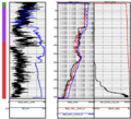
- AHGW Geophysical Log Plots - AHGW 3 4.png 800 × 409; 44 KB
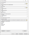
- AHGW Geophysical Plot Setup dialog.png 539 × 576; 48 KB
- AHGW Geophysical Plot Tools - AHGW 3 4.png 600 × 545; 231 KB
- AHGW GeoSection To Points h.png 430 × 252; 9 KB
- AHGW Groundwater Analyst example.png 340 × 199; 86 KB
- AHGW HGU Color Manager dialog color palette.jpg 158 × 132; 12 KB
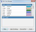
- AHGW HGU Color Manager dialog example.jpg 824 × 391; 44 KB
- AHGW HGU Color Manager dialog.jpg 406 × 354; 44 KB
- AHGW HGU Setup dialog.jpg 260 × 180; 21 KB
- AHGW HydroID Tables Manager dialog.jpg 474 × 328; 29 KB
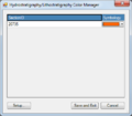
- AHGW Hydrostratigraphy-Lithostratigraphy Color Manager dialog.png 406 × 354; 18 KB
- AHGW Import GeoSection From XML - XML example.jpg 251 × 538; 28 KB
- AHGW Import GeoSection From XML 2.jpg 326 × 136; 6 KB
- AHGW Import GeoSection from XML dialog.jpg 486 × 287; 41 KB
- AHGW Import GeoVolume from XML dialog.jpg 486 × 232; 32 KB
- AHGW Import GeoVolume From XML example.jpg 645 × 217; 45 KB
- AHGW Import GeoVolume From XML results.jpg 326 × 134; 6 KB
- AHGW Import MODFLOW Tables dialog v3 1 0.png 400 × 326; 63 KB
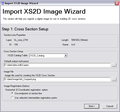
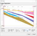
- AHGW Import XS2D Image Wizard dialog page 1.png 599 × 560; 21 KB
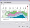
- AHGW Import XS2D Image Wizard dialog page 2.png 599 × 560; 139 KB
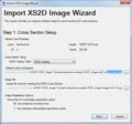
- AHGW Import XS2D Image Wizard dialog Step 1.png 599 × 560; 48 KB
- AHGW Import XS2D Image Wizard dialog Step 3.png 599 × 560; 37 KB
- AHGW Import XS2D Image Wizard dialog Step 4.png 599 × 560; 44 KB
- AHGW Import XS2D Image Wizard output example.png 808 × 372; 150 KB
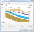
- AHGW Import XS2D Image Wizard Step 2.png 599 × 560; 114 KB
- AHGW Lithological Description Tool example - AHGW 3 4.png 1,200 × 590; 278 KB
- AHGW Lithostratigraphic and Hydrostratigraphic Display - AHGW 3 4.png 1,200 × 558; 265 KB
- AHGW Make Time Series Statistics dialog.png 377 × 743; 22 KB
- AHGW MODFLOW Analyst example.png 340 × 250; 52 KB
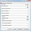
- AHGW MODFLOW Analyst Features - Boundary to DIS dialog.png 486 × 415; 31 KB
- AHGW MODFLOW Analyst Features - Build Boundary Rectangle dialog.png 486 × 332; 25 KB
- AHGW MODFLOW Analyst Features - Create MODFLOW Cell2D dialog.png 486 × 278; 28 KB
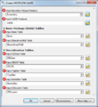
- AHGW MODFLOW Analyst Features - Create MODFLOW Cell3D dialog.png 486 × 528; 45 KB
- AHGW MODFLOW Analyst Features - Create MODFLOW Node2D dialog.png 486 × 230; 23 KB
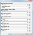
- AHGW MODFLOW Analyst Features - Create MODFLOW Node3D dialog.png 486 × 532; 45 KB
- AHGW MODFLOW Analyst Features - DIS to Boundary dialog.png 486 × 348; 28 KB
- AHGW MODFLOW Analyst Import - Add Output File dialog.png 486 × 358; 28 KB
- AHGW MODFLOW Analyst Import - Create MODFLOW World File dialog.png 486 × 301; 26 KB
- AHGW MODFLOW Array-based Parameters Table.png 611 × 376; 47 KB
- AHGW MODFLOW Cell2D and Cell3D features example.jpg 797 × 247; 26 KB
- AHGW MODFLOW Data Model v3 0.png 2,640 × 2,118; 657 KB
- AHGW Modify AHGW Geodatabase dialog v3 2 0.png 615 × 525; 35 KB
- AHGW New Feature Dataset dialog 2.png 485 × 567; 8 KB
- AHGW New Feature Dataset dialog.png 485 × 567; 7 KB
- AHGW plan view of a sectionline.png 811 × 375; 6 KB
- AHGW saltwater interface Ssa2.png 440 × 257; 116 KB
- AHGW Set Layer as Map Grid dialog.png 436 × 275; 22 KB
- AHGW Show-Hide Depth Range dialog.png 450 × 353; 24 KB
- AHGW Subsurface Analyst Features - Create BoreLines.png 486 × 515; 32 KB
- AHGW Time Series example.png 340 × 192; 50 KB
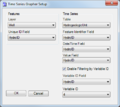
- AHGW Time Series Grapher Setup dialog.jpg 427 × 385; 27 KB
- AHGW Time Series Grapher Setup dialog.png 435 × 387; 27 KB
- AHGW TimeSeries Grapher1.png 680 × 449; 28 KB
- AHGW TimeSeries Grapher2.png 489 × 339; 22 KB
- AHGW Transform Lines to XS2D Points dialog v3 2 0.png 615 × 384; 40 KB
- AHGW Updating key filed using the Assign Related Identifier tool.png 529 × 159; 14 KB
- AHGW using the Time Series Statistics tool with example results.jpg 766 × 616; 144 KB
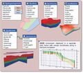
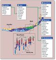
- AHGW-image-library.png 940 × 430; 272 KB
- ArcGIS Pro AHGW Pro Toolkit.png 414 × 351; 26 KB
- ArcGIS Pro Arc Hydro Groundwater Ribbon.png 939 × 117; 15 KB
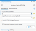
- ArcGIS Pro Assign HydroID GW.png 350 × 303; 14 KB
- ArcGIS Pro Assign Related ID.png 271 × 304; 12 KB
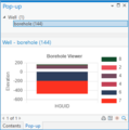
- ArcGIS Pro Borehole Pop up.png 341 × 344; 12 KB
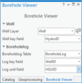
- ArcGIS Pro Borehole Viewer.png 267 × 269; 12 KB
- ArcGIS Pro Create AHGW Raster Catalog.png 373 × 302; 15 KB
- ArcGIS Pro Create Blnk AHGW Geodtabse.png 349 × 963; 31 KB
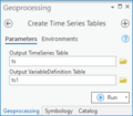
- ArcGIS Pro Create Time Series Table.png 287 × 252; 11 KB
- ArcGIS Pro Create Unique ID Table.png 349 × 243; 11 KB
- ArcGIS Pro Create Well Feature Class.png 333 × 210; 10 KB
- ArcGIS Pro Create XS2D Cross Section.png 287 × 929; 38 KB
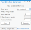
- ArcGIS Pro Flow Direction Generator.png 269 × 260; 11 KB
- ArcGIS Pro HGU Color Manager.png 323 × 597; 20 KB
- ArcGIS Pro HGUClrMnger clrmenu.png 273 × 276; 5 KB
- ArcGIS Pro Make Time Series Statistics.png 451 × 744; 26 KB
- ArcGIS Pro Modify AHGW Geodtabse.png 462 × 960; 38 KB
- ArcGIS Pro Time Series Grapher.png 295 × 378; 14 KB
- ArcGIS Pro XS2D Cross Section Image.png 334 × 787; 32 KB
- ArcGIS Pro XS2D Image.png 595 × 568; 88 KB
- Archydrogw framework.jpg 1,260 × 856; 311 KB
- Archydrogw geology.jpg 918 × 726; 290 KB
- Archydrogw hydrostratigraphy.jpg 928 × 814; 204 KB
- Archydrogw overview.jpg 1,500 × 840; 473 KB
- Archydrogw wellsandboreholes.jpg 808 × 856; 171 KB
- Archydrogw XS2D.jpg 1,140 × 885; 290 KB
- ArcPro Add XS2D Borehole Image.png 404 × 588; 15 KB
- Create AHGW Raster Catalog.png 602 × 401; 25 KB
- Create Blank AHGW Geodatabase dialog.png 637 × 914; 63 KB
- Create Time Series Tables dialog.png 513 × 264; 22 KB
- Create Unique ID Table dialog.png 522 × 251; 21 KB
- Create Well Feature Class dialog.png 513 × 264; 21 KB
- Modify AHGW Geodatabase dialog.png 522 × 840; 59 KB
- Process 3D features from survey data.png 685 × 101; 9 KB
- Simulation Features.png 1,154 × 822; 636 KB
- Temporal.jpg 878 × 854; 212 KB


