Category:GMS GIS Dialogs
From XMS Wiki
Jump to navigationJump to search
Files and articles related to dialogs in the GIS module
Pages in category "GMS GIS Dialogs"
The following 4 pages are in this category, out of 4 total.
Media in category "GMS GIS Dialogs"
The following 22 files are in this category, out of 22 total.
- Add Data Dialog.jpg 507 × 340; 47 KB
- DisplayGIS.png 733 × 573; 20 KB
- GIS CreateContourArc.jpg 284 × 134; 4 KB
- GIS LayerProperties.png 642 × 441; 38 KB
- GIS SelectData.png 507 × 340; 24 KB
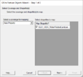
- GIS to Feature Objects Wizard -- Step 1 of 2.jpg 740 × 485; 31 KB
- GIS to Feature Step1.png 479 × 445; 13 KB
- GISchecklayers.jpg 276 × 140; 12 KB
- GISidentify.jpg 295 × 191; 18 KB
- IdentifyResults.jpg 493 × 244; 33 KB
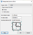
- Lidar to UGrid.png 348 × 368; 14 KB
- LidarDisplayOptions1.png 687 × 416; 19 KB
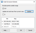
- LidarExclusionExtents.png 315 × 287; 9 KB
- LidarToRaster.png 314 × 244; 10 KB
- MergeRasterCellSize.jpg 288 × 157; 15 KB
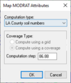
- MODRATMapAtts.png 202 × 237; 5 KB
- Raster-to-flood-depths.png 336 × 285; 16 KB
- RasterDisplayOptions.png 405 × 416; 13 KB
- RasterSmoothingOpts.jpg 280 × 270; 23 KB
- RasterToScatter.png 364 × 147; 5 KB
- RasterTrimWarning.jpg 468 × 171; 21 KB
- ResampleExportRaster.png 278 × 237; 9 KB


