GMS:3D Scatter Point Module: Difference between revisions
From XMS Wiki
Jump to navigationJump to search
No edit summary |
No edit summary |
||
| Line 4: | Line 4: | ||
[[GMS:Interpolation|Interpolation]] is useful for setting up input data for analysis codes and it is also useful for site characterization. | [[GMS:Interpolation|Interpolation]] is useful for setting up input data for analysis codes and it is also useful for site characterization. | ||
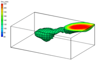
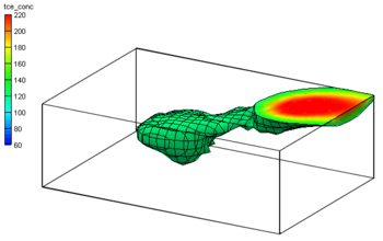
[[Image:Sample_Interp. | [[Image:Sample_Interp.png|thumb|none|left|350 px|Interpolation of TCE data to a 3D grid]] | ||
{{Navbox GMS}} | {{Navbox GMS}} | ||
Revision as of 14:53, 22 April 2016
The 3D Scatter Point module is used to interpolate from groups of 3D scatter points to meshes, grids, or TINs. Several interpolation schemes are supported including kriging.
Interpolation is useful for setting up input data for analysis codes and it is also useful for site characterization.
GMS – Groundwater Modeling System | ||
|---|---|---|
| Modules: | 2D Grid • 2D Mesh • 2D Scatter Point • 3D Grid • 3D Mesh • 3D Scatter Point • Boreholes • GIS • Map • Solid • TINs • UGrids | |
| Models: | FEFLOW • FEMWATER • HydroGeoSphere • MODAEM • MODFLOW • MODPATH • mod-PATH3DU • MT3DMS • MT3D-USGS • PEST • PHT3D • RT3D • SEAM3D • SEAWAT • SEEP2D • T-PROGS • ZONEBUDGET | |
| Aquaveo | ||

