Midwest State Plane: Difference between revisions
From XMS Wiki
Jump to navigationJump to search
No edit summary |
No edit summary |
||
| Line 1: | Line 1: | ||
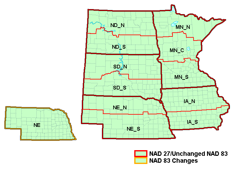
The figure below shows the [[State Plane Coordinate System|state plane zones]] for the Midwest area. | The figure below shows the [[State Plane Coordinate System|state plane zones]] for the Midwest area. | ||
[[Image:Mw27. | [[Image:Mw27.png]] | ||
Revision as of 16:01, 14 November 2016
The figure below shows the state plane zones for the Midwest area.
| NAD 27 / 83 | |||||||||||||||||||||||||||||||||||
| Zone Name | Map Code | Zone ID | |||||||||||||||||||||||||||||||||
|
|
| |||||||||||||||||||||||||||||||||
| NAD 83 Zone Changes | |||||||||||||||||||||||||||||||||||
|
|
| |||||||||||||||||||||||||||||||||
Projections | |
|---|---|
| UTM: | Africa • Asia • Australia • Europe • North America • South America |
| State Plane: | Alaska • Hawaii • Mideast • Midwest • New England • Northwest • South Central • Southeast • Southwest • Virginia Area |
| Other | CPP • Geographic |
