Trim Raster Tool: Difference between revisions
From XMS Wiki
Jump to navigationJump to search
(Created page with "__NOINDEX__ {{Version SMS 13.2}} {{Trim Raster}} {{Navbox SMS}} Category:Toolbox") |
No edit summary |
||
| Line 1: | Line 1: | ||
{{Trim Raster}} | {{Trim Raster}} | ||
Revision as of 15:45, 23 August 2022
Trim Raster
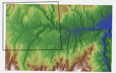
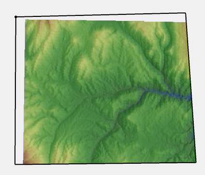
The Trim Raster tool creates a new raster from the raster and coverage selected by the tool. The coverage must contain one or more polygons, which will be used to trim the raster. The polygons can include holes (or interior rings) when used to trim the raster. If more than one polygon is found in the coverage specified, the raster will be trimmed to the polygons, with NODATA values assigned to areas not contained by polygons.
Input Parameters
- Input raster – The raster used to create the trimmed raster.
- Coverage with polygons – The coverage containing one or more polygons used to trim the input raster.
Output parameters
- Output raster – A copy of the input raster, trimmed to the polygon features found in the coverage.
Current Location in toolbox
Rasters/Trim Raster
Related Tools
- Rasters/Extend Raster
SMS – Surface-water Modeling System | ||
|---|---|---|
| Modules: | 1D Grid • Cartesian Grid • Curvilinear Grid • GIS • Map • Mesh • Particle • Quadtree • Raster • Scatter • UGrid |  |
| General Models: | 3D Structure • FVCOM • Generic • PTM | |
| Coastal Models: | ADCIRC • BOUSS-2D • CGWAVE • CMS-Flow • CMS-Wave • GenCade • STWAVE • WAM | |
| Riverine/Estuarine Models: | AdH • HEC-RAS • HYDRO AS-2D • RMA2 • RMA4 • SRH-2D • TUFLOW • TUFLOW FV | |
| Aquaveo • SMS Tutorials • SMS Workflows | ||

