User:Jcreer/SMS:GSSHA: Difference between revisions
| Line 44: | Line 44: | ||
*Long term simulations | *Long term simulations | ||
*Snowmelt | *Snowmelt | ||
| | | | ||
*Permafrost | *Permafrost | ||
| Line 51: | Line 51: | ||
*Storm/tile drain | *Storm/tile drain | ||
*Stochastic | *Stochastic | ||
| | | | ||
*Calibration | *Calibration | ||
Revision as of 22:56, 6 May 2024
| This contains information about functionality available starting at SMS version 13.4. The content may not apply to other versions. |
Gridded Surface Subsurface Hydrologic Analysis (GSSHA) is a two-dimensional finite difference rainfall/runoff model. A finite difference grid is used to establish the computational domain and parameters for surface runoff. The GSSHA model is fully coupled with hydraulic stream flow/routing models. Parameters for stream channels are defined using arcs and then mapped to the appropriate underlying grid cells.
Features of GSSHA include 1D stream flow and infiltration, 2D overland flow and groundwater, and full coupling between the groundwater, shallow soils, streams, and overland flow.[1] "Sediment and constituent fate and transport are simulated in the shallow soils, overland flow plane, and in streams and channels. GSSHA can be used as an episodic or continuous model where soil surface moisture, groundwater levels, stream interactions, and constituent fate are continuously simulated. The fully coupled groundwater to surface-water interaction allows GSSHA to model basins in both arid and humid environments."[1]
The GSSHA model can be added to a paid edition of SMS.[2]
Building a GSSHA Simulation
Creating a GSSHA Simulation in SMS requires several components. These components include:
- a 2D UGrid
- a GSSHA boundary conditions coverage
While the project can contain multiple UGrids, only one UGrid can be attached to each GSSHA simulation. The 2D UGrid must follow certain rules that include square cells, not rotated, and numbered the in the way required by GSSHA. The GSSHA 2D UGrid tool can be used to created this UGrid.
To create a GSSHA simulation:
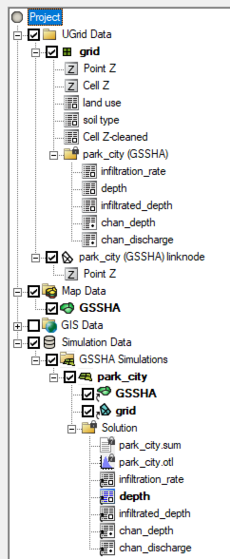
- Right-click on an empty space in the Project Explorer, or right-click on "
 Project" in the Project Explorer, and select New Simulation | GSSHA.
When the simulation has been initially created, the selected UGrid can be linked to the simulation.
GSSHA Graphical Interface
GSSHA uses a custom interface to specify boundary conditions, model parameters, model control, and material parameters. The interface includes the following:
- GSSHA Simulation
- GSSHA Coverages
- GSSHA Model Control
- GSSHA Mapping Tables
Simulation Right-Click Menu
Importing an Existing GSSHA Model
SMS can import a GSSHA simulation by opening the GSSHA project file in SMS. Any of the file opening methods in SMS can be used. The GSSHA Project file starts with “GSSHAPROJECT” on the first line of the file. Typically the GSSHA starting filew has a *.gssha or *.prj extension.
Read GSSHA Solution
Unsupported GSSHA Features
Currently, the following features are not support in the SMS interface:
|
|
|
SMS – Surface-water Modeling System | ||
|---|---|---|
| Modules: | 1D Grid • Cartesian Grid • Curvilinear Grid • GIS • Map • Mesh • Particle • Quadtree • Raster • Scatter • UGrid |  |
| General Models: | 3D Structure • FVCOM • Generic • PTM | |
| Coastal Models: | ADCIRC • BOUSS-2D • CGWAVE • CMS-Flow • CMS-Wave • GenCade • STWAVE • WAM | |
| Riverine/Estuarine Models: | AdH • HEC-RAS • HYDRO AS-2D • RMA2 • RMA4 • SRH-2D • TUFLOW • TUFLOW FV | |
| Aquaveo • SMS Tutorials • SMS Workflows | ||
- ^ a b "Overview:Overview". GSSHA Wiki. http://www.gsshawiki.com/Overview:Overview. Retrieved on April 26, 2019.
- ^ "SMS Editions & Pricing". Aquaveo. http://www.aquaveo.com/software/sms-pricing. Retrieved on April 26, 2019.
